Viking Ring Fortresses: Digital Reconstruction of the Fyrkat Archaeological Site, Denmark
Fyrkat, located near Hobro, Denmark, is one of five historic Viking ring fortresses built during the reign of King Harald Bluetooth around 980 AD. Sometimes called Trelleborg-type fortresses, these circular forts were carefully planned and built with remarkable precision. Together, they show the engineering skill and organization that helped shape the kingdom more than a thousand years ago.
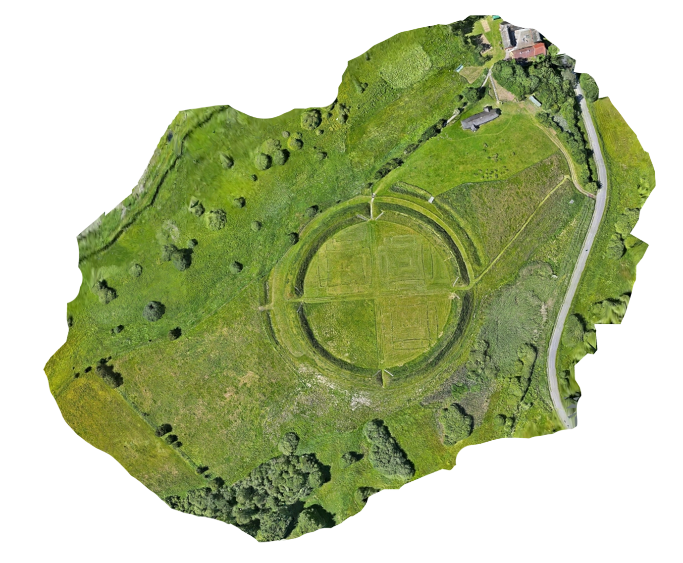
Today, the grassy rampart and marked outlines of Fyrkat’s longhouses are still visible across the landscape. From the ground, visitors can walk through the fortress and imagine its original scale. From the air, its full design becomes clear: a near-perfect circle divided by straight roads into four matching sections. Also on locations is a replica longhouse visible on the Northeast end of the model.
Using aerial photography and PixElement, this project turns the site into a detailed 3D model. The model records the exact shape of the fortress, reveals subtle changes in the terrain, and gives researchers, historians, and the public a new way to explore this important Viking monument.
Aerial Mapping & Reconstruction
To capture the Fyrkat ring fortress and its surrounding landscape, the drone team flew a systematic double-grid flight plan at a low altitude. A DJI Matrice 4TD with RTK positioning collected 1,328 high-resolution RGB images across the 10.4-hectare site.
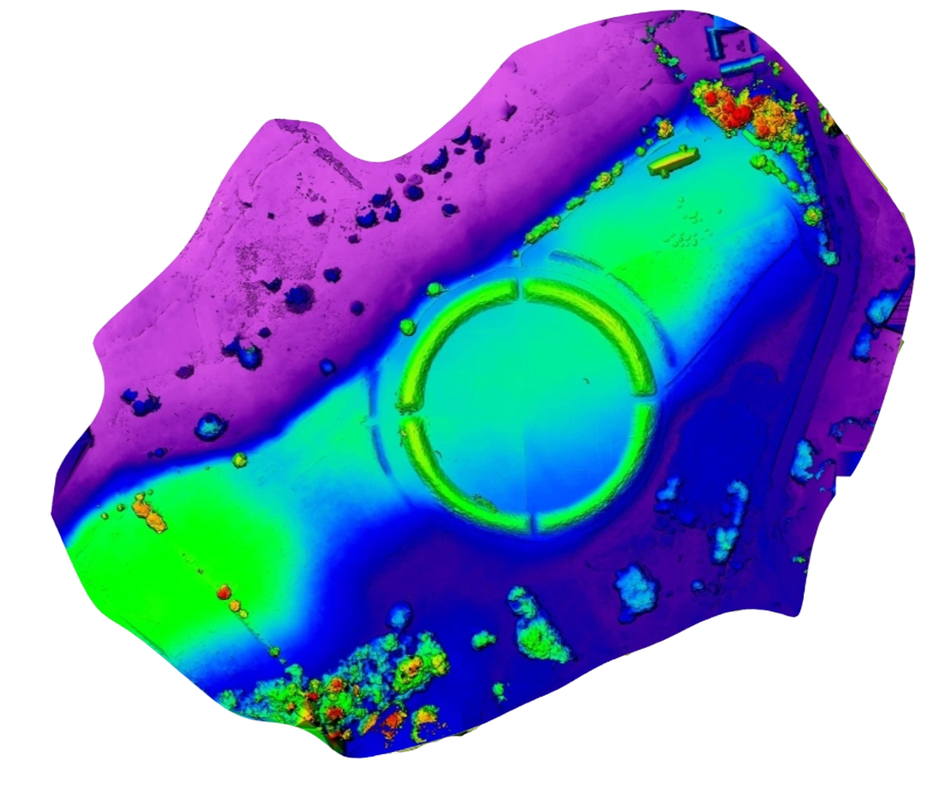
The images were then processed with PixElement to produce a detailed 3D mesh, digital elevation model (DEM), dense point cloud, and orthomosaic. Together, these outputs provide both a clear and easy-to-understand overview of the site and accurate data for measurement and analysis.
The orthomosaic shows the full plan of the fortress from above. The elevation model highlights small rises and depressions in the ground, while the 3D mesh makes it possible to explore the fortress grounds, longhouses, and surrounding terrain from any angle. Researchers can use these products for non-destructive spatial analysis, erosion monitoring, and virtual interpretation without disturbing the archaeological site.
Orthoimage vs DEM - Drag the Slider to Compare
Historical Significance
Fyrkat was built during a period when Harald Bluetooth was bringing more of Denmark under one ruler. The fortress may have served as a military stronghold, a center of royal authority, and a way to oversee important routes through the region.
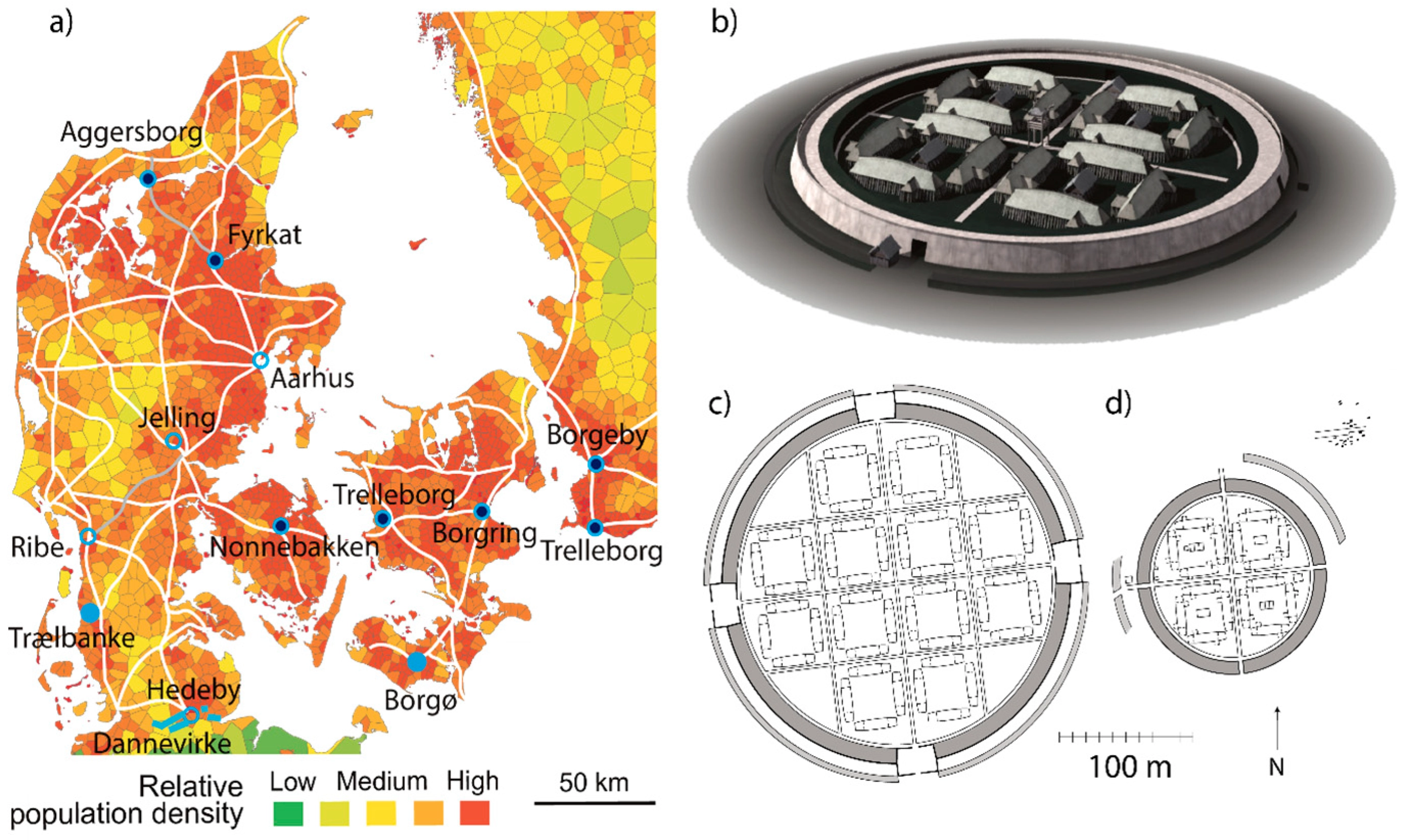
The fortress measures approximately 120 meters in diameter. Four gates and two straight roads divide the circle into four sections. Each section originally contained four wooden longhouses arranged around a courtyard, creating a total of 16 longhouses inside the rampart. A 12 meter wide and 3 meter high rampard with a planked facade was built around the fortress. A moat 7 meters wide and 2 meters deep was dug in front of the rampart. Sections of it are still visible in the landscape.
Building such a large, precise structure required skilled workers, careful measurement, and organized leadership. Fyrkat and the ring fortresses at Aggersborg, Nonnebakken, Trelleborg, and Borgring offer a clear picture of Denmark’s transition toward a unified medieval kingdom. In 2023, the five sites were added to the UNESCO World Heritage List as the Viking-Age Ring Fortresses.
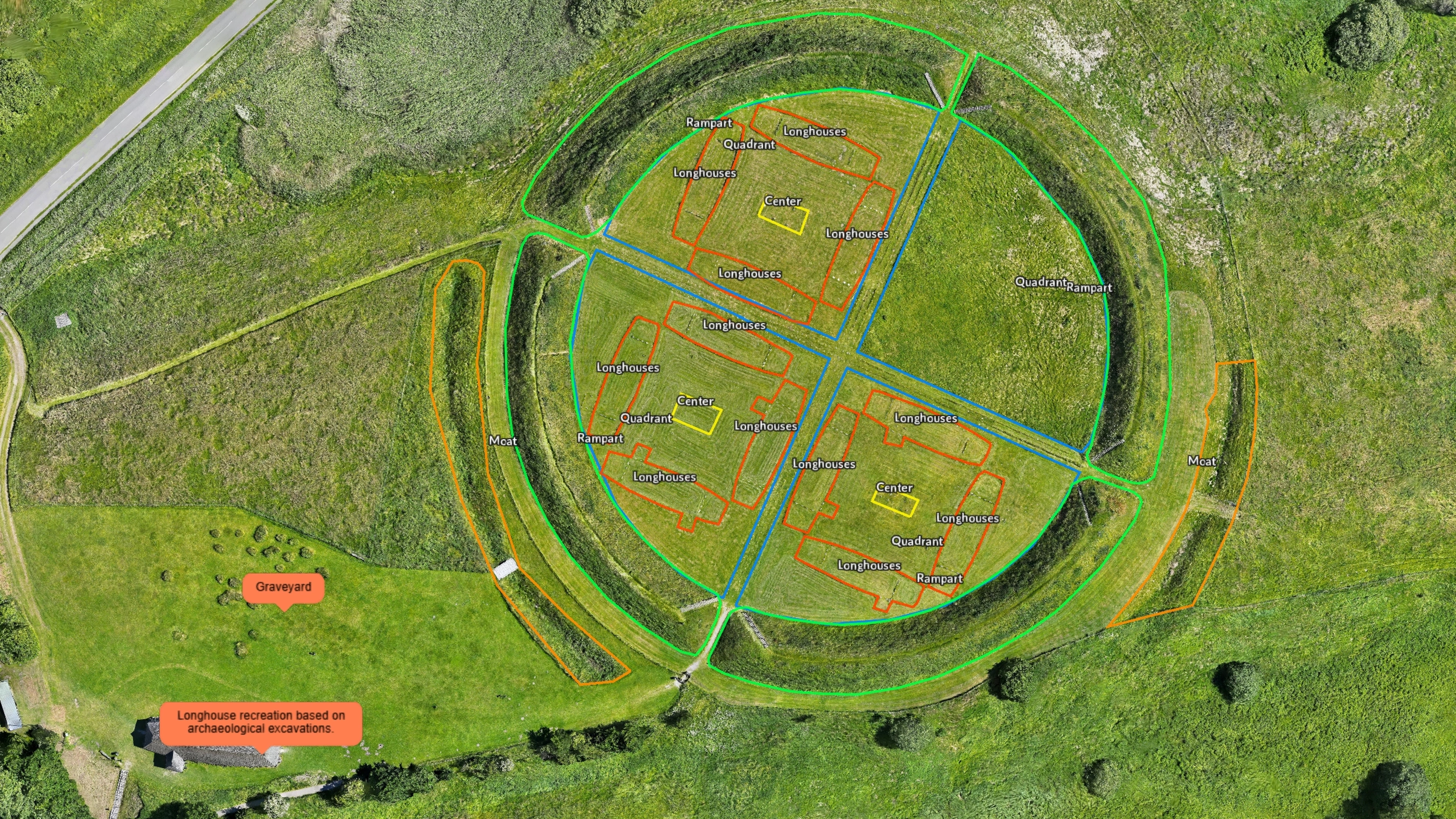
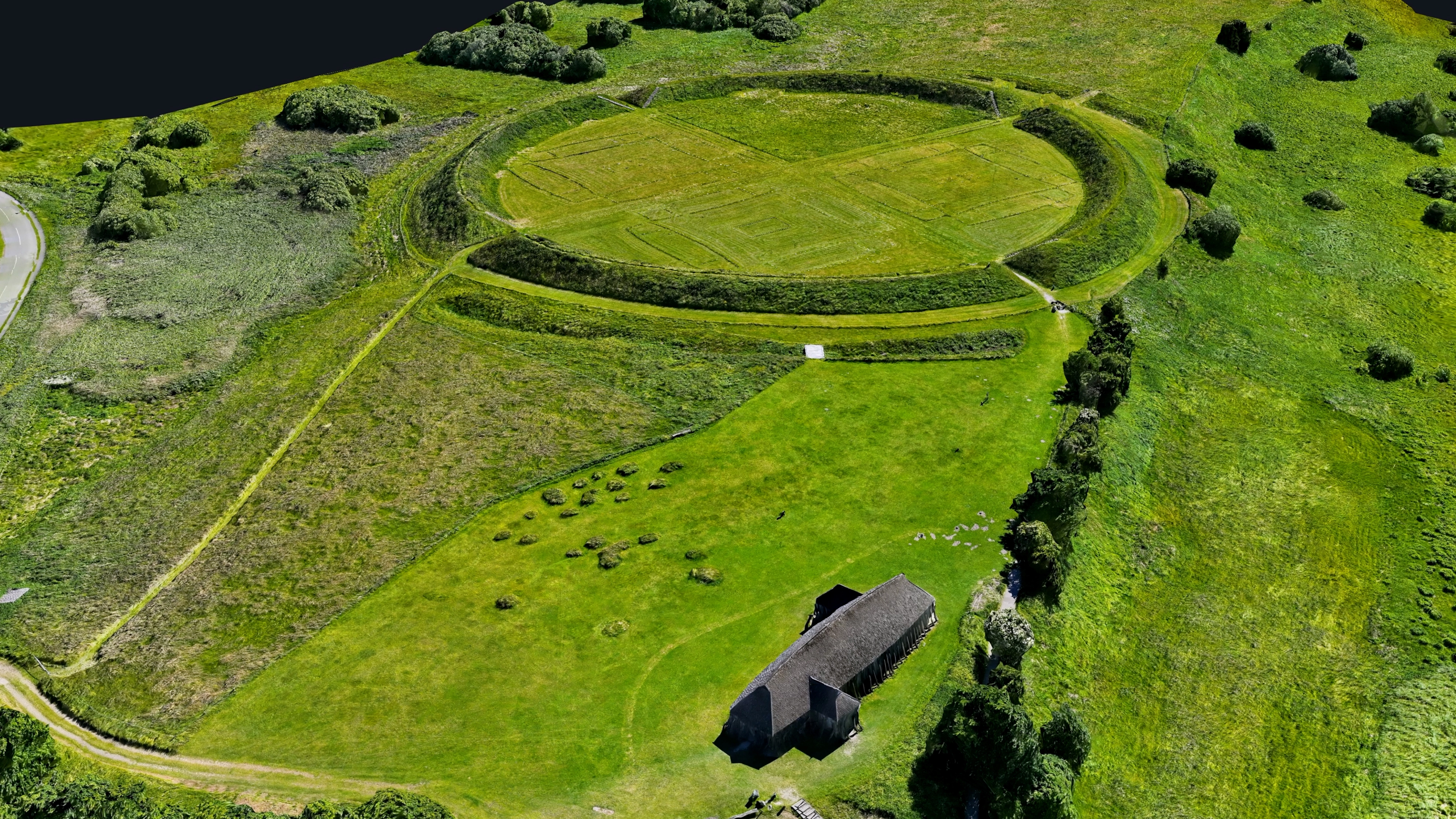
Photogrammetry makes this geometric system measurable. Distances between gates, changes in rampart height, the alignment of internal paths, and the footprint of reconstructed features can all be examined within a common spatial reference. A digital model does not replace archaeological excavation, but it provides a non-invasive framework for connecting field observations, historical plans, and future surveys.
Life Inside the Ring
Archaeological finds show that people lived and worked within and around the fortress. The 16 longhouses were organized in four groups, each framing an internal courtyard. Finds connected to crafts and daily activity indicate that the site was more than an empty defensive earthwork, even if its exact function and the length of its use remain subjects of interpretation.
North of the fortress, excavations revealed a cemetery of approximately 30 graves containing men, women, and children. One richly furnished woman’s grave was especially unusual. Objects including a metal staff and henbane seeds have led researchers to suggest that she may have been a völva, a woman associated with ritual knowledge and prophecy in pre-Christian Norse tradition. This interpretation offers a glimpse into the religious and political transitions taking place as Harald Bluetooth consolidated royal power and promoted Christianity.
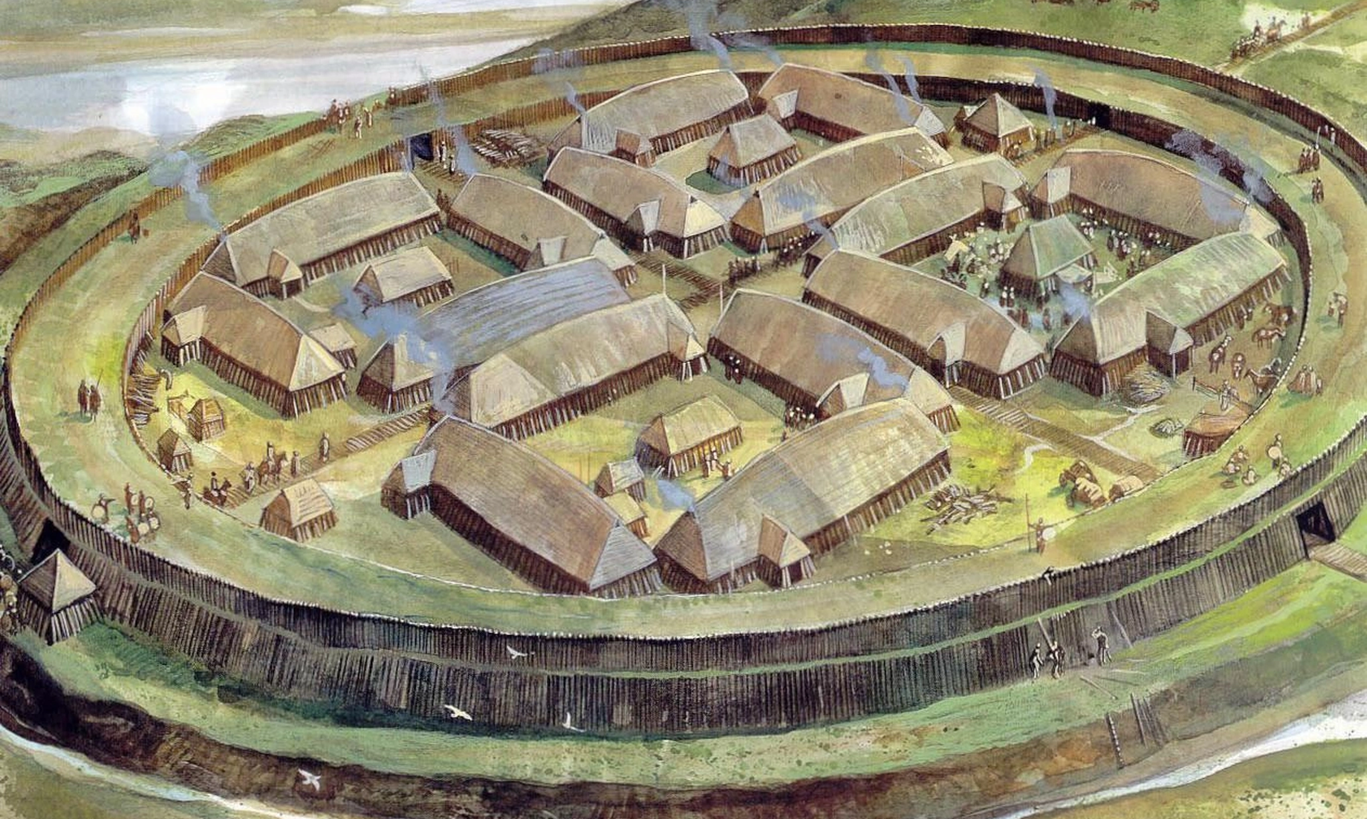
The fortress appears to have been used for only a short period. That brevity makes its coherence all the more striking: Fyrkat preserves the imprint of a concentrated building program undertaken at a pivotal moment, when political centralization, military organization, trade, and religious change were reshaping Denmark.
Reading Subtle Earthworks with Photogrammetry
Unlike a standing stone fortress, Fyrkat survives primarily through archaeological deposits and shaped terrain. PixElement’s 3D models, orthomosaics, and digital elevation models (DEMs) let researchers strip away surface texture to analyze subtle topography, measure dimensions without disturbing the site, and perform change detection from repeat surveys.
Key Heritage Applications
- Archaeologists & Researchers — analyze spatial distribution, document features, and compare with excavation records.
- Conservators & Site Managers — monitor erosion, assess drainage, and plan non-destructive maintenance.
- Museums & Educators — create interactive, accessible 3D models for public interpretation.
- Heritage Authorities — establish a durable, high-resolution record of the site’s UNESCO World Heritage value.
Digital Preservation & Archaeological Analysis
The geometry of Fyrkat offers valuable insight into early Danish fortification design and regional planning. By documenting the site’s ramparts and layout in 3D, photogrammetry provides a highly detailed, non-invasive record that complements traditional excavation findings.
Using PixElement to process and analyze these datasets allows researchers, land managers, and educators to measure terrain features, identify subtle topographic changes, and share interactive visualizations. This digital baseline preserves Fyrkat’s spatial context, supporting ongoing research and long-term conservation monitoring.
Explore the Dataset:
References:
UNESCO World Heritage Centre. Viking-Age Ring Fortresses. Inscribed 2023, whc.unesco.org .
UNESCO World Heritage Centre. Viking-Age Ring Fortresses: Management Plan. Kingdom of Denmark, whc.unesco.org .
Nordjyske Museer. The Ring Fortress: The Viking Museum Fyrkat. nordjyskemuseer.dk .
Nordjyske Museer. Fyrkat — From Norse Paganism to Christianity. nordjyskemuseer.dk .
National Museum of Denmark. A Seeress from Fyrkat? en.natmus.dk .