Experience the flexibility of PixElement Cloud: process without local hardware constraints and access your results from any device, anywhere.
Handle a variety of geospatial projects with efficient, browser-based workflows.
No GPU or RAM constraints. Run processing without tying up your machine.
Upload, process, and review results whether you’re in the field or office.
Keep projects in one place for easier access, sharing, and management.
Upload, process, and deliver geospatial outputs without complexity.


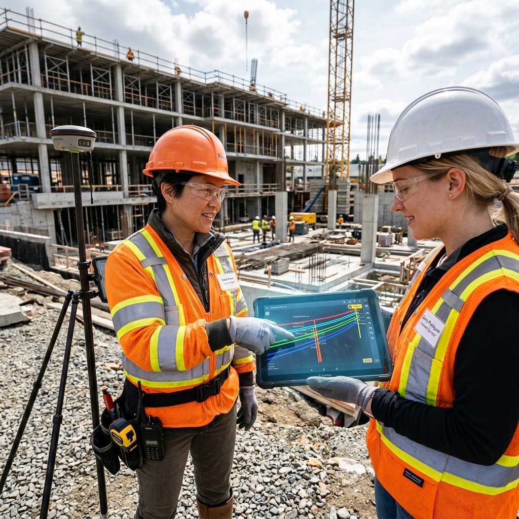
Securely ingest raw imagery and LiDAR data directly into the PixElement platform. We support a wide range of professional sensors and file formats, ensuring direct compatibility for everything from single-drone flights to complex, multi-sensor airborne missions.
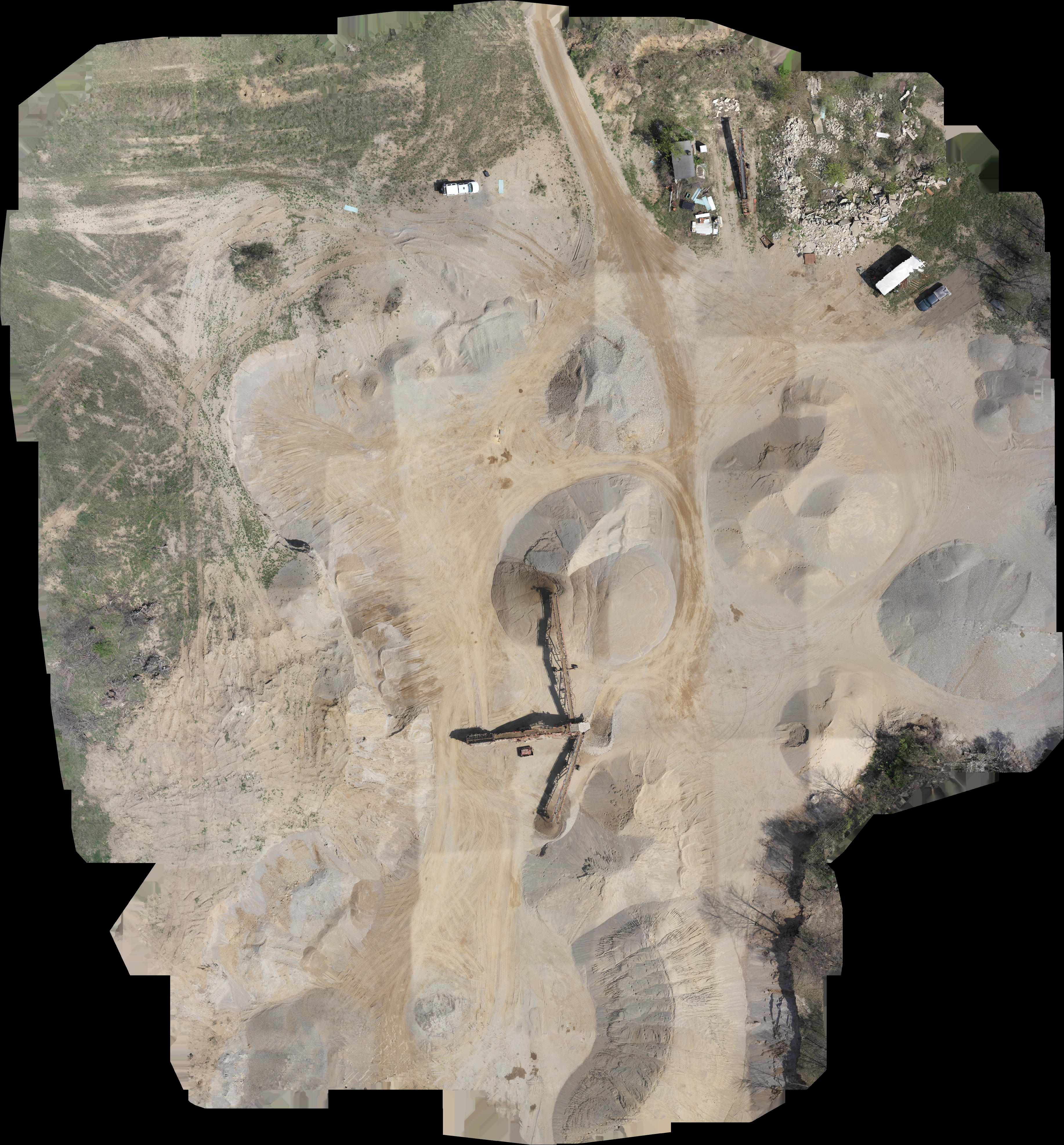
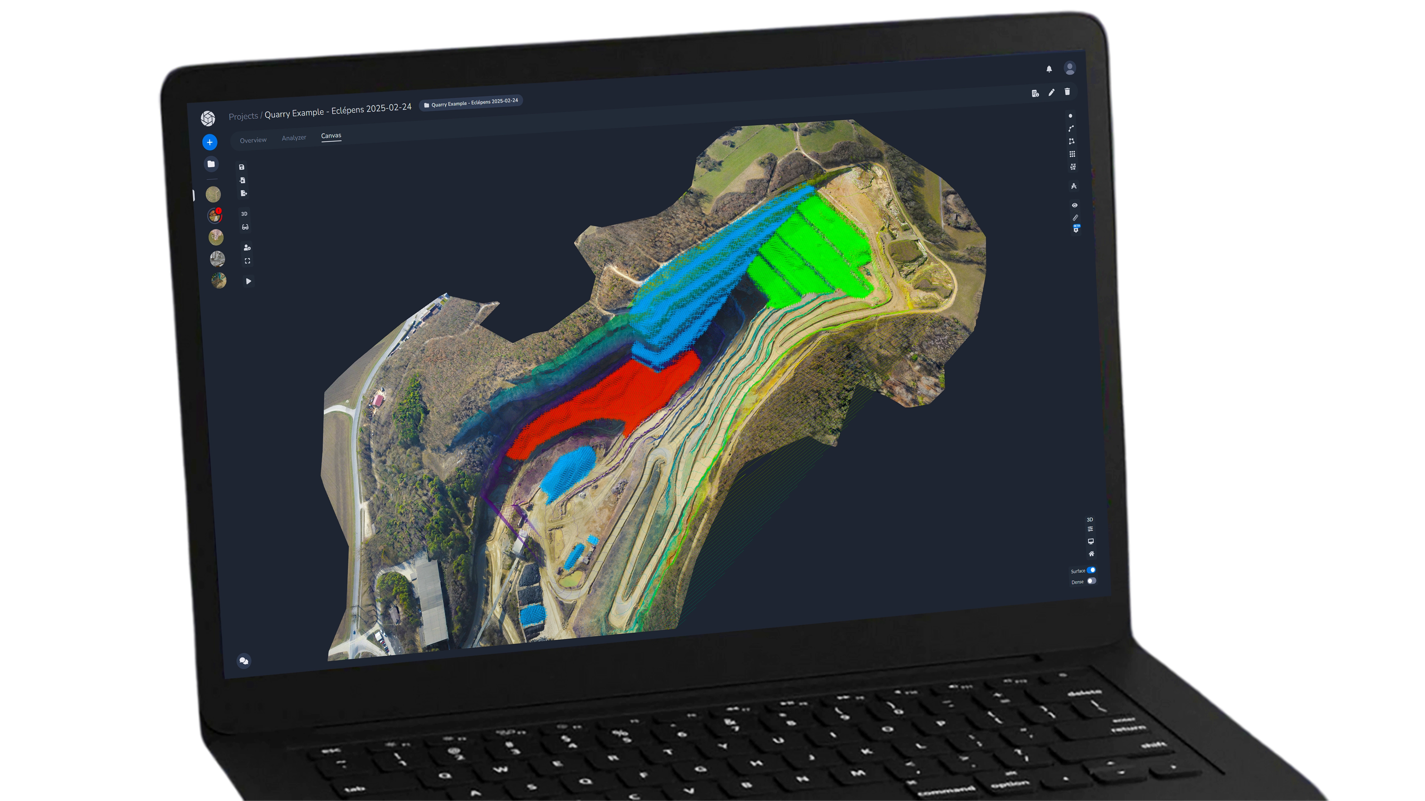
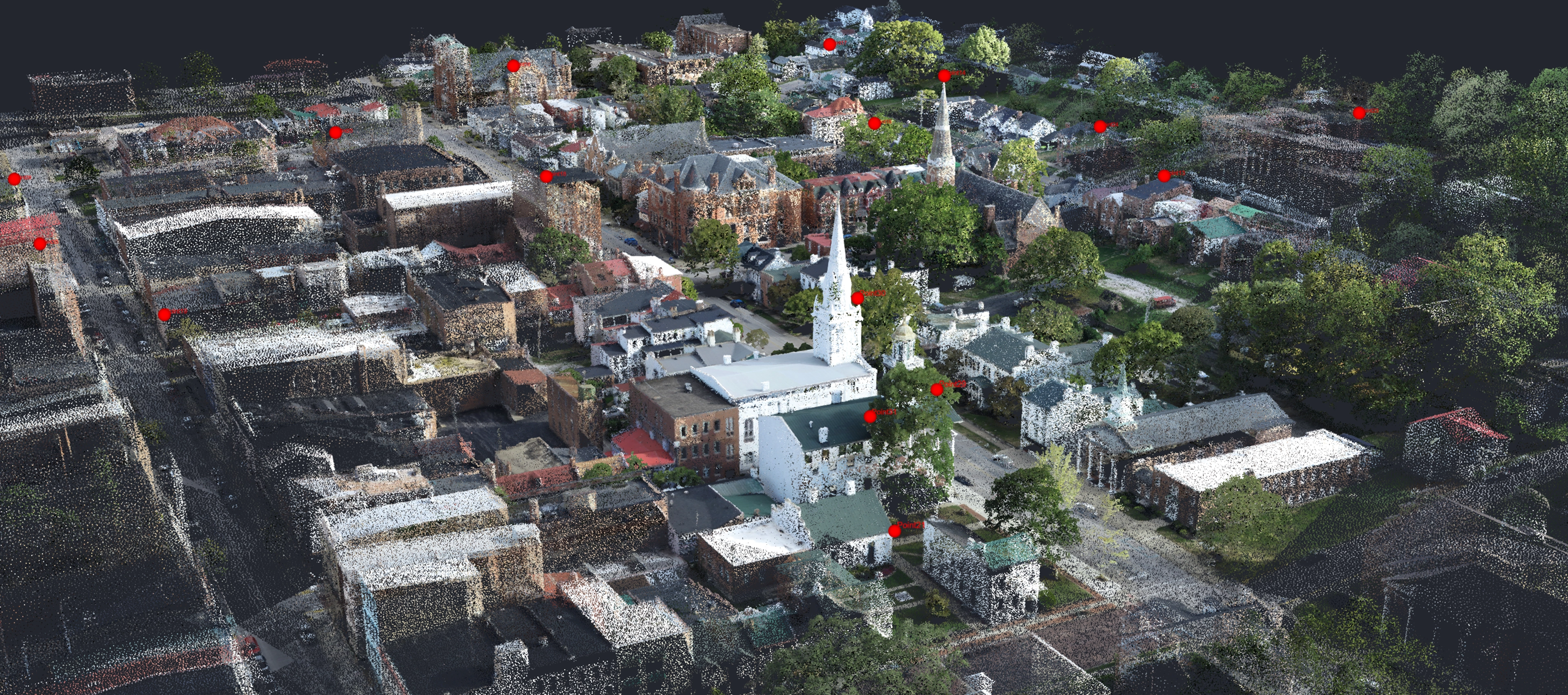
Our advanced engine automates photogrammetry reconstruction, precision bundle adjustment, and aerotriangulation. Transform raw imagery and LiDAR into high-density point clouds and georeferenced orthoimages with centimeter-level accuracy.
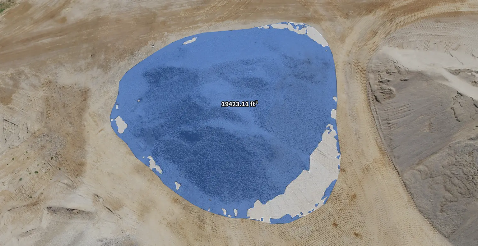
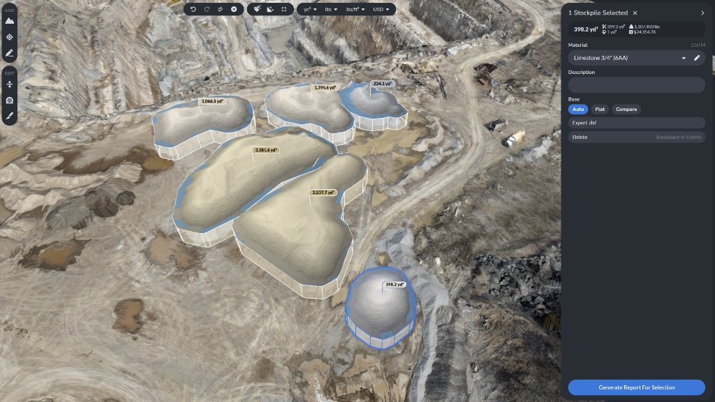
Extract survey-grade 3D measurements and perform volumetric analysis directly in the PixElement Canvas. Leverage specialized tools like StockpileStudio for automated pile reporting and FastDraft for expert linework drafting, alongside automated bare-earth extraction for comprehensive project analysis.


Generate and export engineering-ready deliverables in industry-standard formats (XML, SHP, OBJ, LAS, and more) for direct integration into your GIS or CAD software. Share interactive project links and professional reports to facilitate instant stakeholder collaboration and data-driven decision making.
Handle multi-flight imagery and complex geospatial data without being limited by your local hardware.
Process recurring site surveys quickly and track changes over time. Keep projects moving without delays or processing bottlenecks.
Centralize your projects to enable collaborative workflows and instant data sharing. Communicate findings with stakeholders and team members directly from the cloud platform.
Process from any device without hardware constraints. Offload processing to the cloud and keep your local system free for other work.
If you attempt to upload an image set that pushes you over your plan limits, you’ll have the option to upgrade or pay $149.99 for an additional 5 GB of processing.
Yes! All of our monthly plans include an annual option that saves you 17% off the month-to-month plan. That’s 2 months free!
Absolutely, you can switch plans at any point with no penalty.
Set up an account for free and you get 2 gigabytes of free processing! To keep processing more imagery, you just need to select a plan.
We accept most credit cards, and support invoicing for high-volume processors and larger organizations.