Point Cloud Classification Filtering for Precision Orthomosaic and 3D Mesh Generation
Aerial LiDAR provides powerful, high-resolution 3D point clouds that can contain billions of points. While LiDAR provides incredible detail, it also includes noise and unwanted artifacts like moving cars and pedestrians that must be filtered out during data processing.
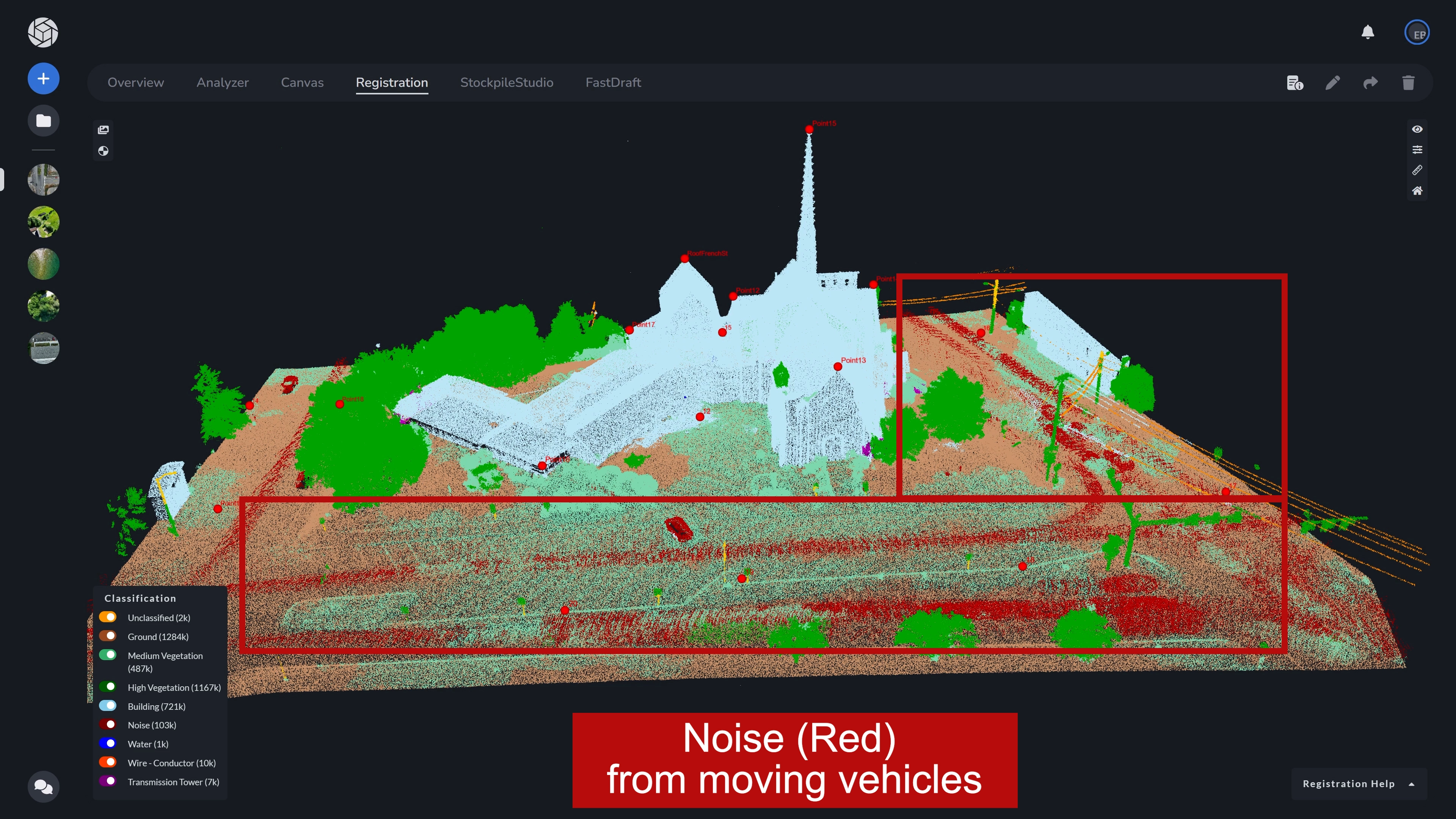
To refine this raw LiDAR data for specific mapping applications, point clouds are often processed into labeled categories (such as Ground, Vegetation, Buildings, Noise, etc).
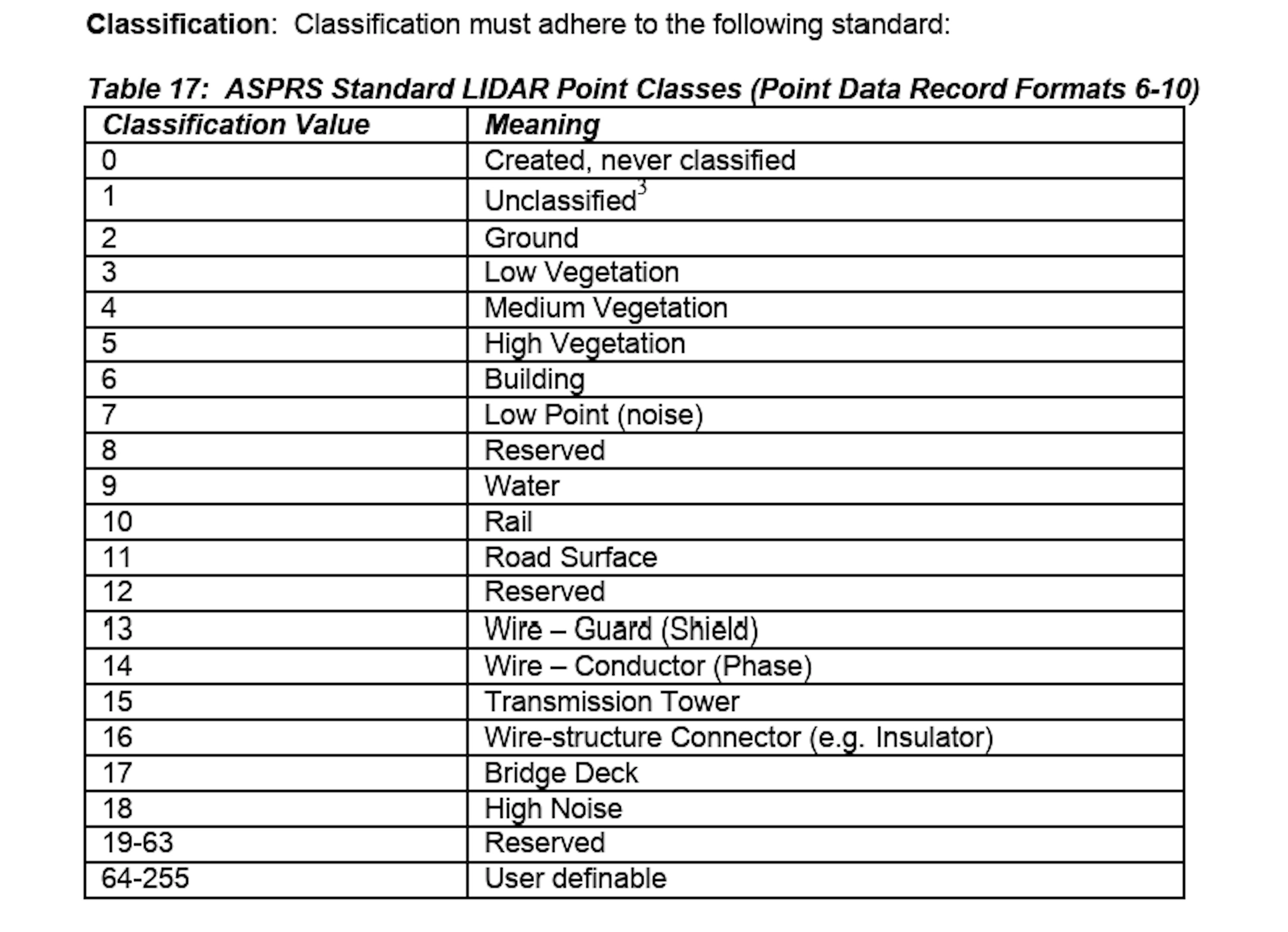
Under the current ASPRS LAS 1.4 specification, there are 19 strictly defined categories reserved for universal feature types like Ground (2), Vegetation (3–5), Buildings (6), Water (9), and High/Low Noise (7 & 18). By leveraging these existing classifications, you can filter your data to exclude unwanted layers before generating your 3D Mesh, Digital Elevation Model, and Orthomosaic.
This new feature gives you granular control over exactly which point classifications are included in your final outputs, thereby guaranteeing that the final dataset contains only the specific information layers that you have chosen.
NOTE: This feature is only applicable to projects where the original LAS files contain classification data.
How it Works:
- Enter the Registration Phase: Once your project is processed, navigate to the Show icon.
- Select Classification: The interface will display a breakdown of point counts per classification category.
- Filter & Refine: Use the toggle switches to disable unwanted data, such as “Noise” or “Medium/High Vegetation.”
- Process: Upon completing your Reference Point and LiDAR registration, click the button to process your project. You will be prompted to confirm your configuration where you can toggle which classification data you would like to exclude.
In this case, we are deselecting, Unclassified, Noise, and Conductor Wires.
Next, select your Orthomosaic Method.
If you are removing classes from LiDAR, using the Mesh Projected setting is the best method when removing data.
Upon hitting process, your final 3D Mesh and/or Orthomosaic will be generated using only your selected, clean data points.
Common Use Cases
A common use case is that often, users only want the buildings and ground to be included in their ortho and 3D mesh (see left example below), or to be able to view the bare earth in a highly vegetated area (see right example below). These workflows enable professionals to isolate essential structural or topographical data without the distraction of peripheral objects.
Better Data, Faster
This update is part of our ongoing commitment to making PixElement the most flexible and precise tool in your mapping arsenal. By allowing you to filter data at the source, we are helping you deliver higher-quality products with significantly less manual cleanup.
Log in and try out the new selection tools on your next project today.