Generate TIN Tool and Smarter Terrain Editing
Major updates to the TIN workflow now give users greater flexibility in creating, editing, and analyzing terrain models. This guide walks through the new Generate TIN tool, explains the improved generation options, and shows how these changes make working with surface models faster, more intuitive, and more powerful. Survey Canvas.

What’s New: Three Ways to Generate TINs
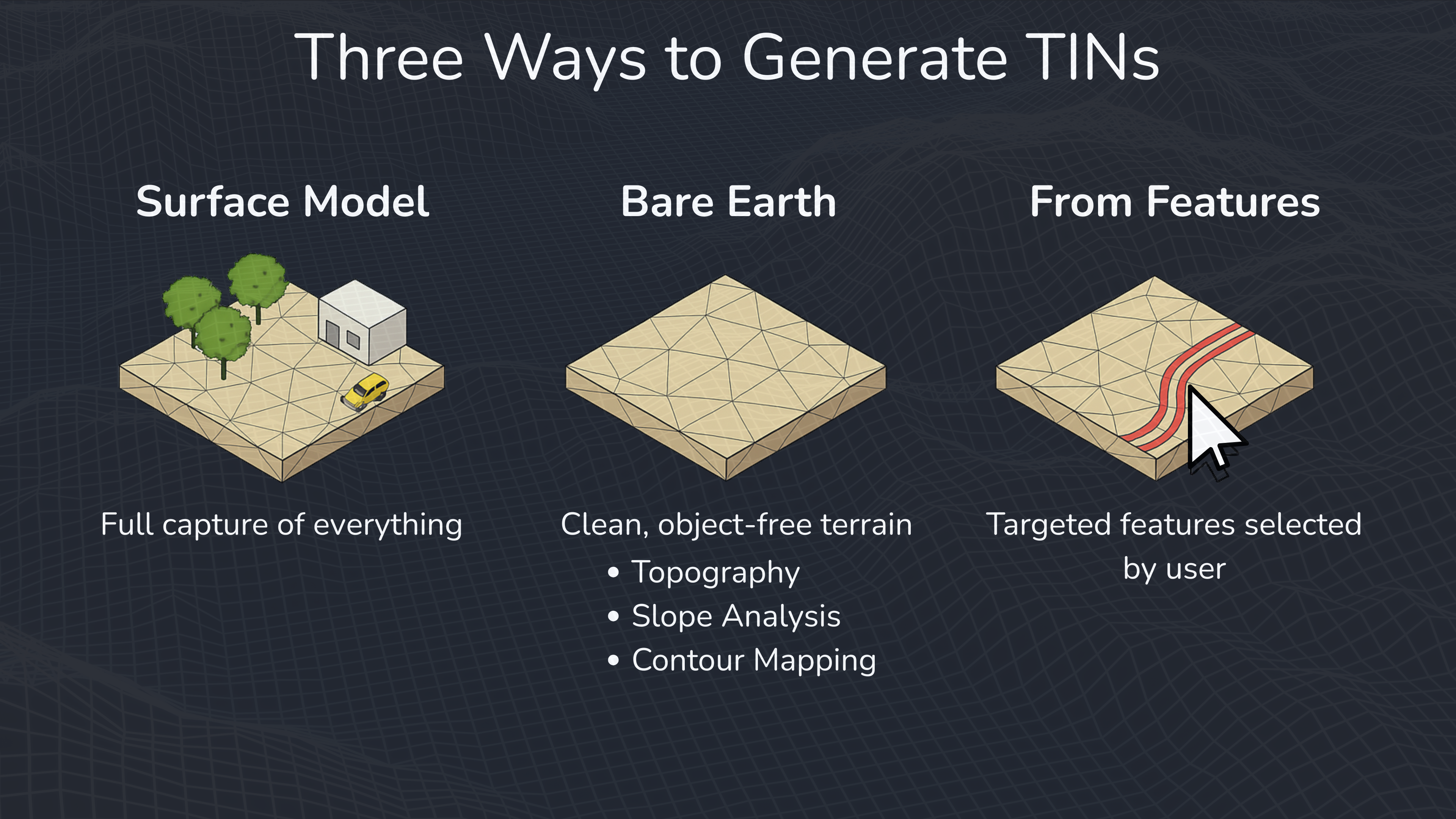
There are now three ways you can generate TINs:
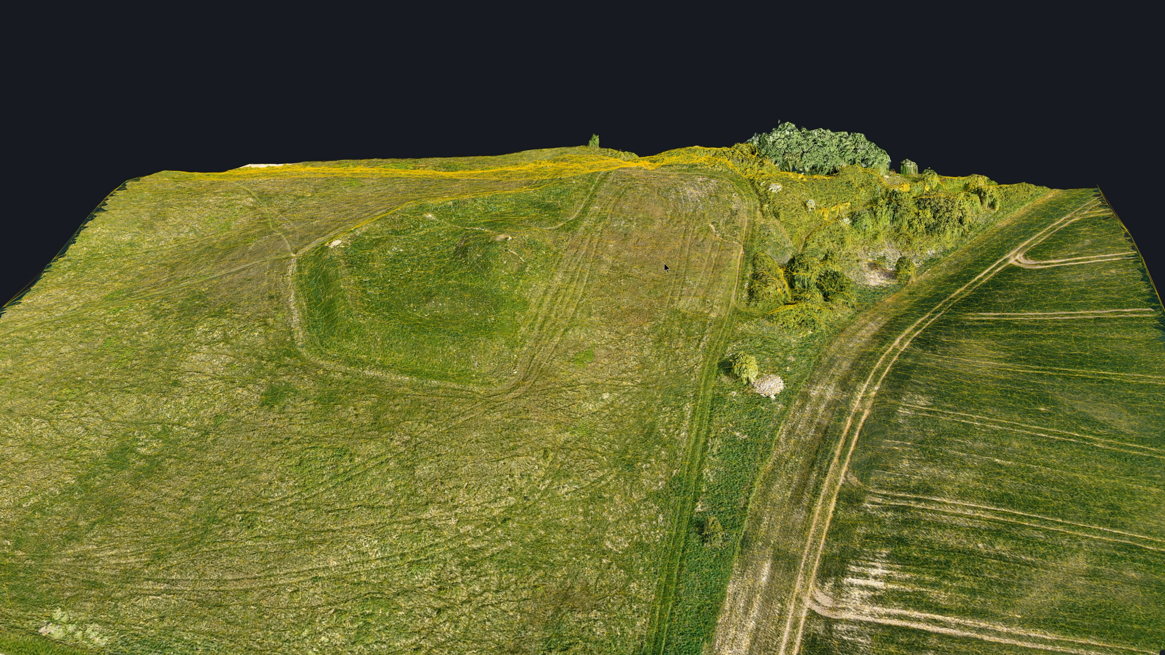
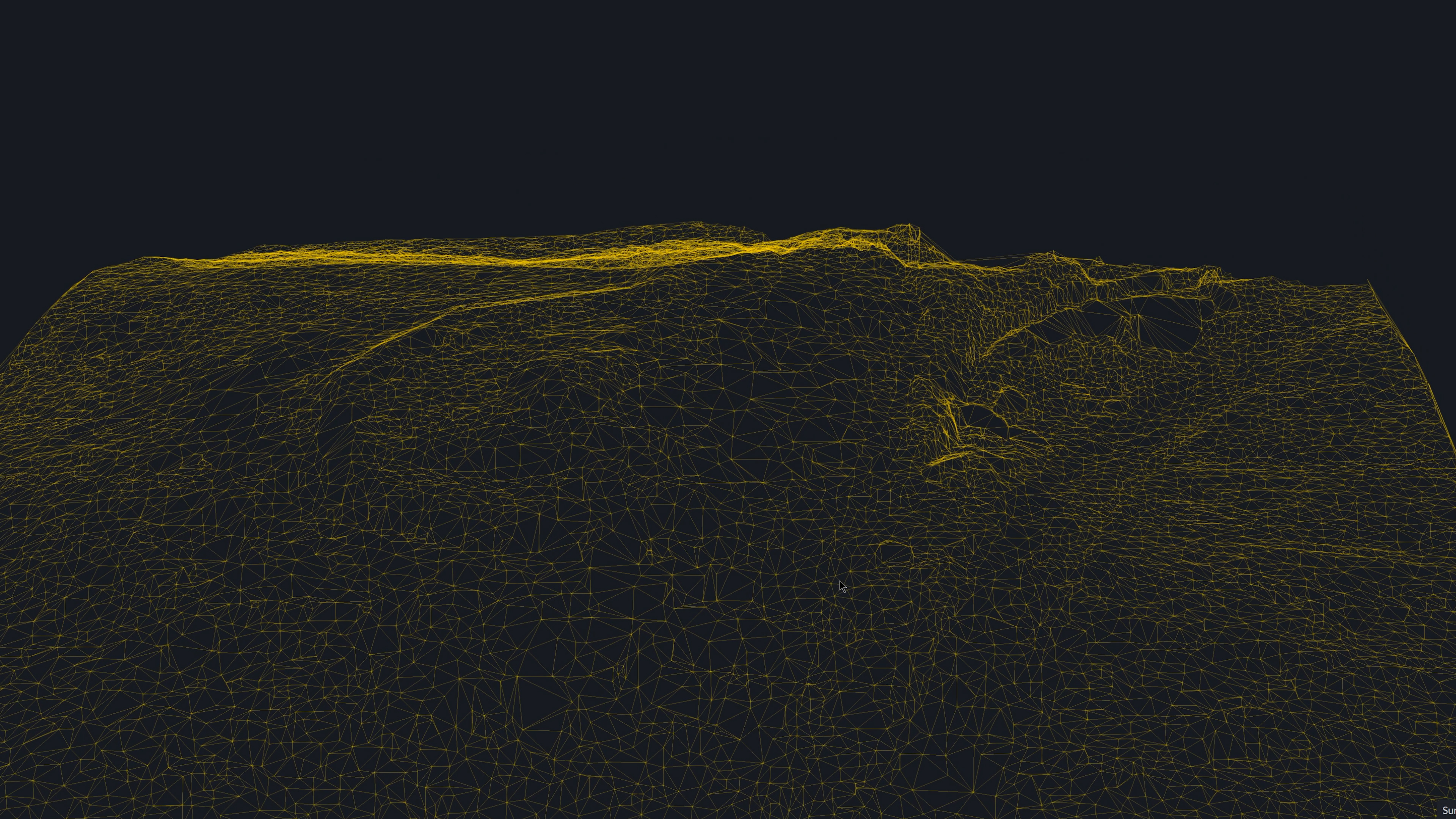
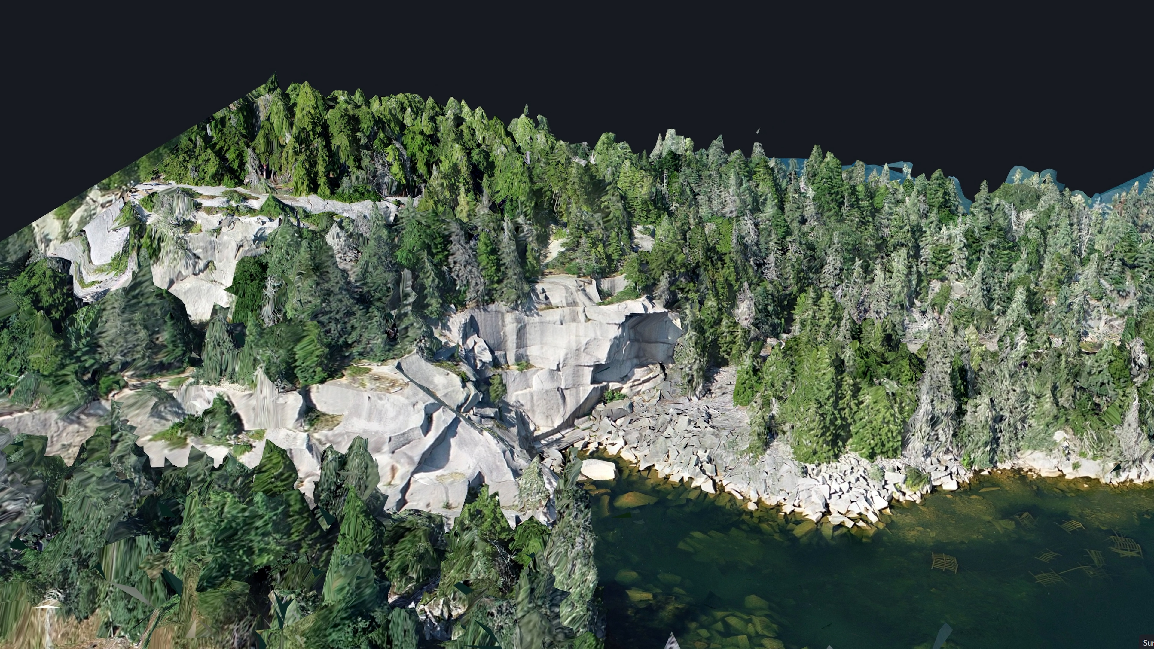
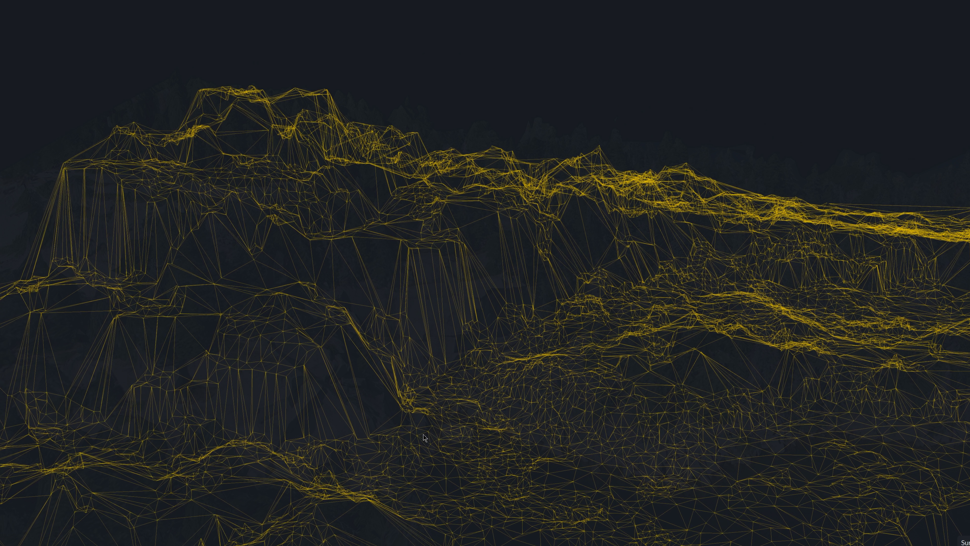
Surface Model: Creates a TIN based on the surface model itself, with no bare earth estimation or filtering. Best for a faithful representation of all visible surface features, including trees, vehicles, and structures.
Bare Earth: Creates a TIN from the bare earth model, excluding trees, vehicles, and structures. Ideal for clean topography, slope analysis, and contour mapping.
From Features: Creates a TIN from selected features such as points, breaklines, and holes. Perfect for custom modeling or design surfaces.
Choosing Bounds for Your TIN
Next in the Generate TIN menu, you have the option to choose your bounds.
For Surface Model and Bare Earth modes:
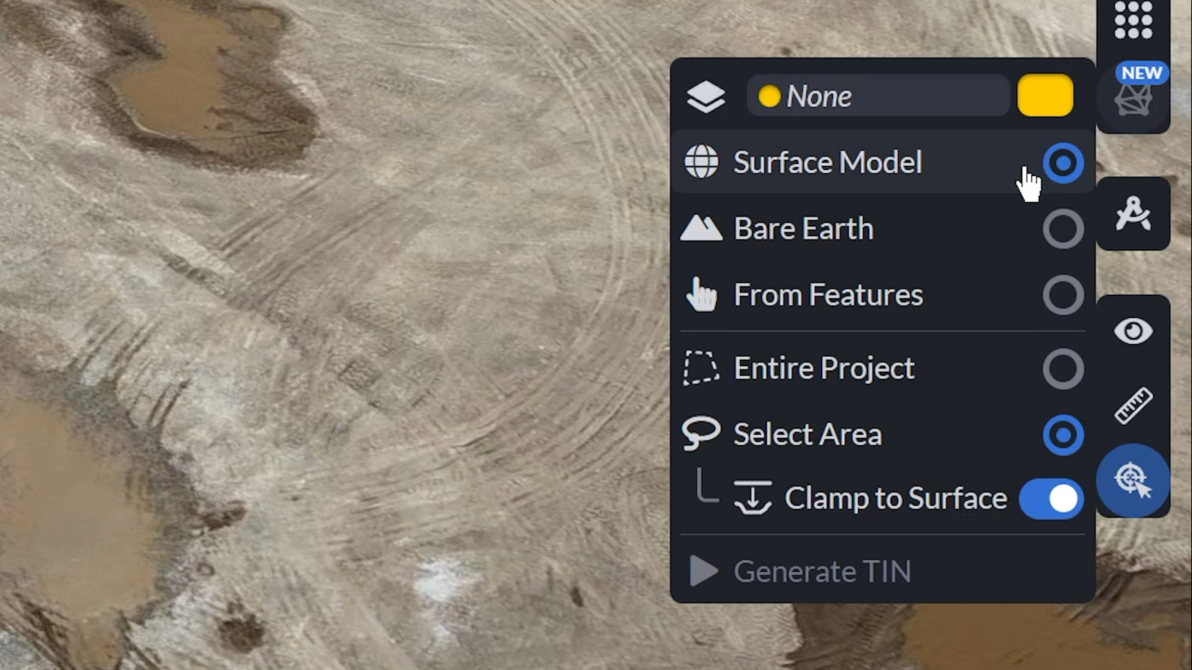
You can either select:
- Entire Project: Use the entire project extent to create the TIN.
- Select Area: Draw a polygon to define your bounds.
For applications using Bare Earth, you will be wanting to strip away any vegetation and buildings so your model represents just the underlying terrain, giving you a cleaner base to work with.
When selecting From Features:
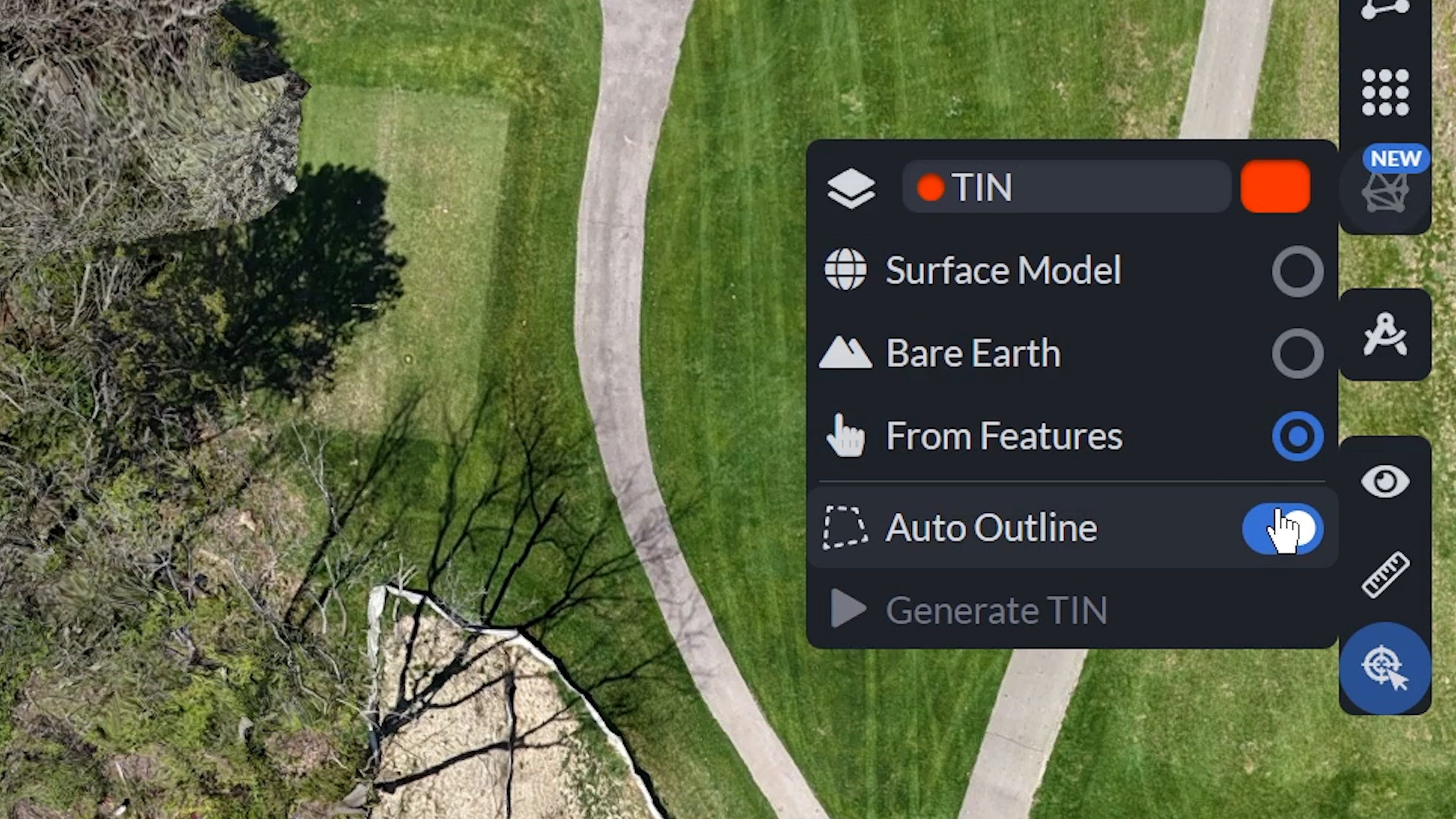
- Auto Outline: Toggle between auto-generated outlines or manually drawn ones.
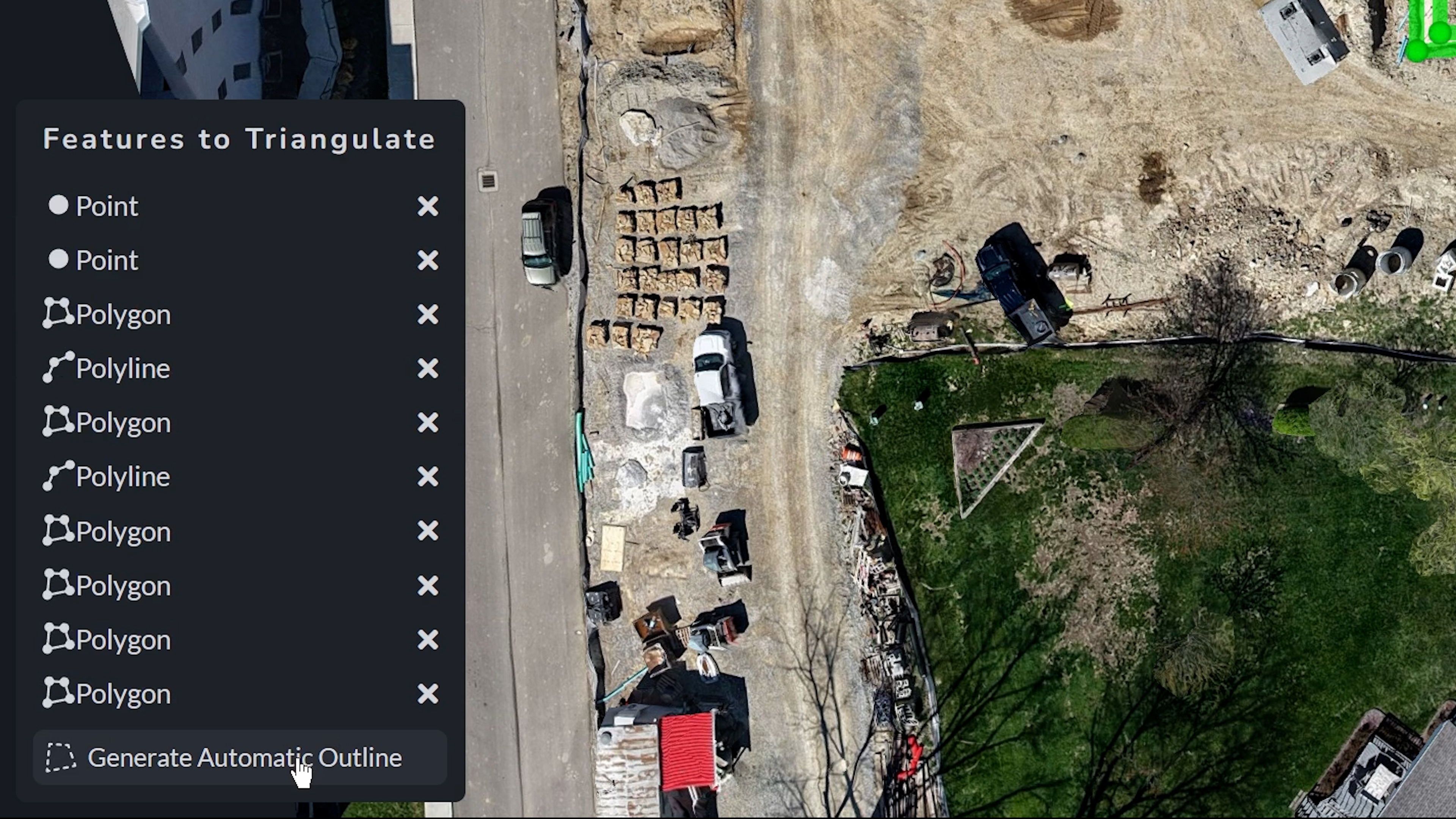
- Enabled: Follow the bottom-left prompt to select features (points, polylines, polygons or grids) to create one large triangulated TIN from all selected features. Then click submit to render.
- Disabled: Draw an outline polygon around the desired annotated features, then submit for triangulation.
Upon adding the features, a list will appear where you have the option to remove a feature, or continue, to Generate Automatic Outline.
Improved TIN Editing Tools
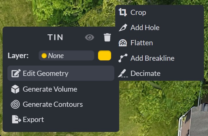
After generating and bounding your TIN, refine it with the updated editing suite to edit the TIN geometry, generate Volumes and Contours, or export your triangulation. The toolset allows you to apply breaklines to enforce sharp elevation changes, flatten areas to remove unwanted features like trees or vehicles, create holes to exclude regions from calculations, and decimate to reduce triangle density for performance. These capabilities give you fine-grained control over the final surface, ensuring it meets the exact requirements of your project before sharing or integrating into other workflows.
Handling Common Surface TIN Challenges
Because Surface Model TINs replicate the raw surface you can sometimes run into:
- Spikes, floating objects, and holes
- Some TINs may fail volume calculations if not watertight.
*If this occurs, switch to a TIN-from-grid to create a simpler, watertight surface.
When to Use Each TIN Type
| Situation | Recommended TIN |
| Fast site surface for visual context | Surface Model TIN |
| Slope, drainage, topo surveys | Bare Earth TIN |
| Road design, curb layout, custom grading | From Features TIN |
| Volumes from complex surfaces failing | TIN-from-grid fallback |
Real-World Example
Picture a busy construction site dotted with machinery, stockpiles, and debris. You begin with a Surface Model TIN to capture every object for full situational awareness. Next, for grading plans, you generate a Bare Earth TIN to reveal clean underlying terrain. Finally, for precise detailing like pad edges and curbs, you use From Features TIN to triangulate only selected elements. At each stage, you refine with flattening, breaklines, and hole tools, ensuring a model tailored to your exact needs.
Final Thoughts
These updates offer three versatile generation modes—Surface Model for comprehensive capture, Bare Earth for uncluttered terrain, and From Features for targeted design—paired with powerful editing tools like breaklines, flattening, holes, and decimation. Together, they transform the Generate TIN tool into a faster, smarter, and more adaptable solution for all stages of terrain modeling. With quick generation, precise control, and reliable fallback options, you can produce cleaner, more efficient results ready for GIS analysis, CAD design, or any downstream application.