What’s New in PixElement: Point Cloud Enhancements, Bare Earth LiDAR Tools, and More
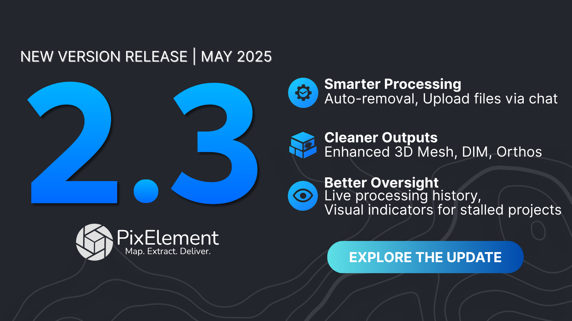
PixElement’s latest update introduces a set of practical tools and performance improvements aimed at making your mapping workflows more efficient, accurate, and user-friendly. Whether you’re working with dense point clouds, LiDAR-based terrain models, or large datasets on desktop, these new features were built to handle real-world challenges faced by professionals who use PixElement every day.
Here’s a breakdown of what’s included in the newest version:
🟡Point Cloud & Mesh Enhancements:
We’ve made significant improvements to how point clouds and 3D meshes are generated. These updates are already available on PixElement cloud, and are also part of the standalone desktop release. The latest algorithm produces:
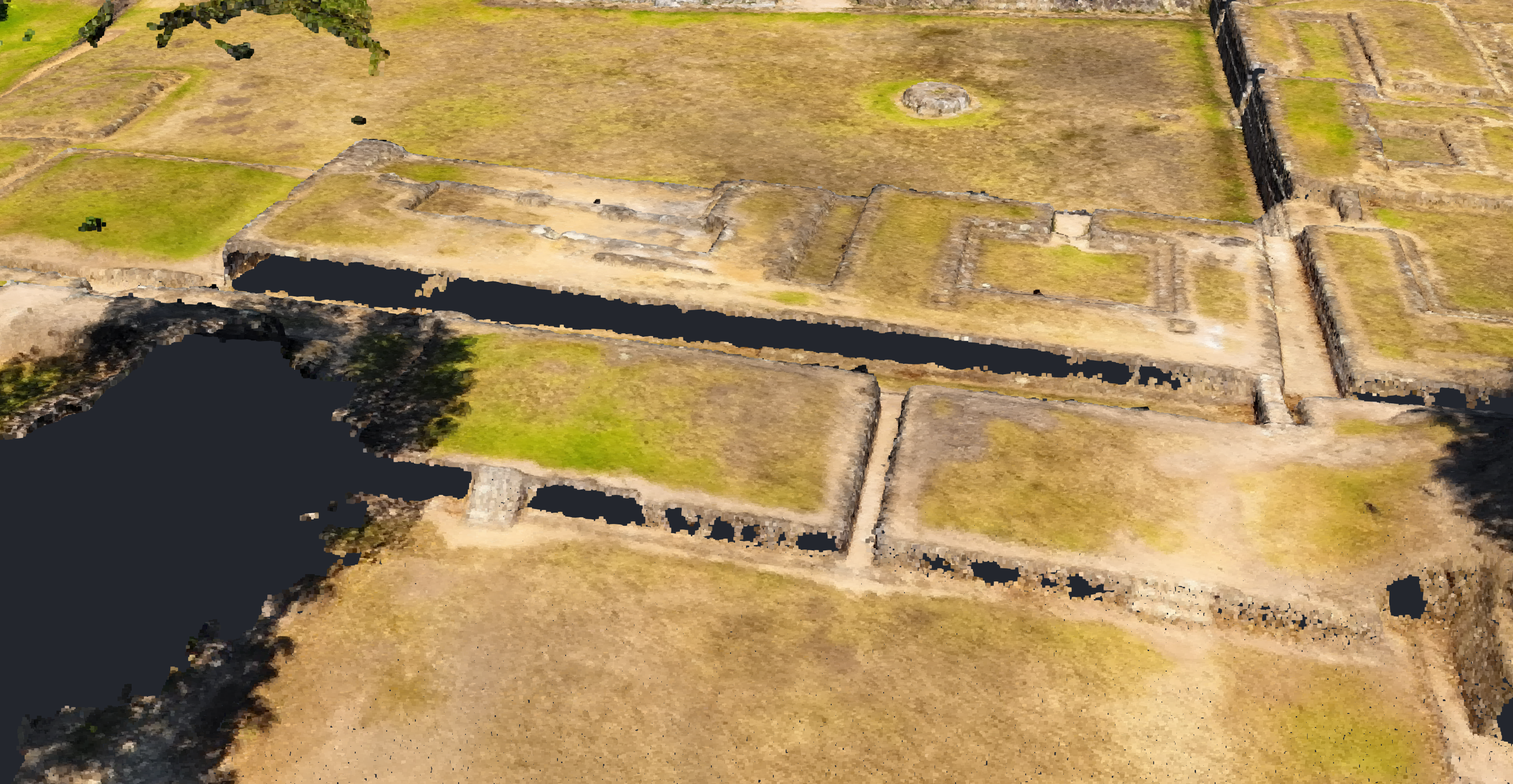
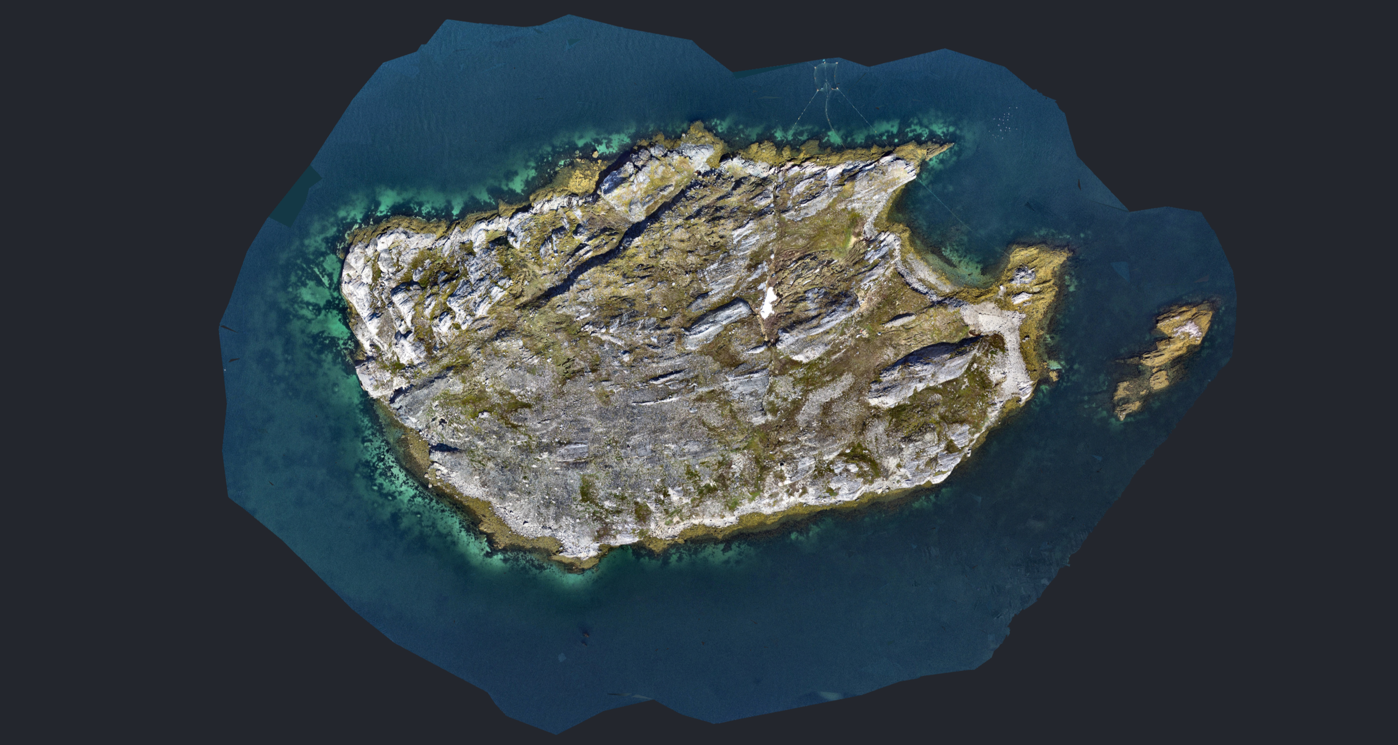
- Denser Point Clouds, giving you more detailed and robust models.
Before
After
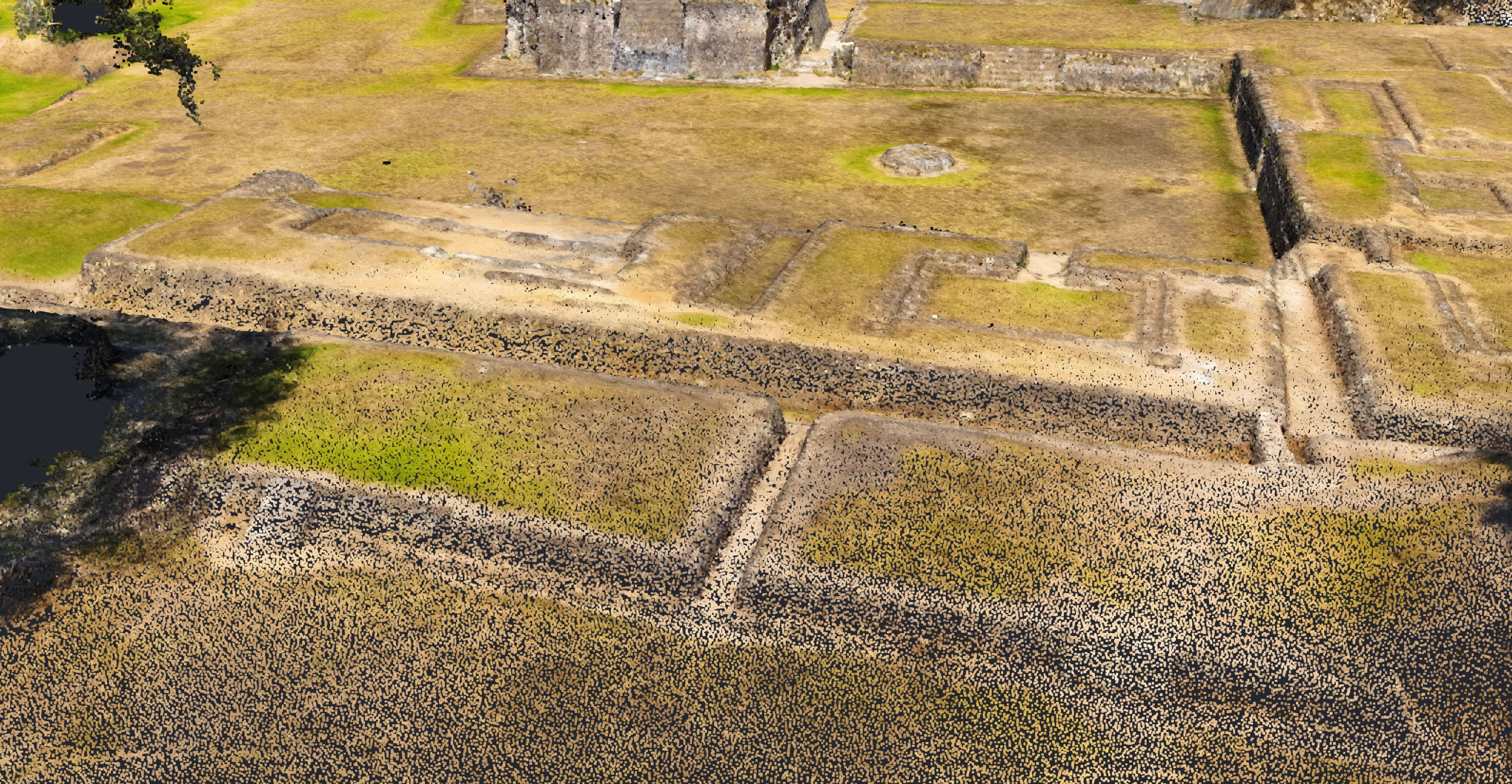
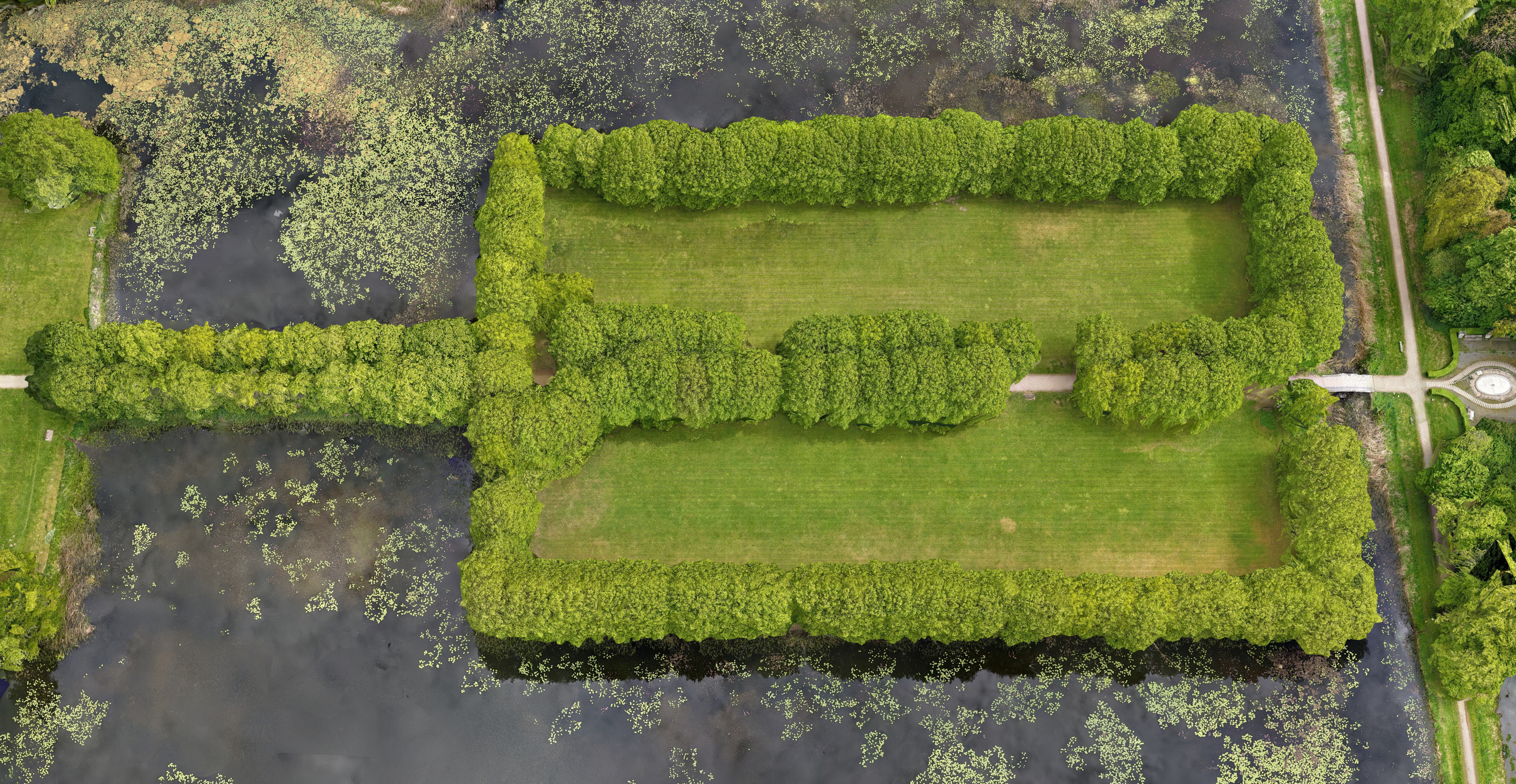
- More complete coverage along the edges of datasets, reducing cutoffs
Before
After
Building facades are typically incomplete when captured from nadir-only flights. While PixElement offers advanced reconstruction tools, it can’t recover details that weren’t visible in the images to begin with.
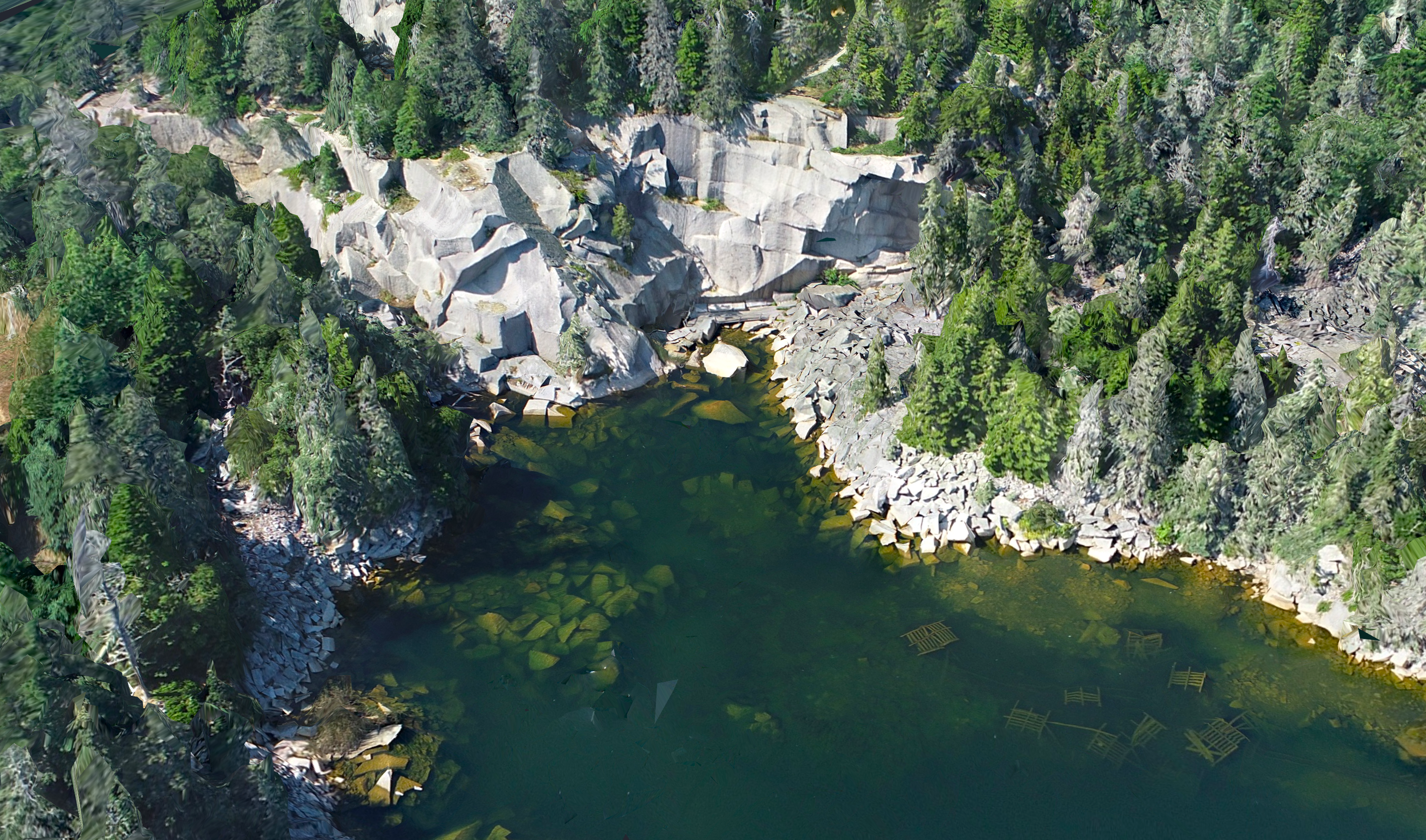
- Better tree modeling, especially in areas where photogrammetry typically struggles – LiDAR inputs now produce even better and more reliable vegetation structure.
It is important to note that tree modeling is best done with LiDAR+imagery projects. Imagery projects alone can struggle to accurately capture dense vegetation structures, often resulting in sparse canopies or gaps due to shadows, overlap issues, or limited ground visibility.
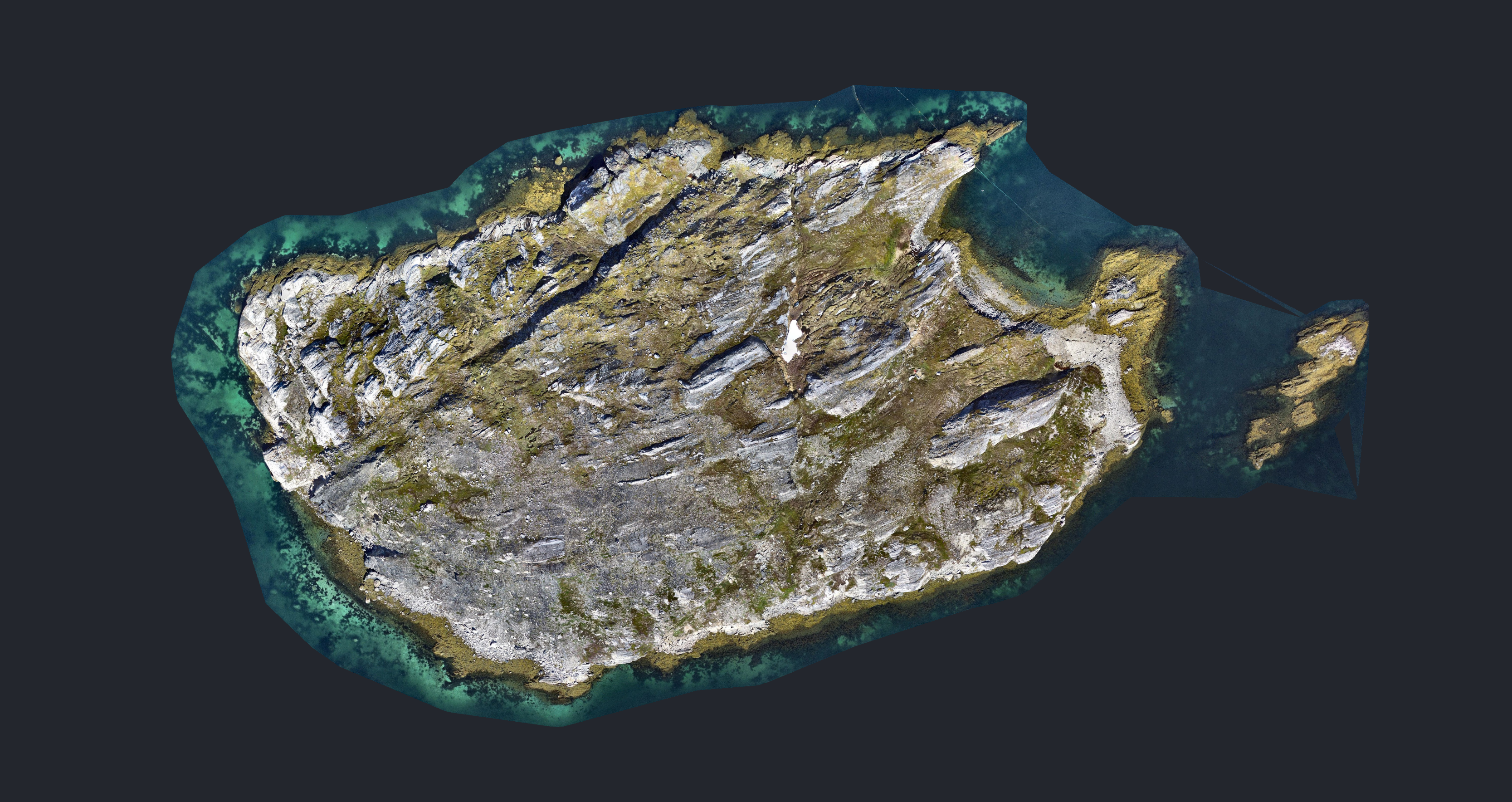
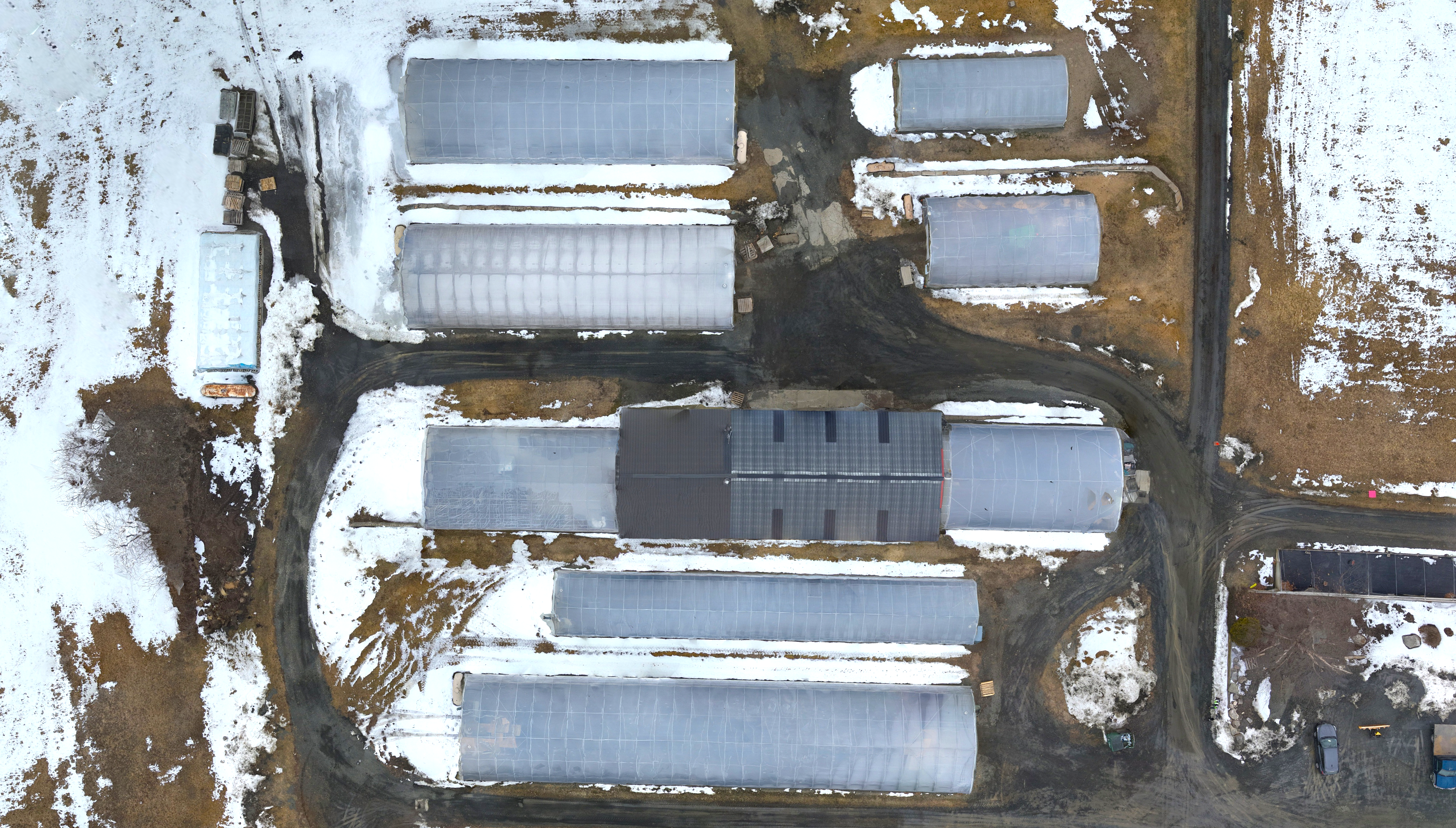
- Improved handling of reflective surfaces like metal roofs, and water – reducing noise and gaps in the dataset.
These upgrades not only improve 3D models but also result in higher-quality 2D orthomosaics derived from the enhanced point data.
🌐Bare Earth Generation for Orthos/DEMs/Meshes from LiDAR:
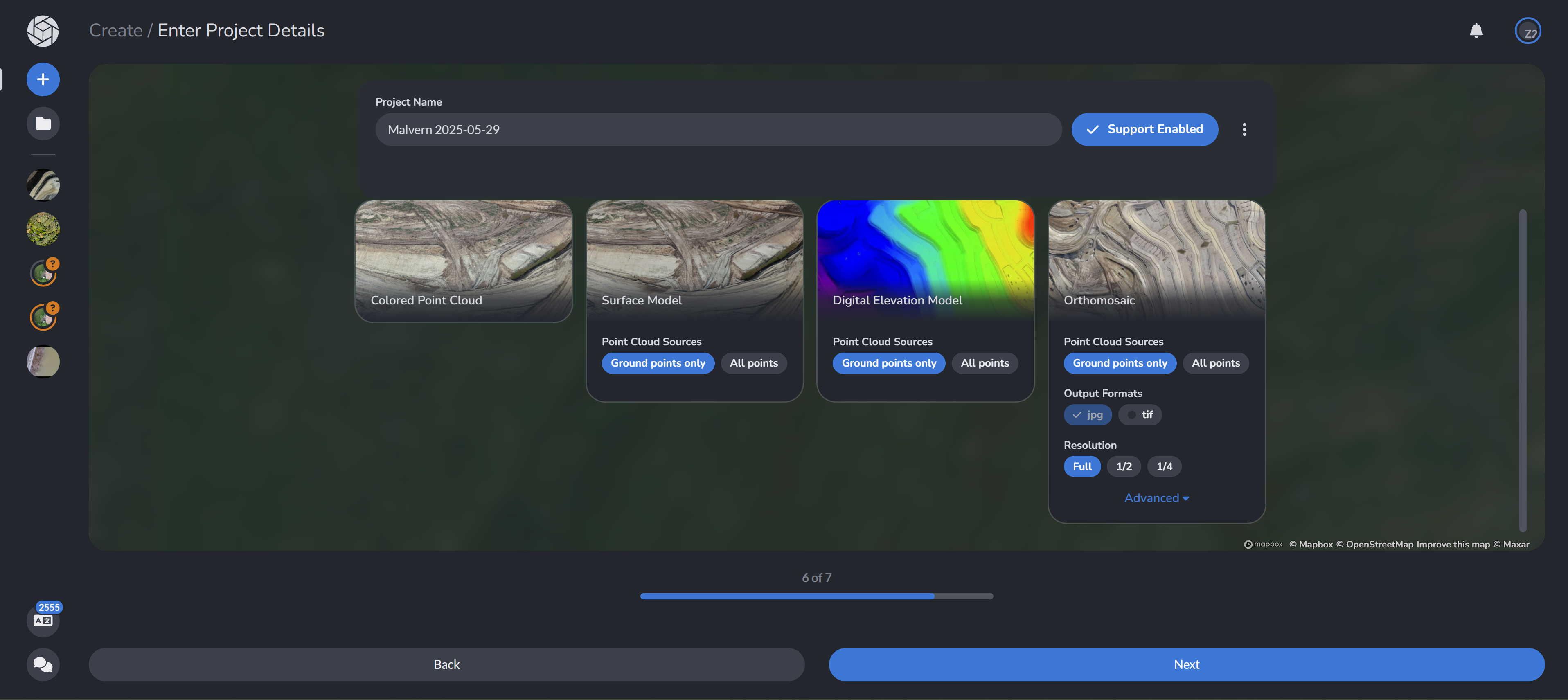
For users working with LiDAR, we’ve added a “Ground Points Only” option during project setup. This enables PixElement to either detect existing ground classifications embedded in your .LAS file or automatically classify ground points when classification isn’t present.
Key benefits:
- Works with existing classified datasets, so no rework is needed
- Automatically detects embedded classification when available
- Allows users to quickly extract bare earth surfaces for volume measurements and terrain modeling
- Offers a cleaner way to define TINs—no need to generate a full grid first
This makes it easier to cut through vegetation, isolate terrain, and focus on what really matters for bare-earth calculations.
⏱ Better Processing Timers:
We’ve heard from users that processing feedback on large desktop projects wasn’t always helpful—especially when progress bars appeared stuck at a certain percentage.
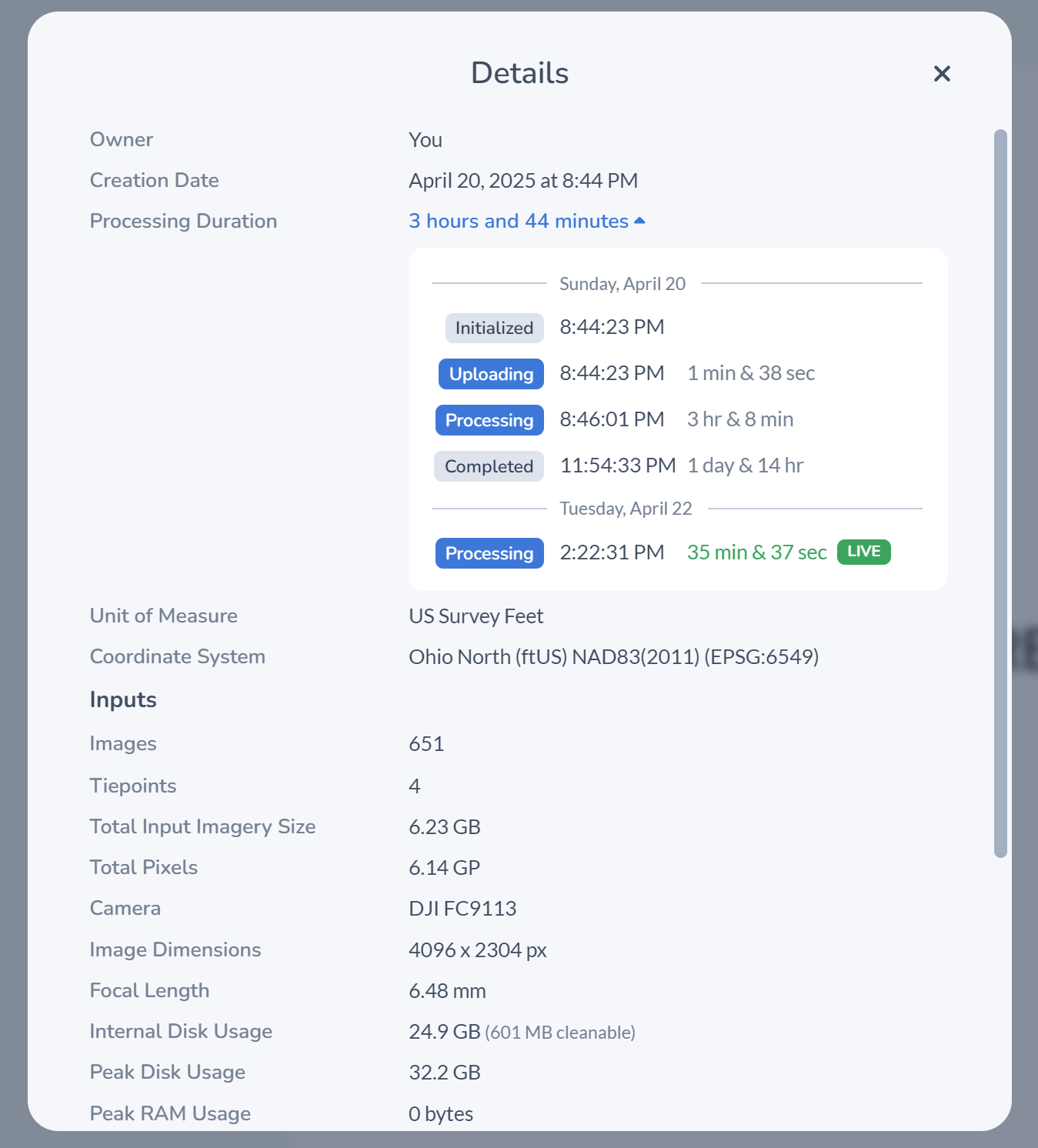
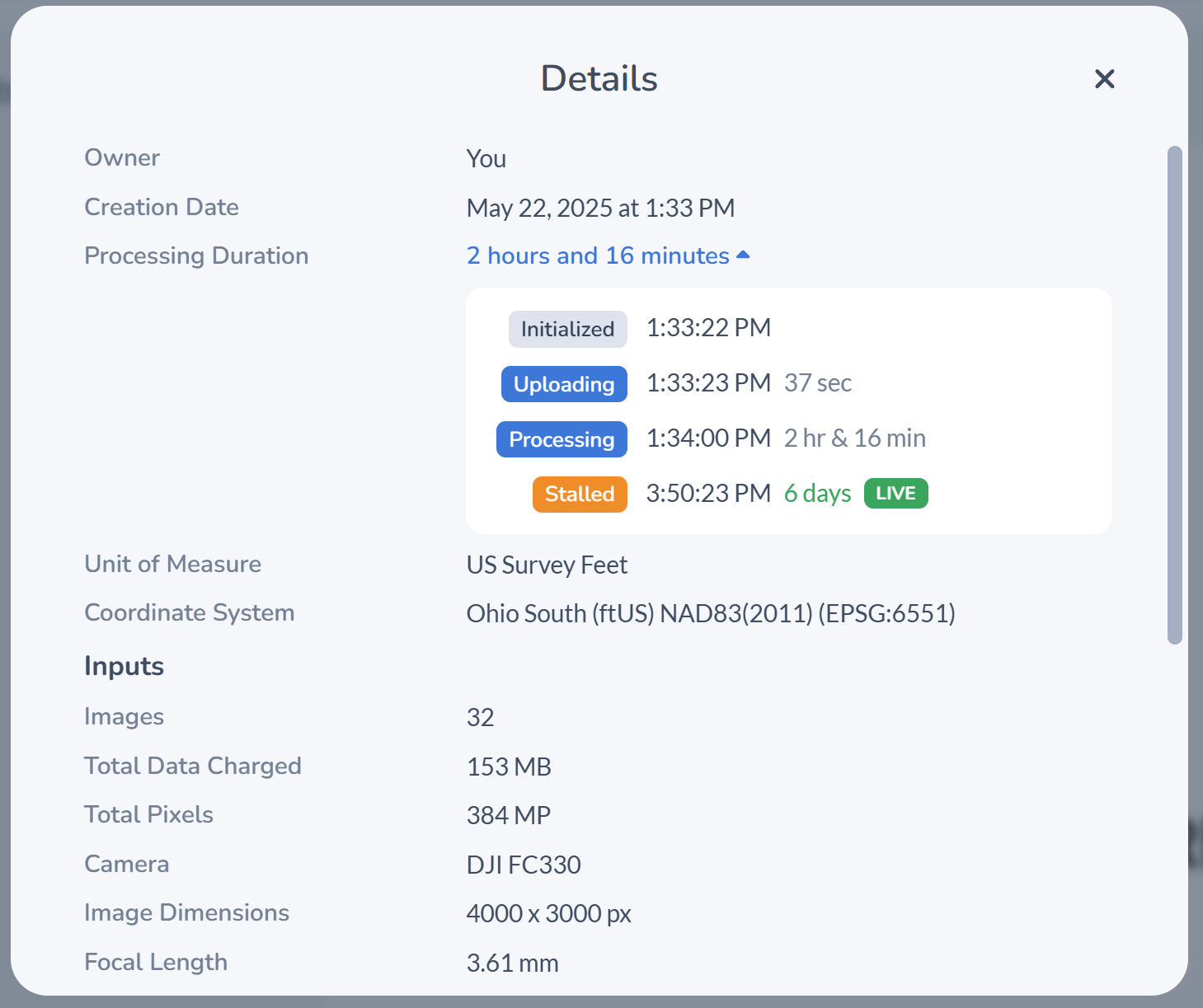
Upon opening your project, click on the  details button on the top right toolbar and click the dropdown for Processing Duration. You will then be able to view all steps that your project has taken, along with the starttime and duration.
The new update introduces:
- Granular step-by-step progress tracking
- Timestamps showing when each step began
- Duration indicators for how long each part of the process has been running
This helps clarify whether a task is moving slowly due to data size or has actually stalled, improving transparency and reducing unnecessary restarts.
🈳Translation Tool
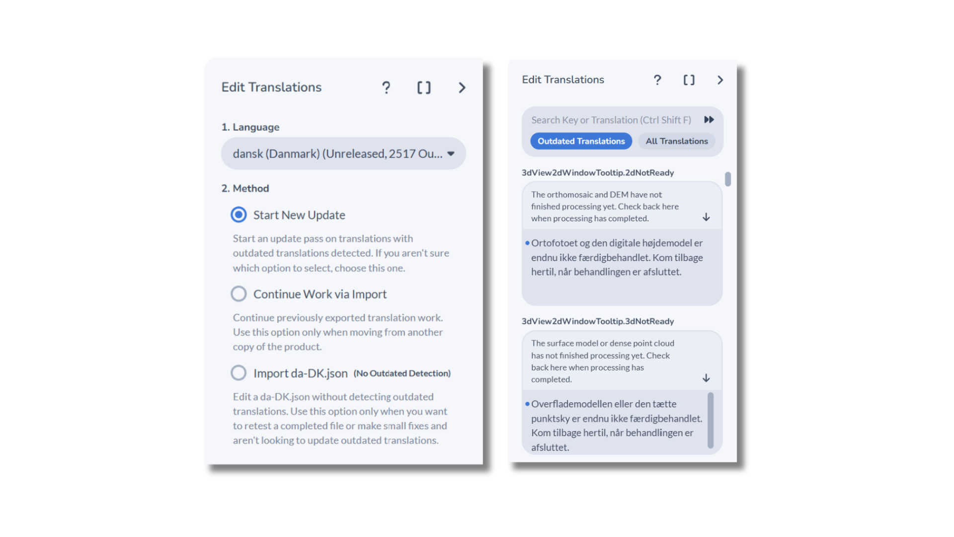
Managing localization is now easier with the new Translation Tool in the desktop version of PixElement. View our Translation Tool blog post and tutorial video here.
Teams can now:
- Modify translations directly within the app
- Contribute updates without exporting or emailing files
- Use new diff tools for tracking and reviewing changes
It’s a simpler way for international teams or partners to maintain up-to-date translations with less overhead.
🛠 Automatic Corrupted Image Removal:
Corrupted or unreadable images can throw off an entire dataset. PixElement now automatically detects and excludes corrupted images during the project creation process, keeping your workflow on track without manual filtering.
🔴 New Visual Indicator for Stalled Projects:
Sometimes a project hangs without clearly communicating why. To make these moments easier to identify, PixElement now includes a visual cue for stalled projects that require manual intervention.
📂 Faster Error Recovery:
If a project fails during processing, users can now instantly upload their input files to PixElement support via the in-app chat, there’s not longer a need to compress and send folders manually. This makes troubleshooting large datasets much faster and easier.
These features are now rolling out across both PixElement Cloud and the upcoming desktop release. Each one is designed to solve specific pain points we’ve seen in real-world workflows—from more reliable point clouds to easier project setup with LiDAR data.
Stay tuned:
We will be releasing short video tutorials walking through some of these features in more detail.
If you have questions or want help using these new capabilities, don’t hesitate to reach out to our support team.