Ellipsoids, Geoids and Datums in Aerial Photogrammetry Modeling
Accurate modeling in aerial photogrammetry relies on a thorough understanding of Geodesy, the science of measuring and representing the Earth. Key concepts such as ellipsoids, geoids and datums are foundational for understanding how software algorithms accurately plot and model projects. In this article, we will explore these topics and help you understand the underlying science behind how precision and reliability are achieved with spatial data.
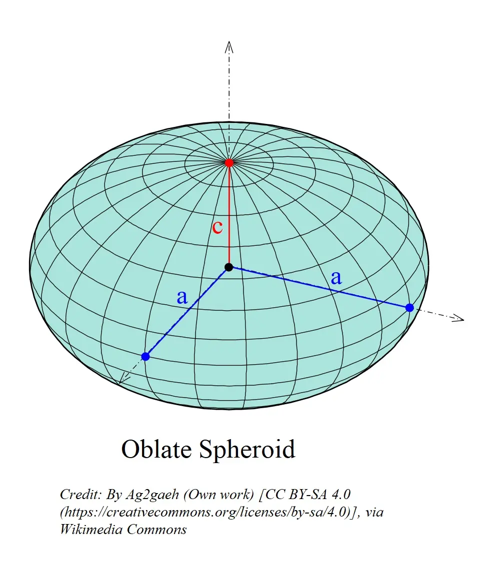
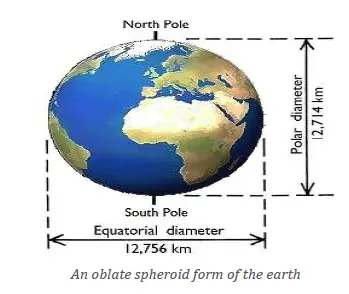
The Earth is not a perfect sphere; instead, it is an oblate spheroid, meaning it is slightly flattened at the poles and bulges at the equator. This shape is more frequently described as an ellipsoid. An ellipsoid lacks symmetry when divided in all directions. Since earth’s equator has a circumference that is approximately 67 km (42 miles) longer than that of its meridians, the planet cannot be accurately described as a perfect sphere.
Ellipsoid
An Ellipsoid is a mathematically defined surface that approximates the shape of the Earth. It provides a simplified model that is useful for mapping and navigation. However, because the Earth’s actual surface includes mountains, valleys, and other varying terrain, the ellipsoid does not match the topographic surface precisely.
Geoid
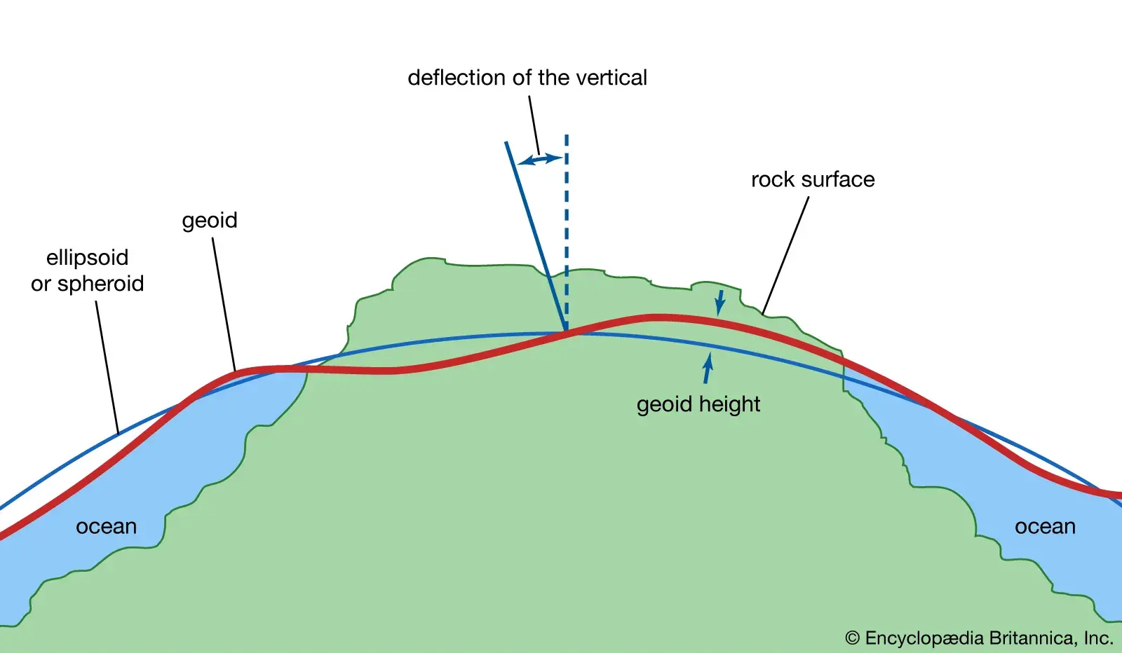
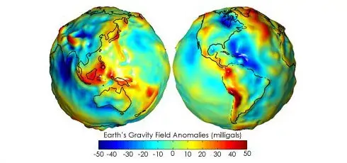
A Geoid is a more complex model that represents the Earth’s mean sea level, taking into account the variations in gravitational strength across the planet. The geoid undulates, reflecting the differences in gravity caused by the Earth’s uneven distribution of mass. These variations mean that the geoid can bulge above or dip below the reference ellipsoid.
Geoid Offset
The Geoid Offset is the difference between the ellipsoid and the geoid at any given location. This offset is crucial for accurate elevation measurements.
How PixElement Uses Vertical Datums to Keep Your Data Consistent
At PixElement, we prioritize the consistency and accuracy of your data, especially for vertical measurements. Ellipsoid and geoid models (of which numerous variations exist) are types of vertical datums. For surveyors or photogrammetrists, these vertical datums act as reference points for determining elevation for both positive altitudes and negative depressions. It is important to use the same geodetic datums throughout your entire project. Changing ellipsoid or geoid models during a project can lead to data inconsistencies. If you have different datasets using various coordinate reference systems and datums, they must be transformed to align with each other for exact measurements.
PixElement goes to great lengths to automatically correct for vertical datum mismatches between images, ground control points, and lidar data (if available).
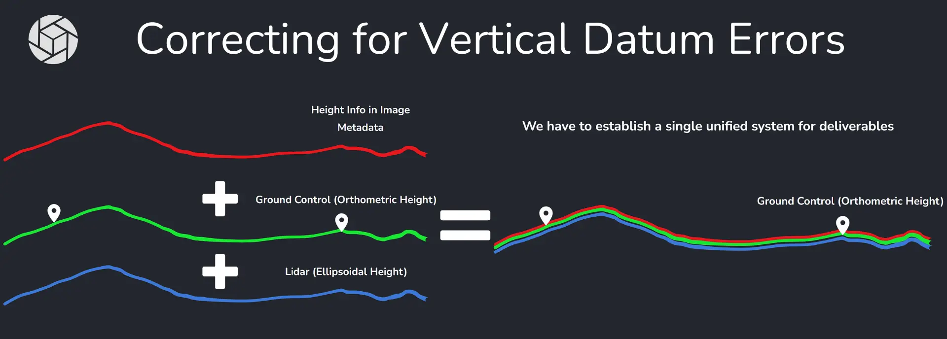
Within an already processed project in PixElement, you are able to transform your product type and select the correct coordinate system to ensure your data aligns accurately with your project’s requirements.
Modern GNSS-leveling technology offers an efficient method for determining ellipsoidal heights, which can then be used to calculate physical heights. However, for this approach to be effective, a precise understanding of the geoid is essential.
Understanding Orthometric Height
To ensure the accuracy of the elevation data collected, it’s essential to understand the different types of height variables involved. These variables—Ellipsoid Height, Geoid Height, and Orthometric Height—each play a crucial role in determining the true elevation above or below sea level.
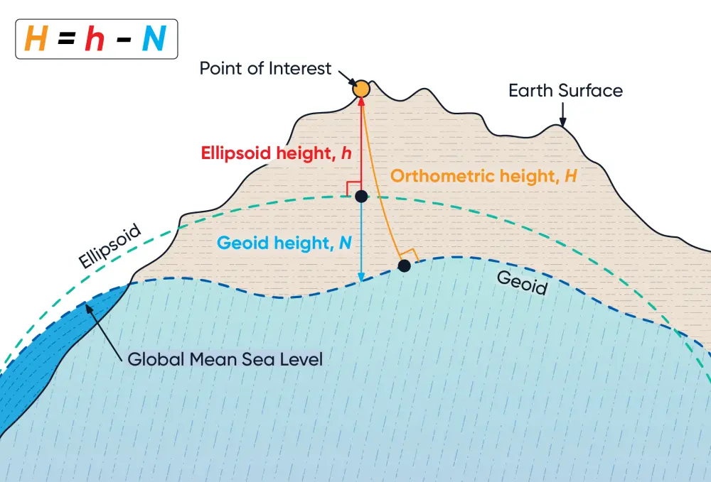
Orthometric Height (H) is the vertical distance between a point on Earth’s surface and the geoid. This height represents the true elevation above or below sea level and is calculated by subtracting the geoid height (N) from the ellipsoid height (h) using the formula: H = h - N.
Ellipsoid Height (h) is the vertical distance between a point on the Earth’s surface and the reference ellipsoid. (Also known as geodetic height).
Geoid Height (N) is the vertical distance between the reference ellipsoid and the geoid at a specific location and represents the true elevation above mean sea level. (Also known as Geoid Undulation).
Understanding coordinate systems, ellipsoids, and geoids is crucial for precise and reliable geomatics and photogrammetry measurements. The Earth’s oblate spheroid shape requires these models to accurately represent elevations and positions. At PixElement, we ensure data consistency by allowing you to select the correct coordinate system and transform your product type accordingly. By understanding the differences between ellipsoid height, geoid height, and orthometric height, professionals and hobbyists alike can further understand the science behind how PixElement achieves reliable and accurate spatial data for successful mapping and modeling endeavors.
Please see the first article in this series: www.pixelement.com/blog/_site/2024/08/06/understanding-coordinate-systems.html.