Understanding Data Deliverables from PixElement
This tutorial supplement will take you through all of the different deliverables you can generate within PixElement.
If you would like to watch a video version of this tutorial, please view it here:
Understanding Data Deliverables
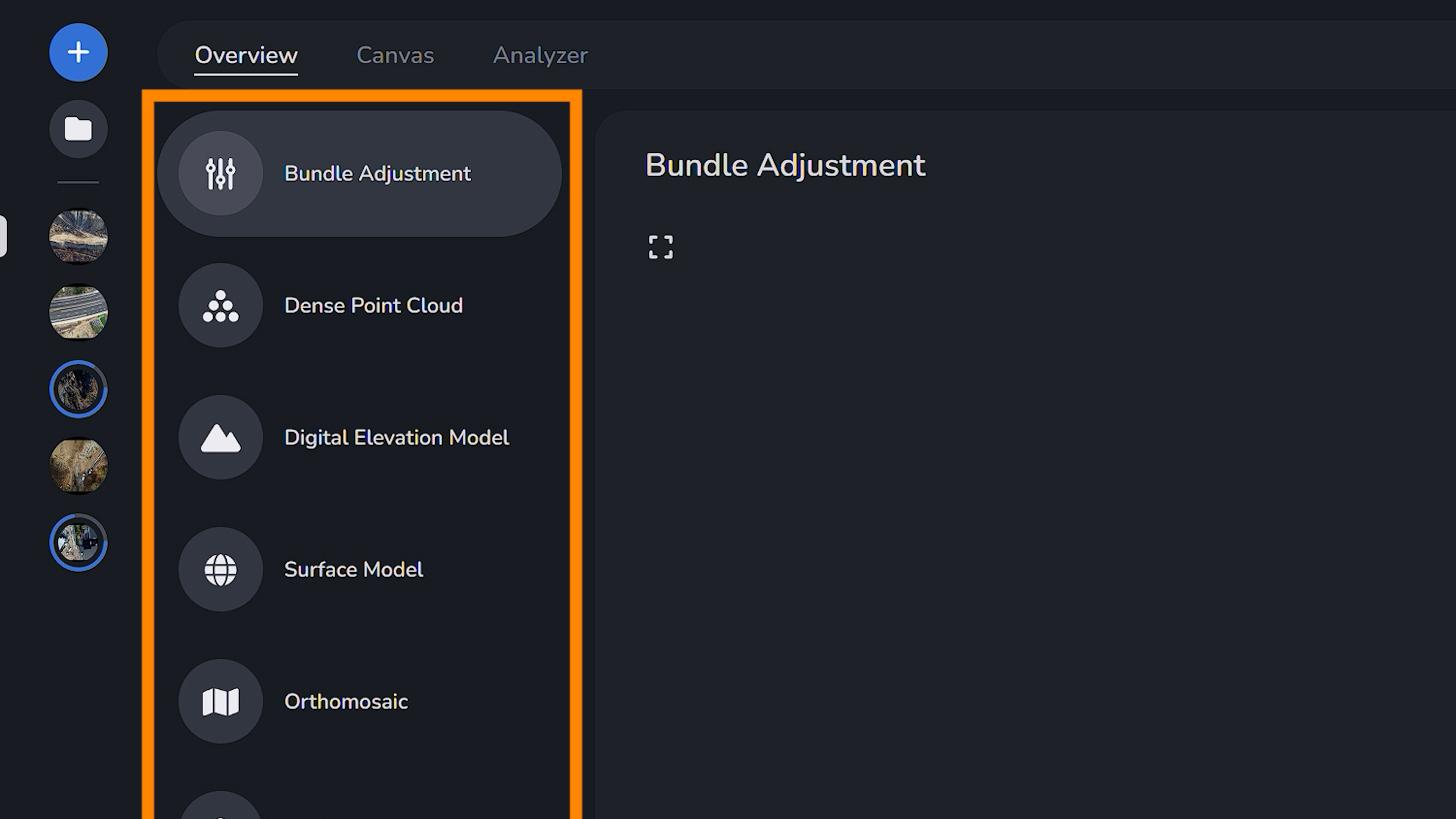
All deliverables are available to view in the overview tab of your project. In the previous article we discussed all aspects of the Bundle Adjustment Report.
Dense Point Cloud
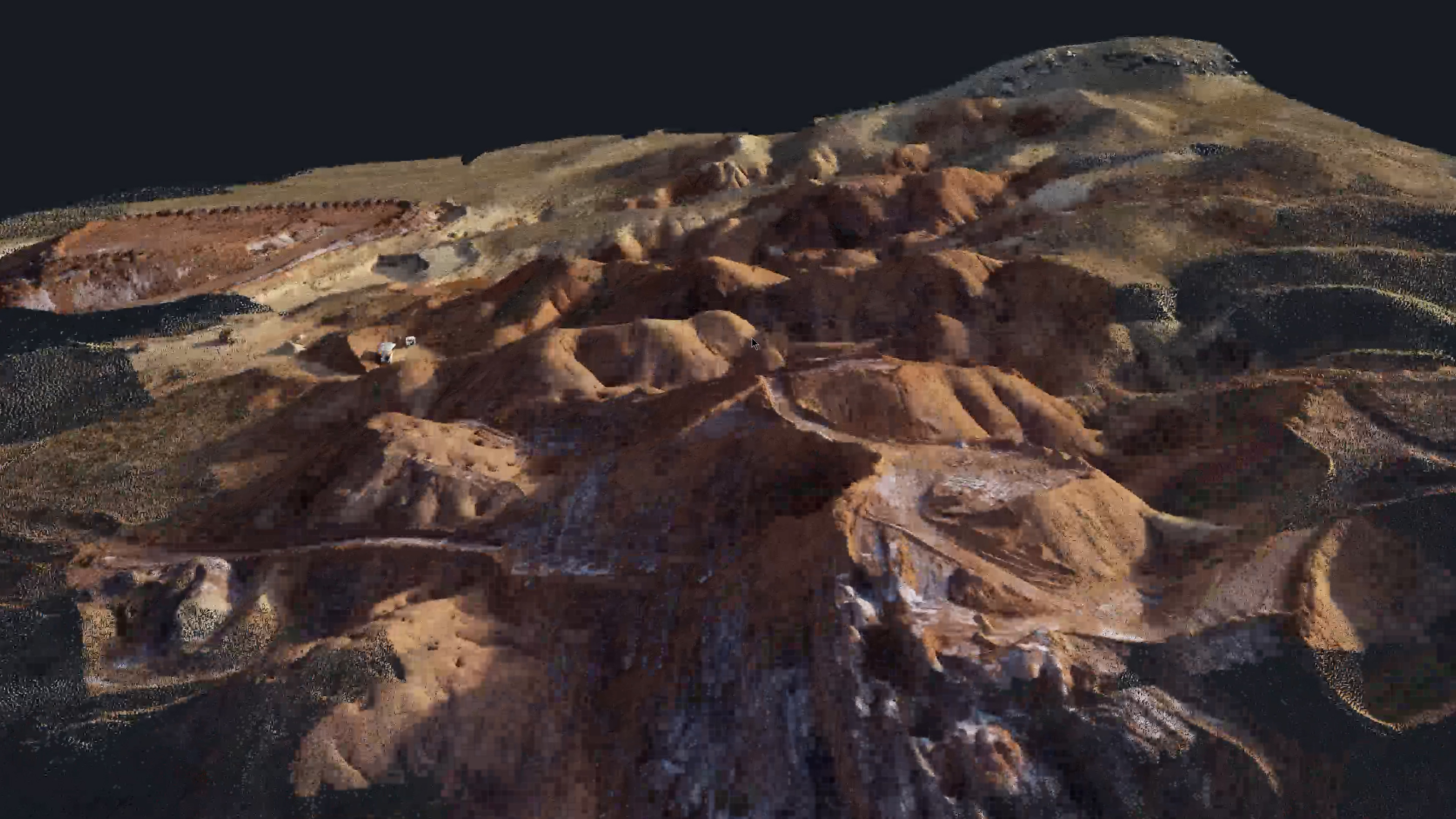
A dense point cloud model is a three-dimensional representation of the earth’s surface that is created from a large number of closely spaced points.
Unlike sparse point clouds, which contain fewer points and are primarily used for initial reconstruction (as you can see in the analyzer tab) dense point clouds capture detailed surface geometry with a high point density. These models provide highly accurate and detailed representations of terrain features such as buildings, vegetation and topography.
Dense point clouds are the foundation of nearly every mapping product and consist of a set of points in space representing the surfaces of scanned objects. The dense point cloud can be used for comparison against CAD models, in visualization, and 3D printing applications. The best dense point clouds are defined by several key features. The greater density of a point cloud allows for modeling and measurement of finer features. Also, it is critical that the points of the dense cloud cover the entire area of interest as any gaps in point coverage will translate to other data products.
It is not sufficient to simply have a dense point cloud - excellent accuracy of point locations is critical to producing valuable data products. The dense point clouds produced by PixElement processing feature unparalleled density. The key to this density is our ability to calculate the relative position of the cameras to sub-pixel accuracies. This accuracy is cutting-edge, the result of extensive research & development work.
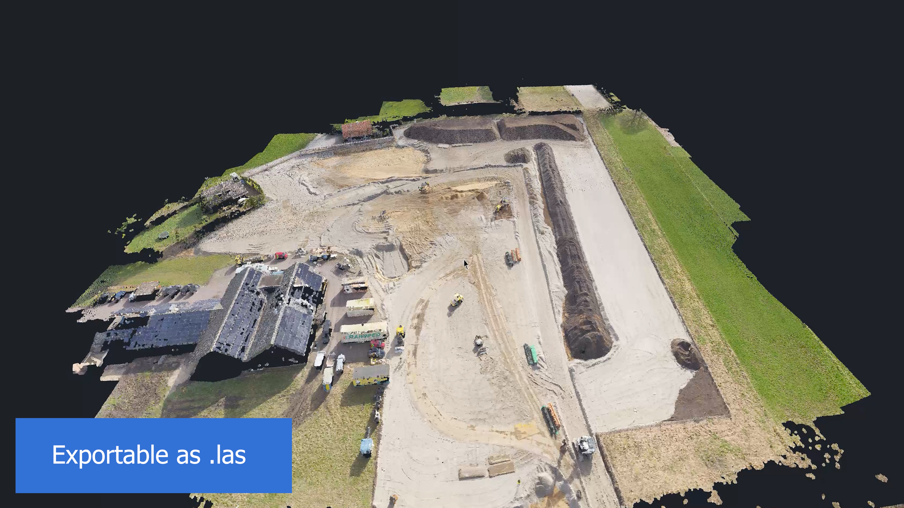
You are able to export this file as a .las (point cloud data).
Digital Elevation Model
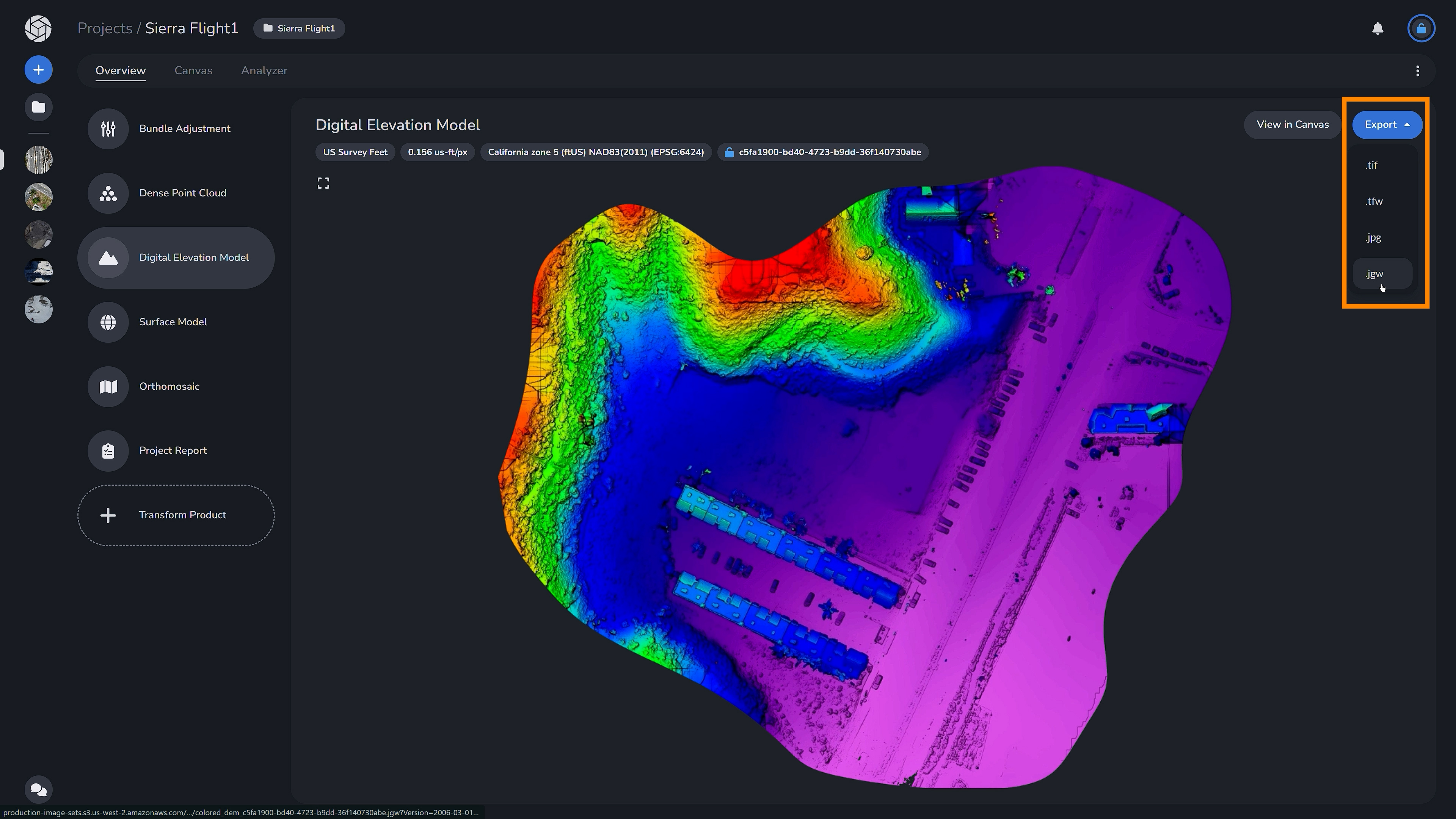
Next is the 2D digital elevation model, or DEM, which is uniformly sampled grids of elevation data. DEMs are valuable as base layers in GIS systems and can be used for terrain visualization, flood modeling, and volume calculations, providing valuable insights into elevation variations and topographic features across landscapes.
Using the imagery that you collect, PixElement processing produces high accuracy DEMs and terrain models suitable for many different applications. A good digital elevation model is produced using a sampling algorithm that produces extremely accurate data that is not impacted by any outlier points. PixElement processing produces dense, precise, and accurate digital elevation models to meet your every need.
You are able to export this file as .tif (raster imagery - tagged image file), .tfw or .jgw (world file - for opening in GIS software or other mapping applications), or as a .jpg
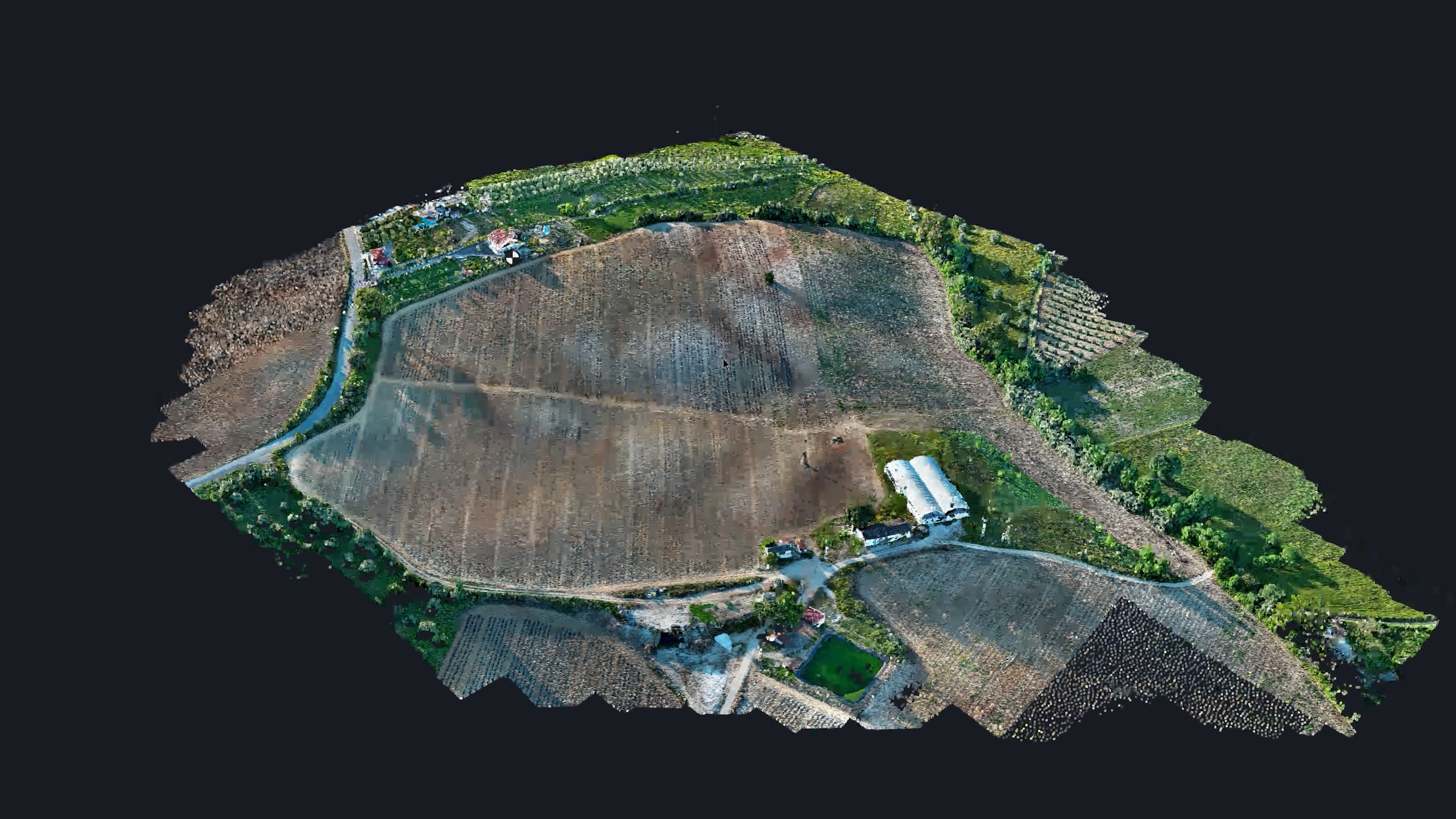
Surface Model
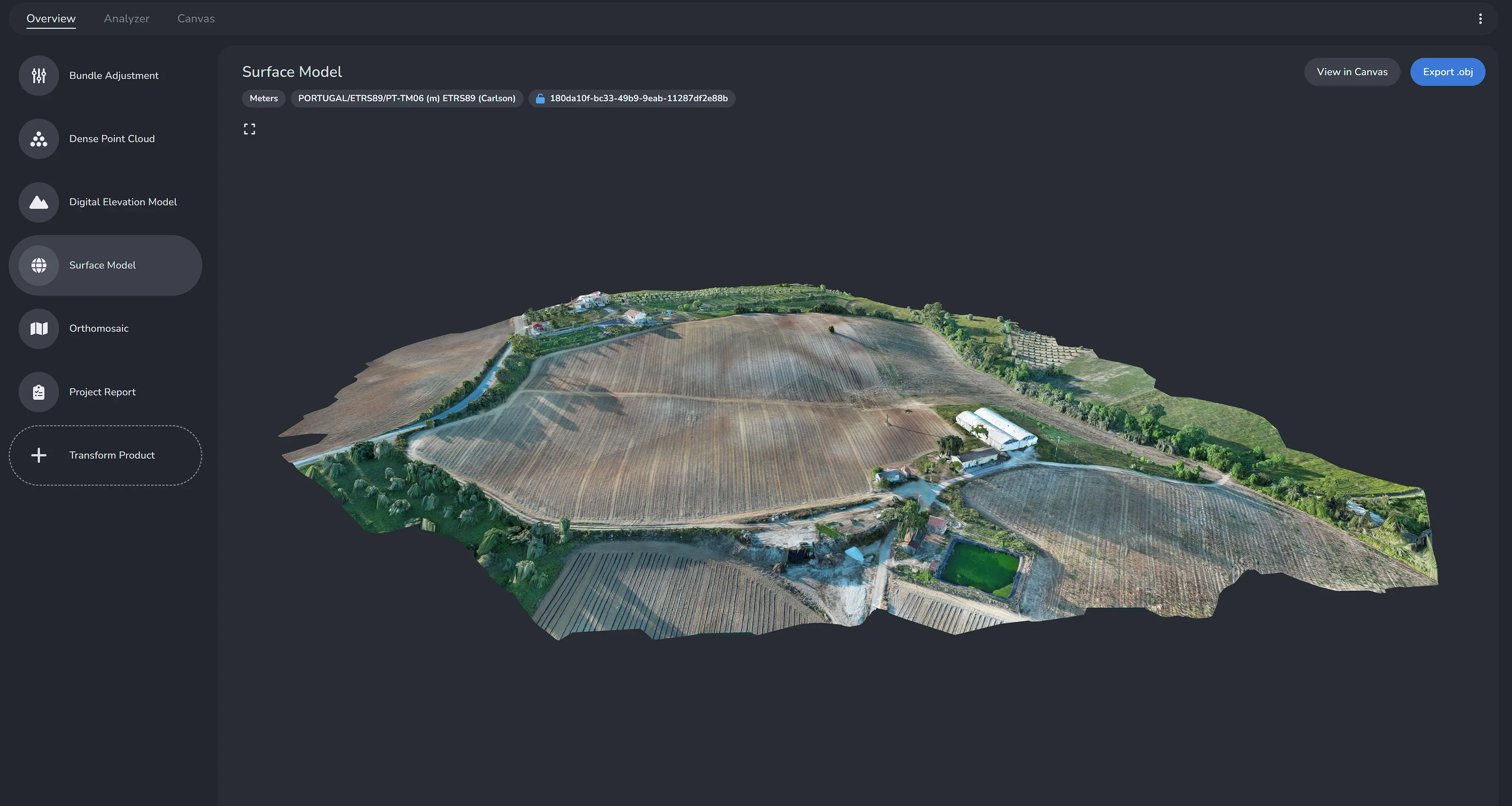
The next model is the 3D manipulatable surface model, which provides information about the elevation, slope and shape of the terrain, as well as spatial relationships between various features such as buildings, vegetation and natural landforms. These models are invaluable for a wide range of applications. With this model in the Canvas tab you can visualize the terrain, extract precise measurements and conduct spatial analyses to support informed decision-making and planning processes.
Surface models are a surfaced version of the dense point cloud. This surface provides a complete surface view of the point data.
Surface models provide a more compact, smaller file format for conveying the data captured in a point cloud.
You are able to export this model as a Wavefront .obj file to open in 3D modeling software.
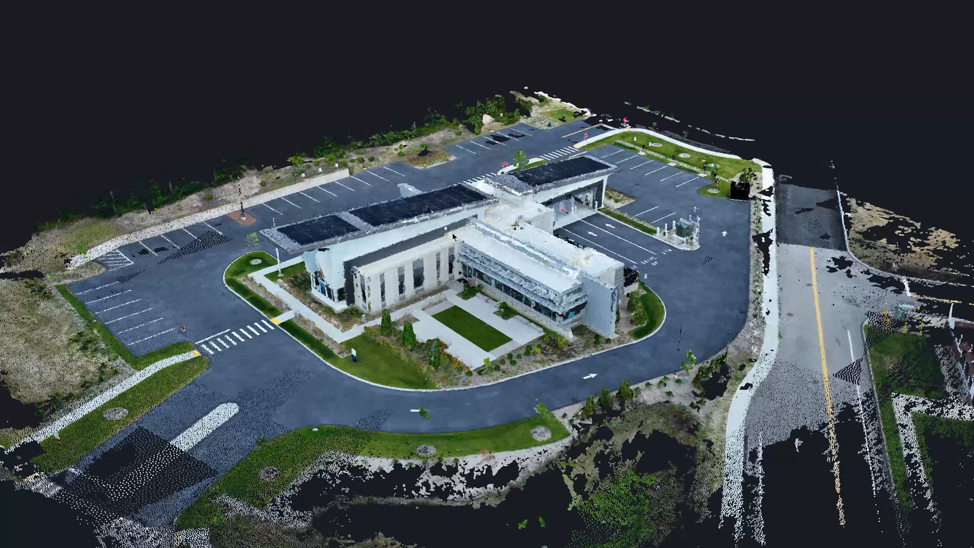
Orthomosaic
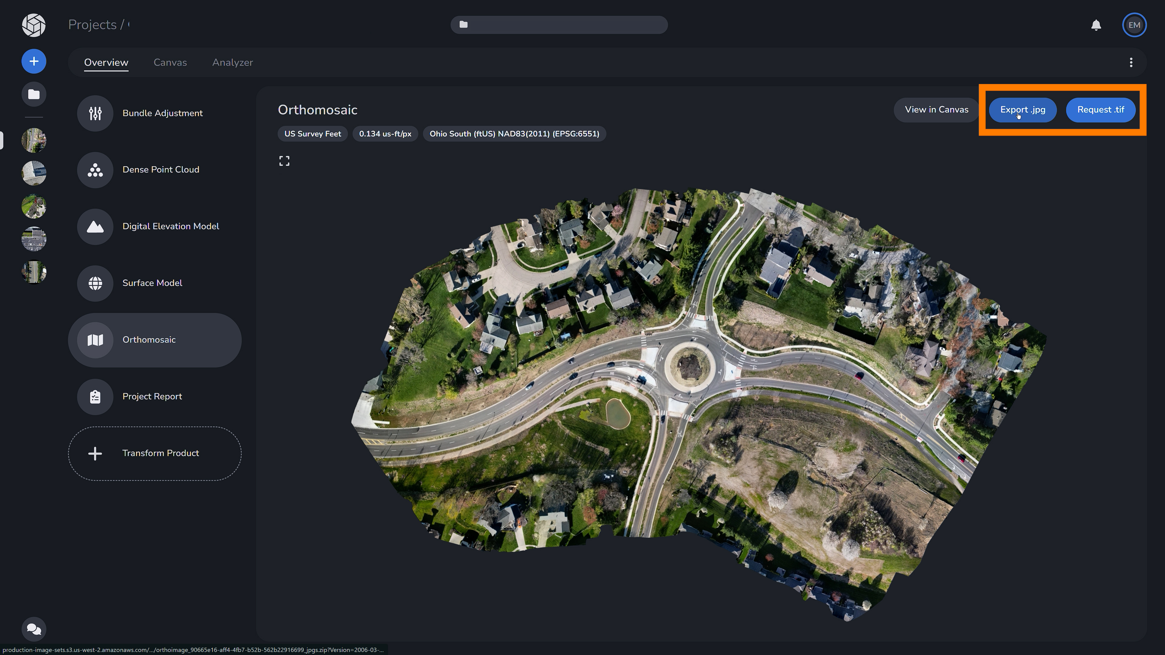
Last but not least is the Orthomosaic model, which is a 2D representation of the surface model. Orthorectification is a process that corrects for image distortions caused by terrain variations and camera perspectives, resulting in an accurate representation of the Earth’s surface with consistent scale and minimal distortion. Orthomosaics, or “Orthos” for short, provide a seamless, high-resolution view of the landscape, enabling precise measurements and analysis.
Orthomosaiced images transform simple aerial photographs into maps. Orthophotos can serve as the base layer in many GIS and other mapping applications such as displaying road vectors and contour. Additionally, orthophotos can be used as a source of measurement much like a traditional map. The orthophoto offers a sweeping view of a large scene which allows for more intuitive analysis versus a disconnected set of raw imagery.
A quality orthophoto is not simply a collection of images that have been stitched together. A good orthophoto is perspective corrected so that the contents of the orthophoto are true, accurate representations of the 3D scene. This perspective correction allows for accurate measurements to be taken directly from the photograph. Orthophotos produced by PixElement processing are expertly orthorectified, with the image being corrected for scale, camera tilt, lens distortion, and topographic relief. PixElement processing produces truly measurably, map-quality images.
You are able to download this as a .jpg or request a .tif.
Project Report
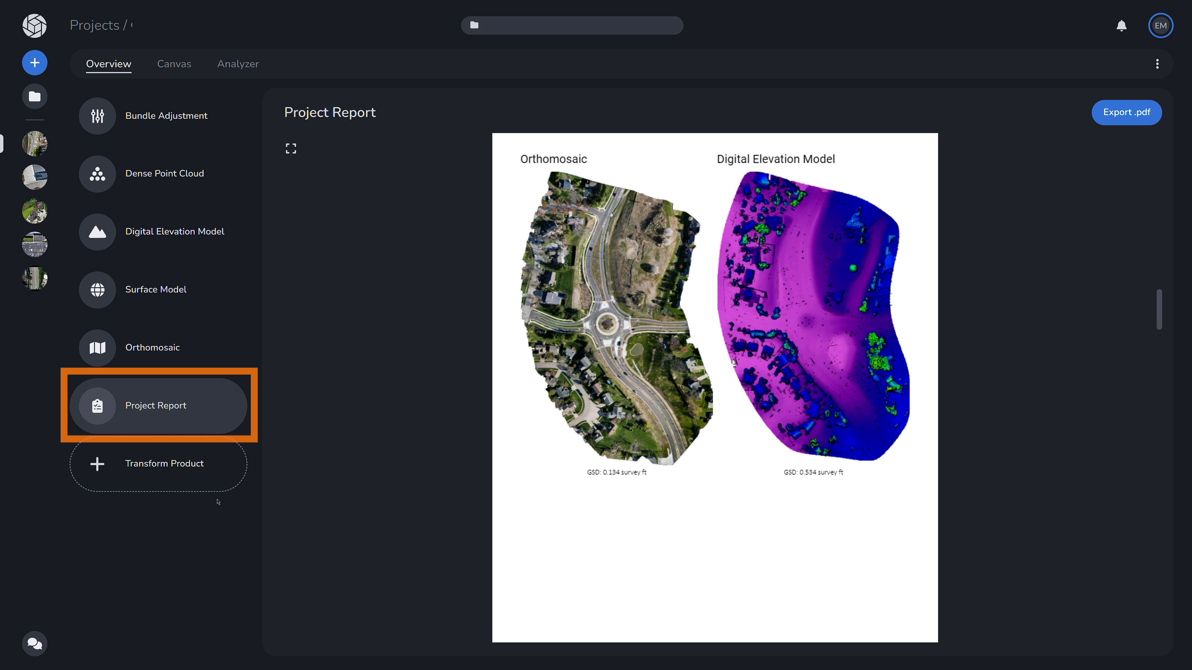
You are able to view a full project report which is the bundle adjustment report from earlier paired with all of your deliverables - the orthomosaic and digital elevation model. For a better understanding of the project report, please see the video tutorial or article on how to interpret all graphs and figures.
Transform Product
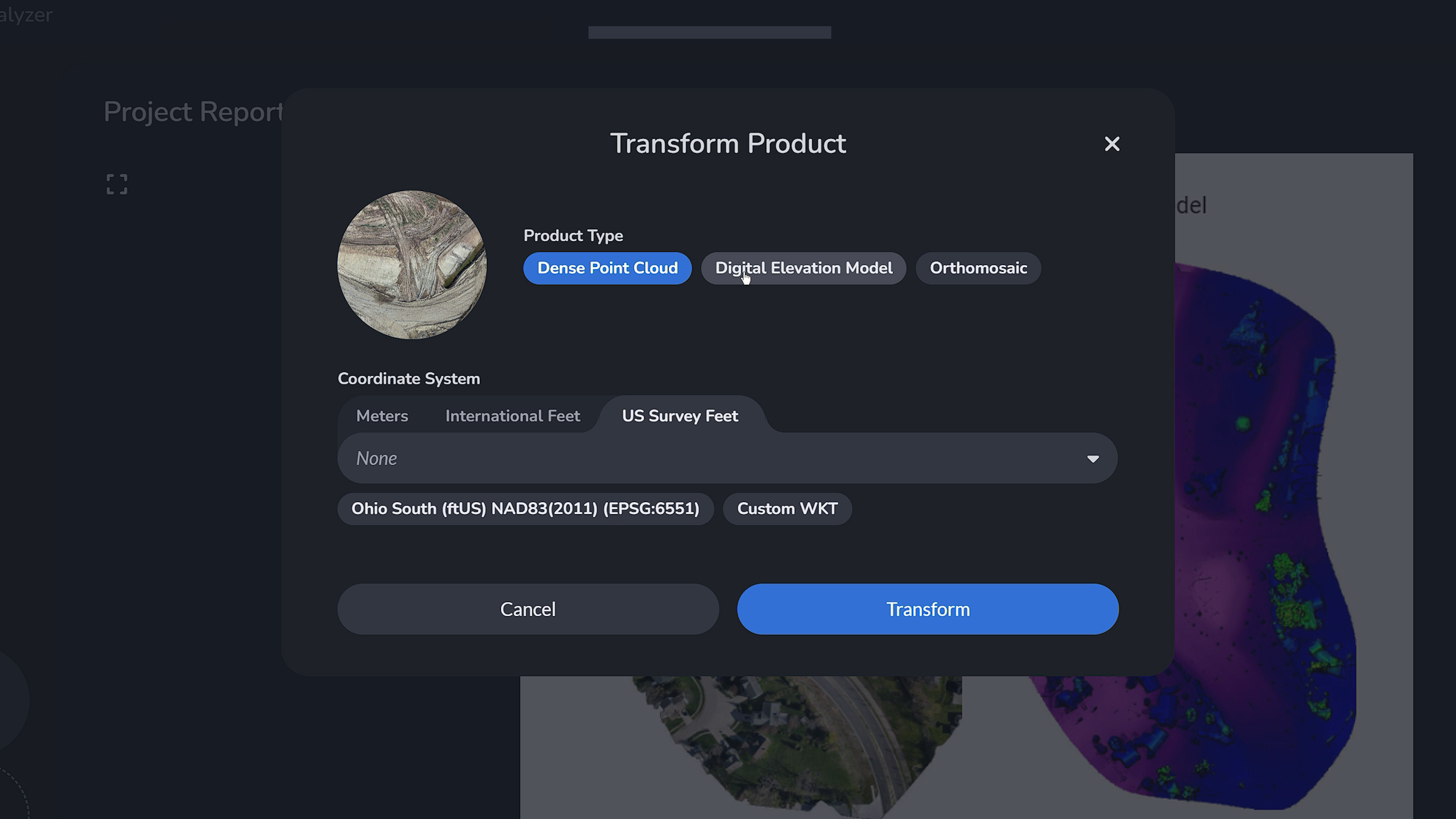
At the bottom of the data deliverables list, you’ll find the option to transform your project deliverables. You can convert your data into a dense point cloud, create a detailed digital elevation model (DEM), or generate a high-resolution orthomosaic. Additionally, you have the flexibility to change the coordinate system of your dataset, ensuring your project aligns perfectly with your specific requirements and standards.
If you would like to view the video version of this article, please find it in our tutorial playlist.