Using the Profile Viewer Feature in PixElement
In this article, we will be looking at delving into the new profile viewer feature now available in PixElement. Please see the associated video tutorial below.
Introducing the Profile Viewer in PixElement’s Survey Canvas
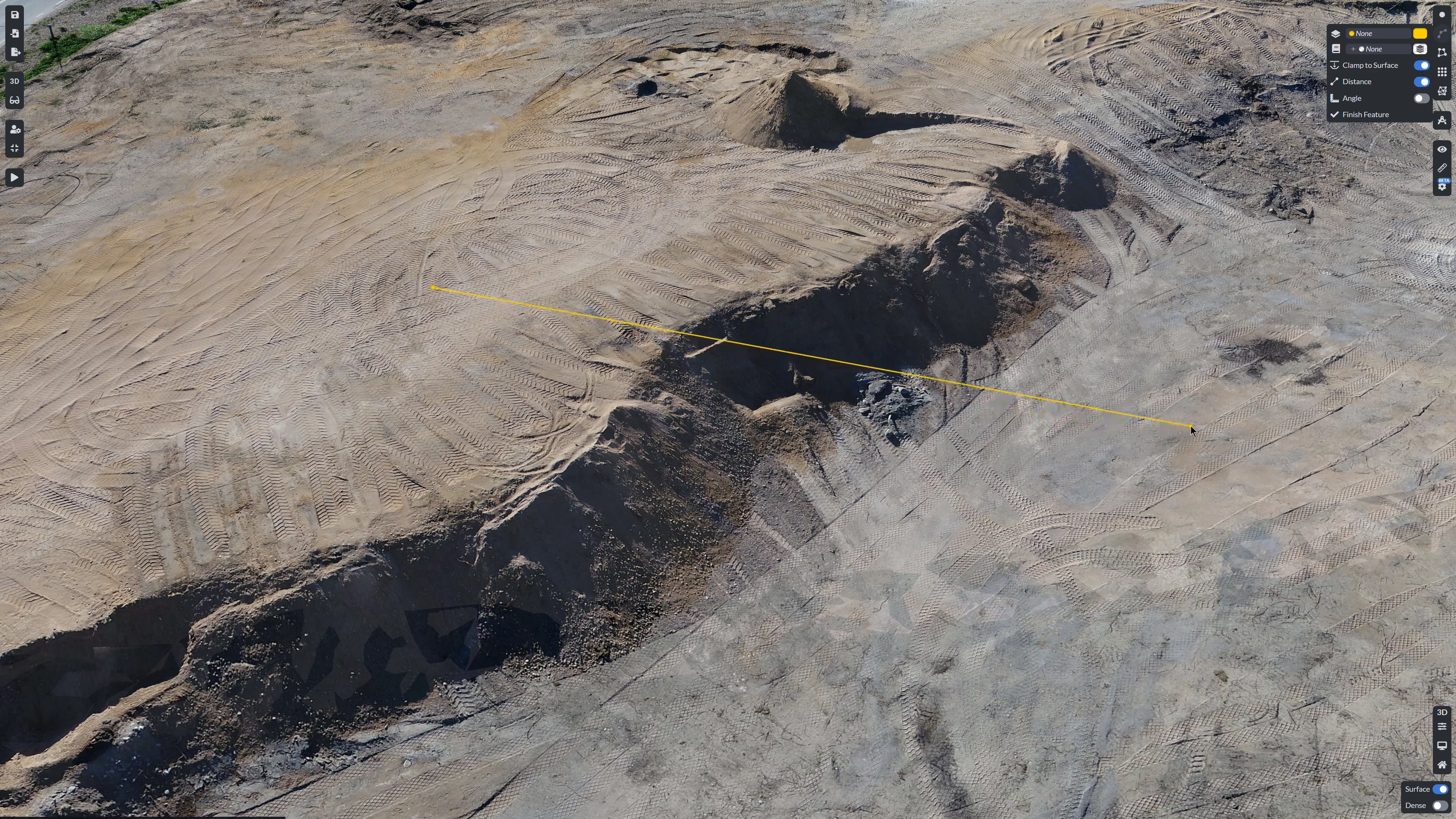
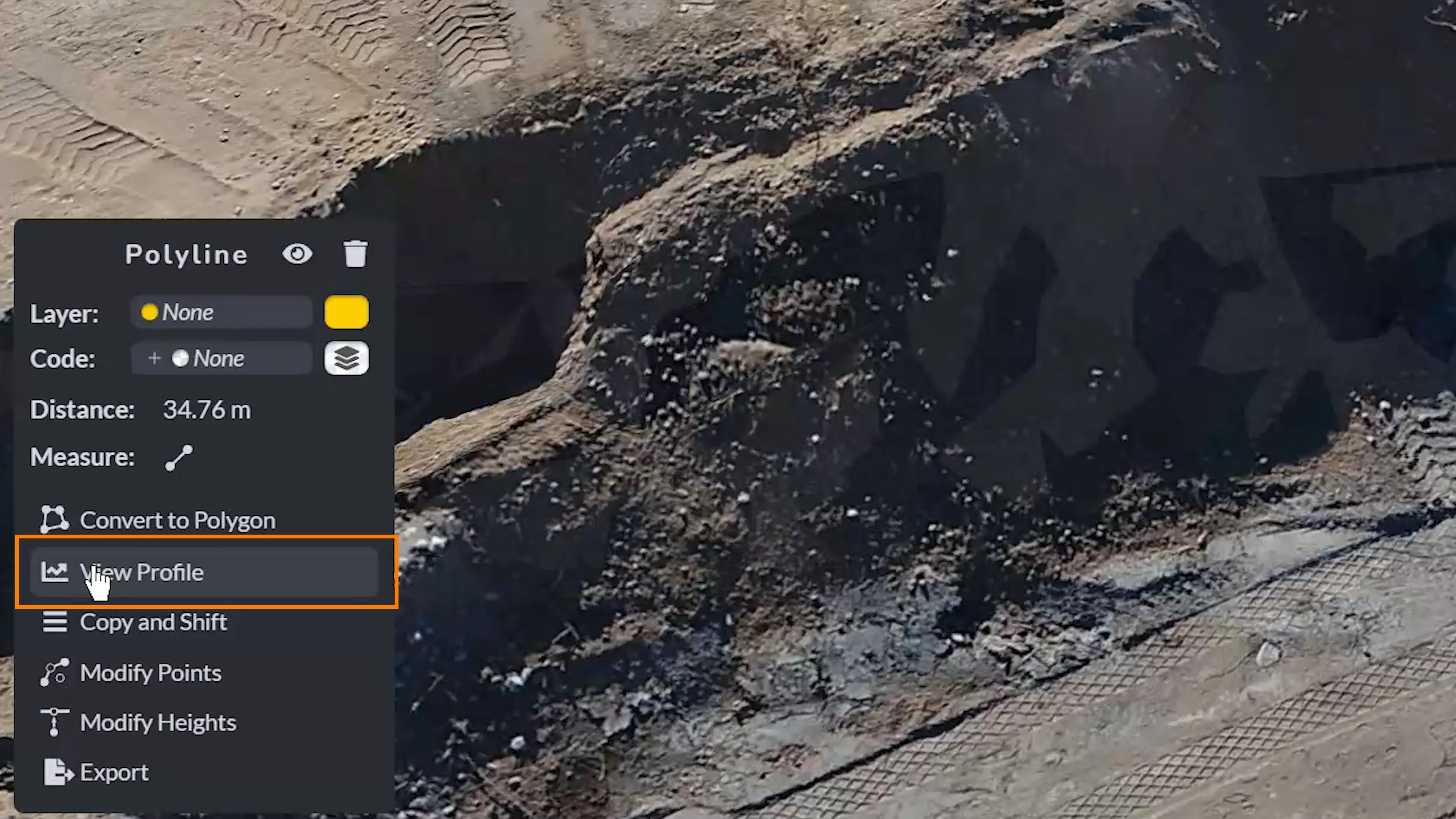
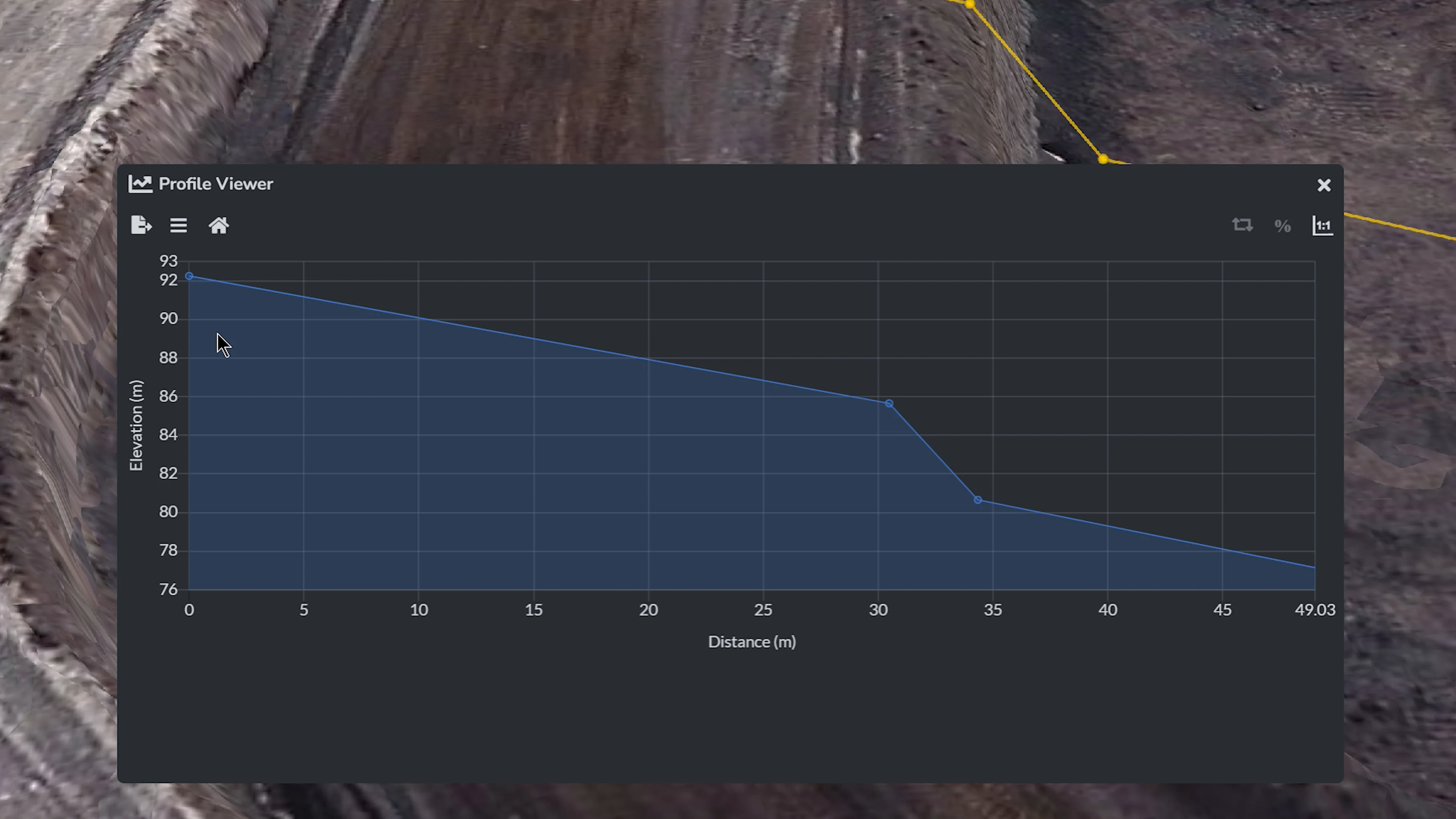
We’re excited to announce the release of Profile Viewer, a powerful new tool in PixElement’s Survey Canvas designed to help users with elevation analysis and grading workflows. Users can create a polyline directly on their map in the Canvas and instantly generate a profile view by selecting “View Profile” in the polyline submenu. Whether you’re assessing grading for water flow management, evaluating terrain for construction planning, or monitoring elevation changes across a site, this feature provides the precision and clarity you need.
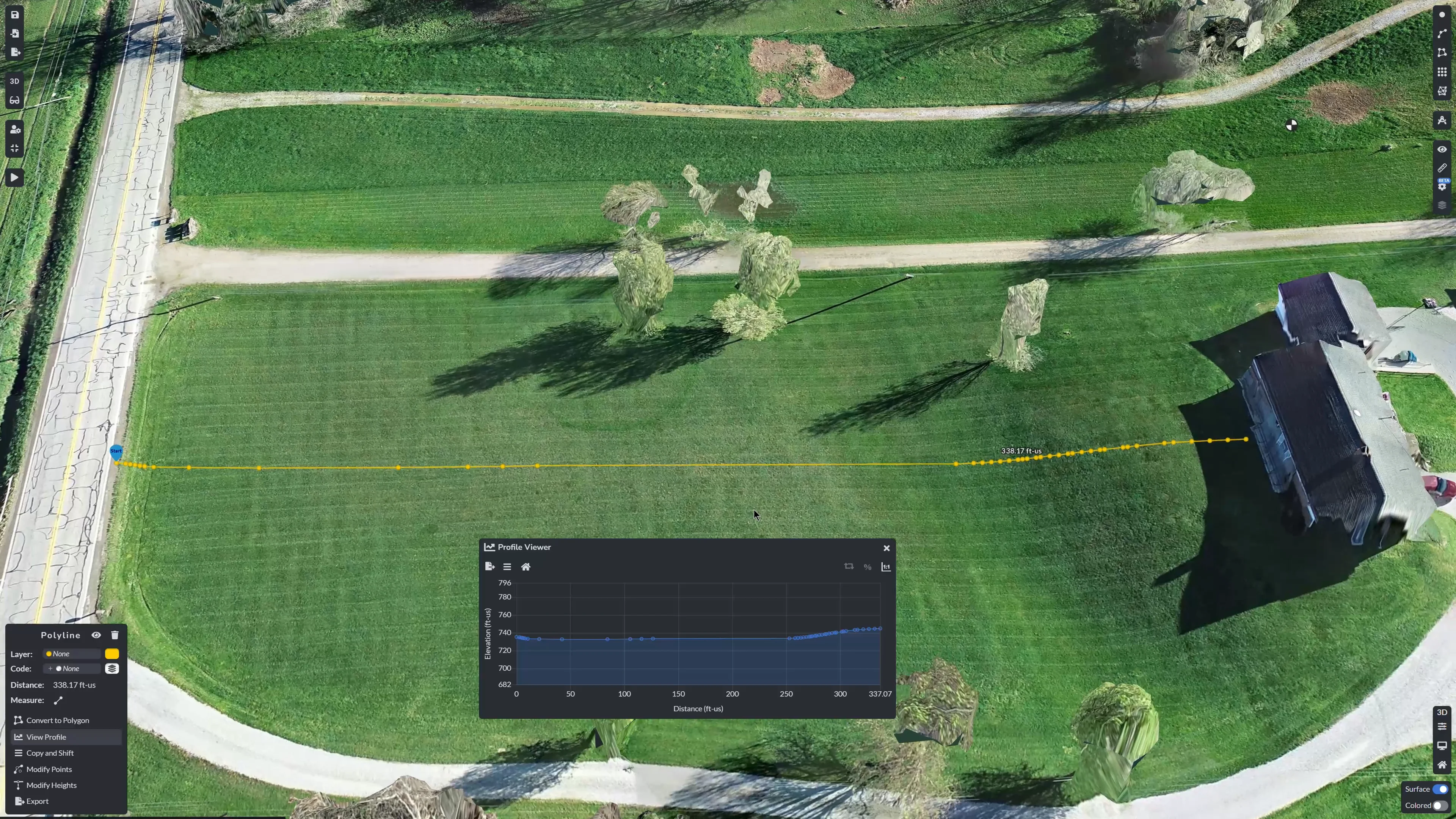
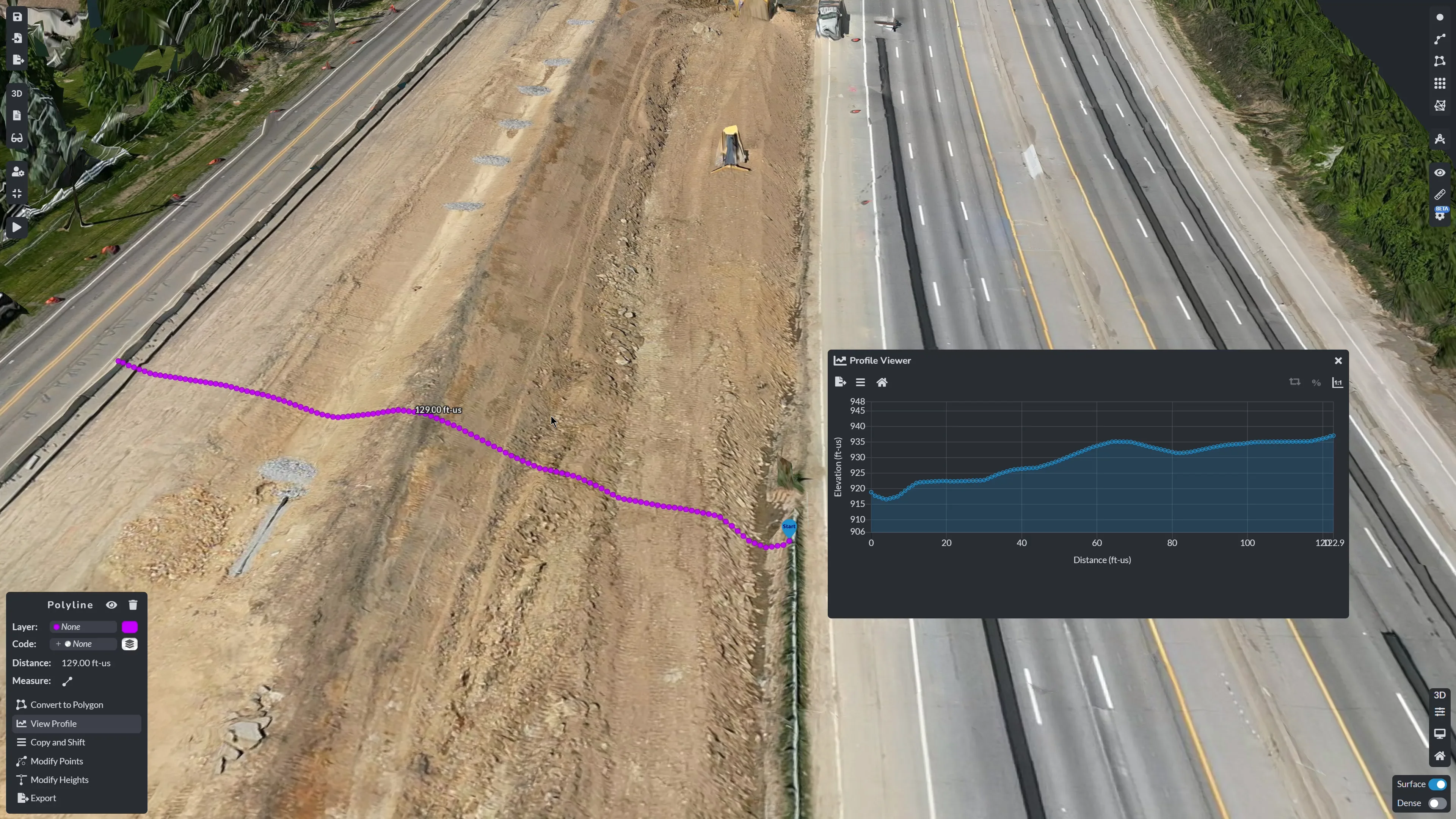
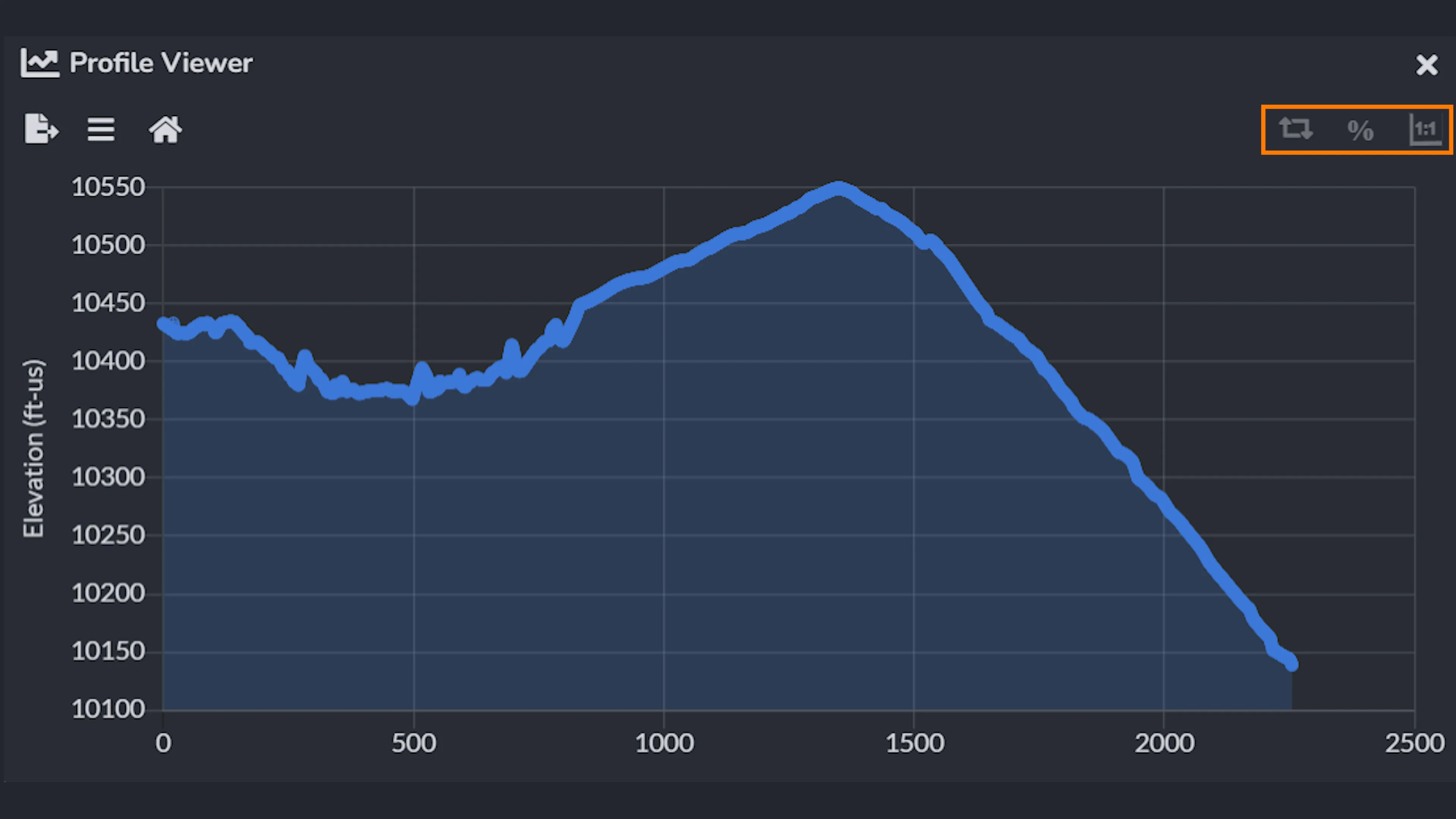
This profile displays a detailed graph of elevation changes along the polyline. Within the Profile Viewer, you have the menu buttons on the top left and right. On first button on the far right allows you to toggle if the units of the X (distance) and Y (height) coordinate axes are equal.
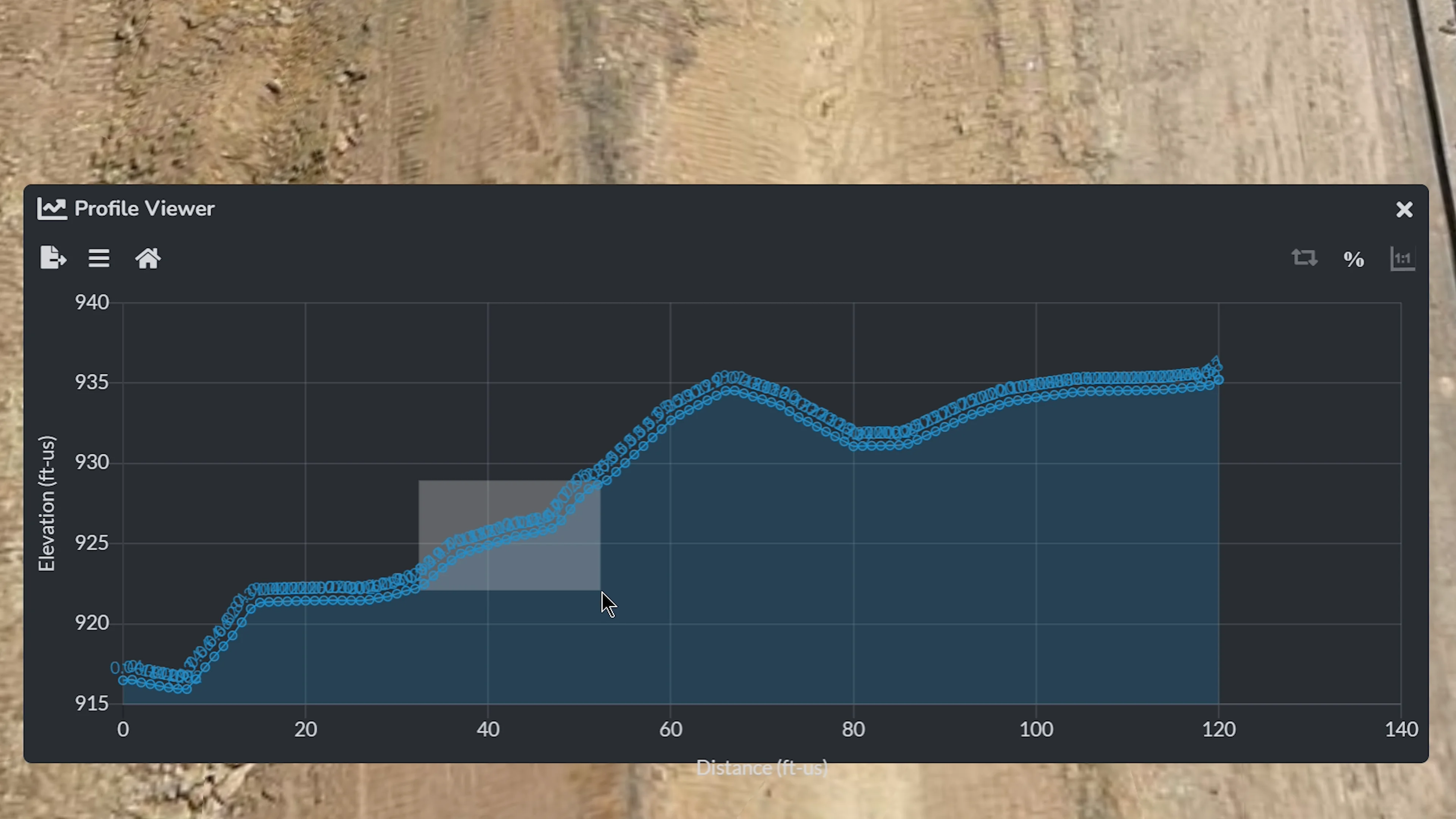
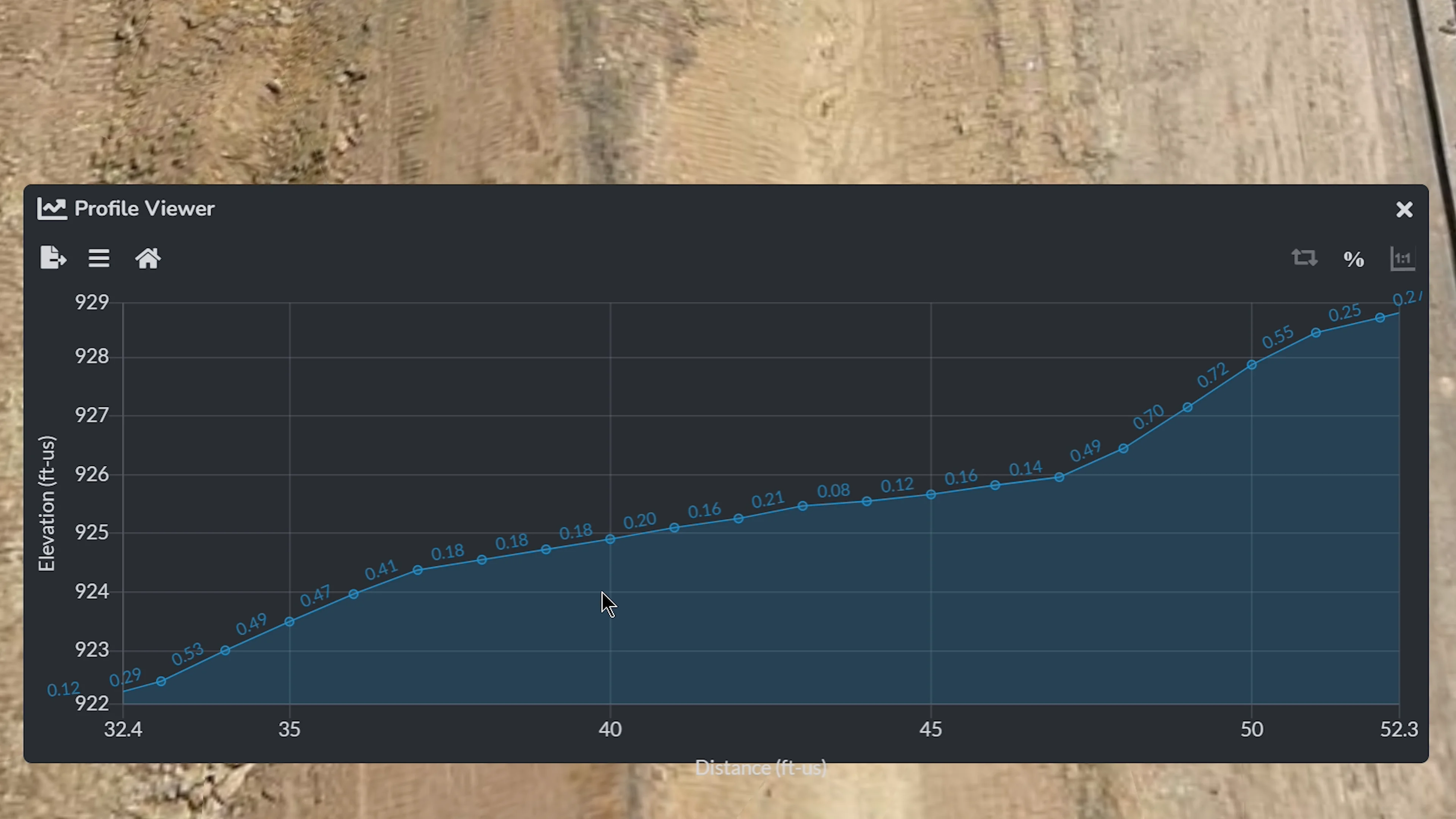
The middle button allows you to toggle to Show Elevation Grades which will then appear on the graph. You are also able to drag a square on the graph to zoom into a certain area.
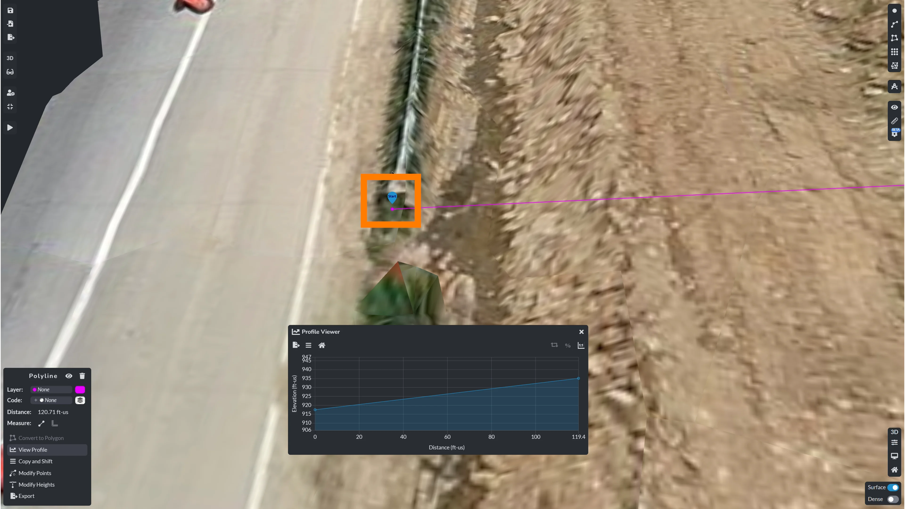
The third button allows you to Toggle Reverse Direction, which will make your last point of the polyline be the “Starting” point on your graph - you are also able to see the starting pin point on your polyline for reference.
On the left-hand-side menu, you are able to reset your view with the “Home” icon. This comes in handy if you have been zooming in on your graph.
Sample/Resample Profile Tool
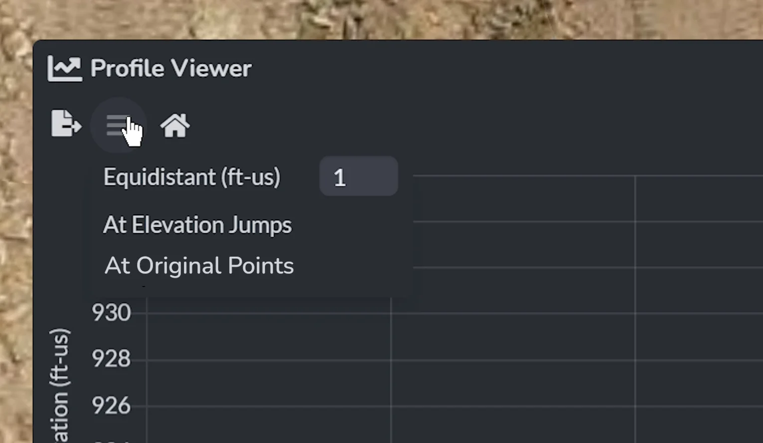
The middle button allows you to select to Sample/Resample Profile - which is where you can select how you want to sample or resample the selected polyline.
Equidistant Sampling
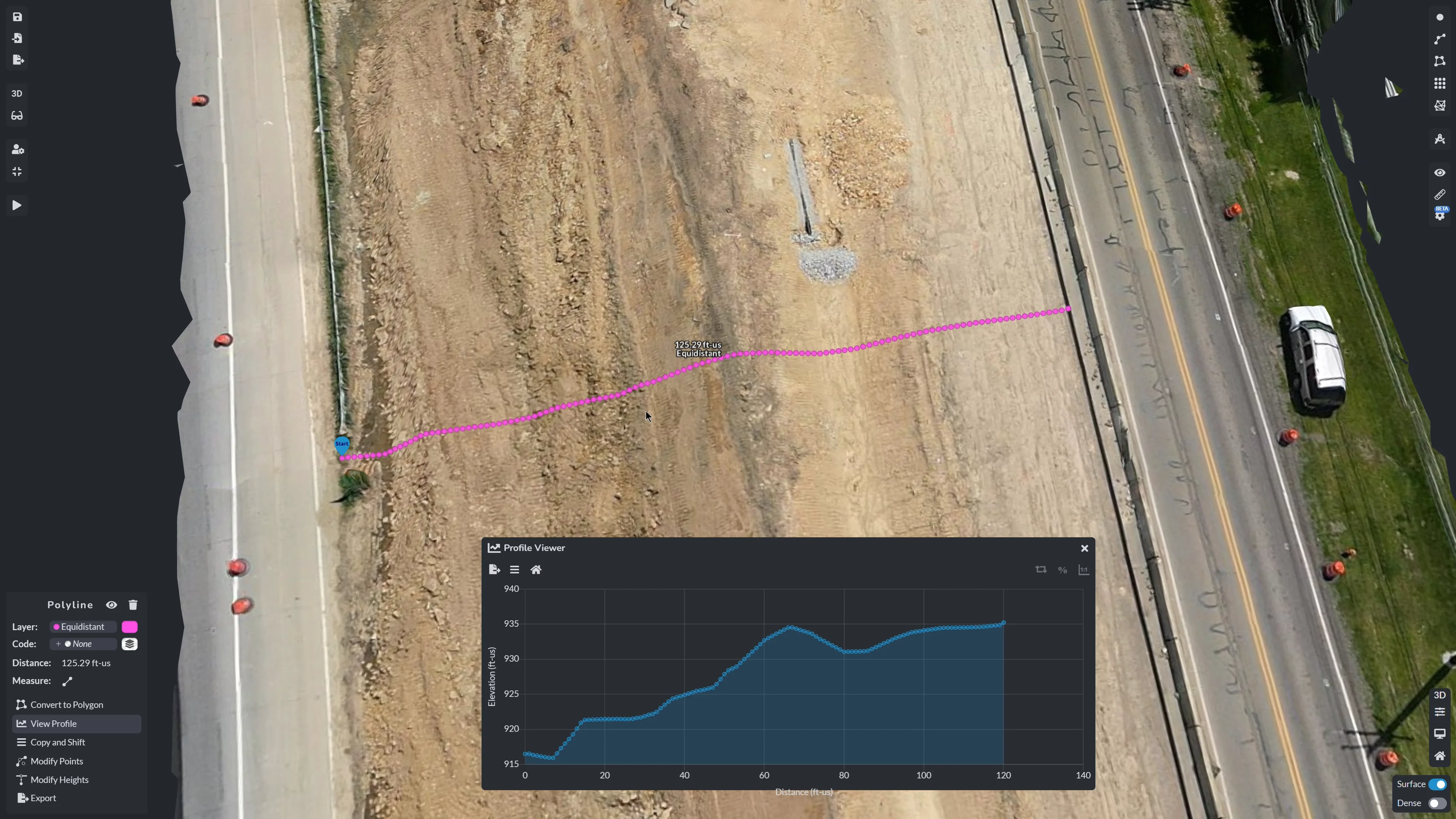
With the Equidistant Sampling tool, elevations will be sampled at equidistant locations. The distance between points can be specified in the text box provided in the submenu. The new elevations are then added to the existing profile graph. Depending on how long your polyline is, this may take some time to render.
At Elevation Jumps
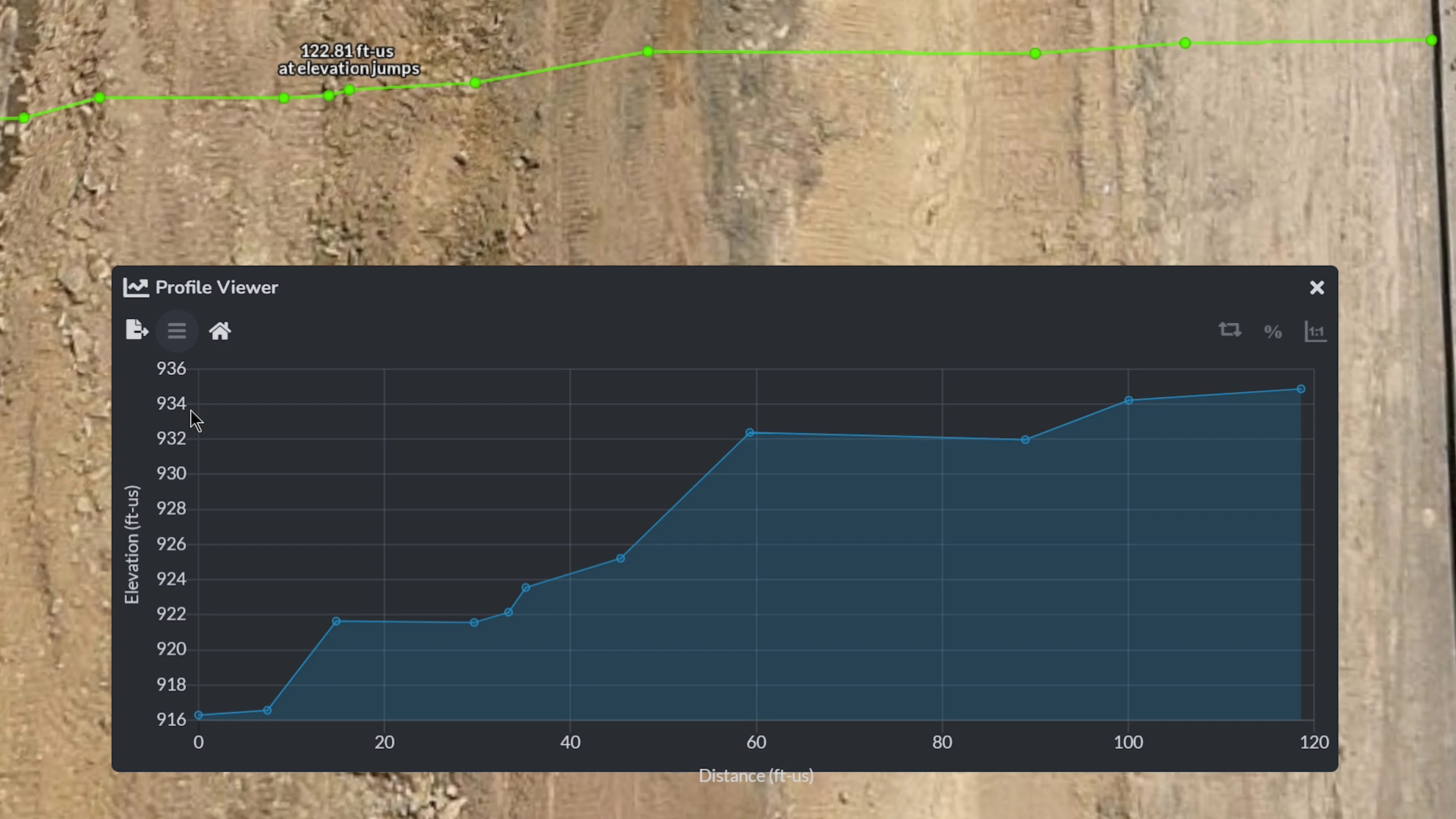
When selecting At Elevation Jumps, an algorithm will automatically find elevation changes that are significant along the polyline. The new elevations will be added to the existing profile.
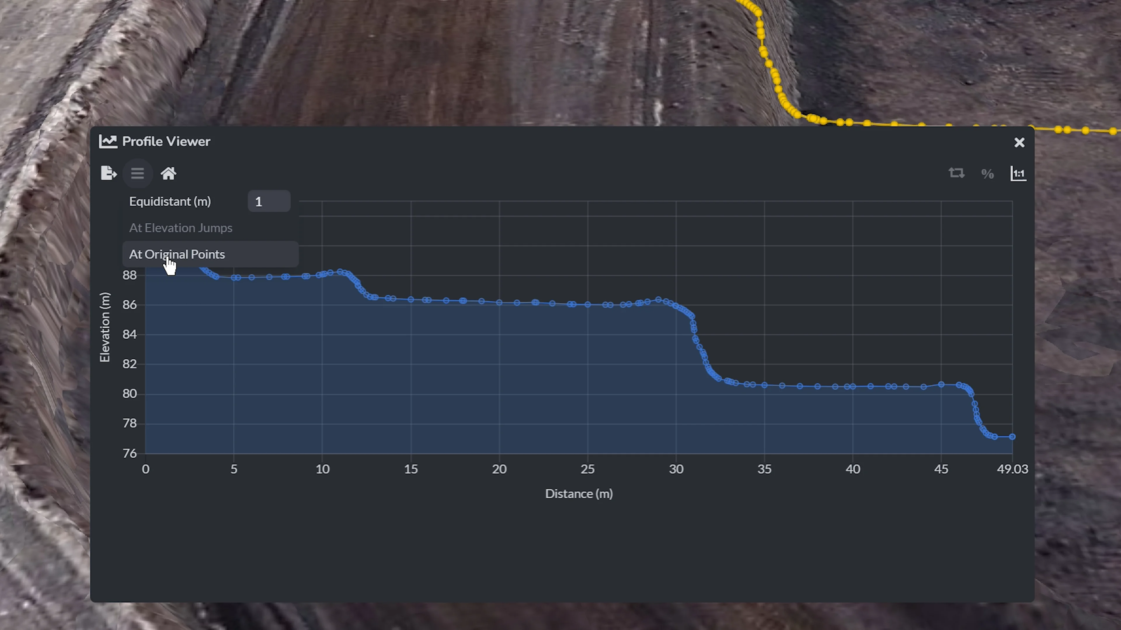
At Original Points
When selecting At Original Points, the profile will reset to only include elevations at the original user-defined points where the polyline was placed. This option removes all current elevations that were automatically added through sampling methods, such as Equidistant Sampling or At Elevation Jumps, and creates a new elevation profile from scratch.

Export Profile
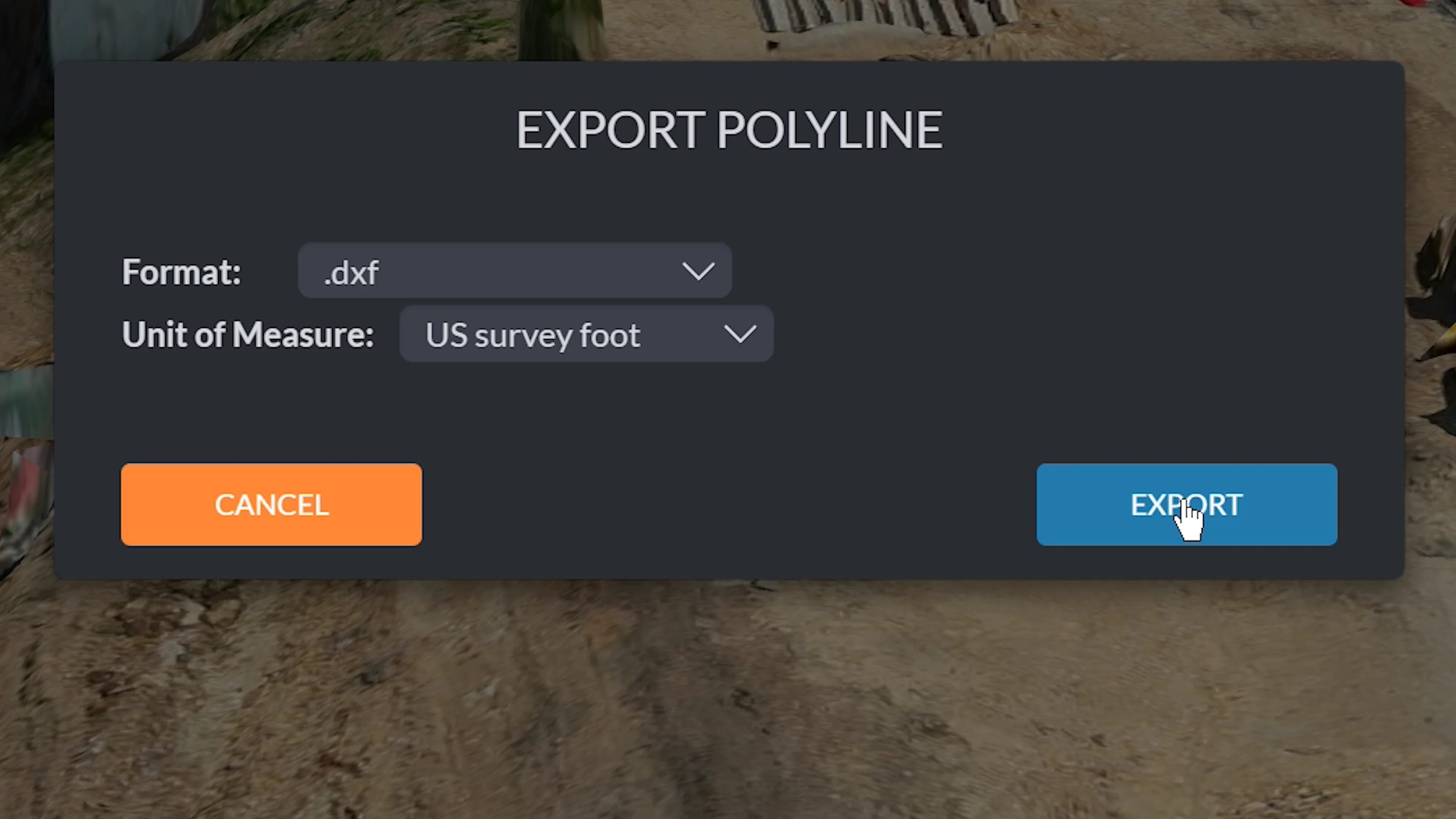
For exporting your profile, you can export 3D, as a DXF or CSV, as well as choose the unit of measure you would like the final file to be in.
Why Profile Viewer Matters for Your Work
The Profile Viewer offers a powerful way to gain insights into elevation data, making it an indispensable resource for professionals across various industries. Here’s how it can support your work:
Evaluate Grading for Water Flow: Ensuring proper drainage is critical for many projects. The Profile Viewer enables you to quickly identify high and low points along a polyline, allowing you to verify or adjust grading to maintain efficient water flow and avoid potential issues like pooling or erosion.
Analyze Terrain for Project Planning: Understanding the elevation changes within a site is fundamental to effective planning. With the Profile Viewer, you can assess terrain variations in seconds, helping you make informed decisions for construction, excavation, or other site development activities.
Simplifying Reporting and Communication: Clear communication is key in any project. The Profile Viewer allows you to generate and export visual elevation profiles that can be easily shared with your team, stakeholders, or clients, ensuring everyone stays on the same page.
By incorporating tools like the Profile Viewer into your workflow, you can simplify complex tasks, enhance collaboration, and make more data-driven decisions. This feature underscores our dedication to equipping professionals with innovative solutions that make their work smarter, faster, and more efficient.
Stay tuned for more updates as we continue to enhance PixElement with features tailored to your needs!
Questions about the Profile Viewer or need assistance? Reach out to us at support@pixelement.com — our team is here to help.