New Tool Feature: Edit Clipping Bounds Tool
We’re excited to introduce a powerful new tool in PixElement - the Edit Clipping Bounds feature. This tool gives you full control over your models by allowing you to crop your datasets to the exact area of interest, making your photogrammetry projects more efficient and precise.
A video version of this post is available here:
What does this tool do?
The Edit Clipping Bounds tool allows you to define the boundaries of your map by drawing a custom polygon around the region you want to keep in your model. Whether you’re working on large-scale mapping projects or need to fine-tune specific areas, this feature ensures that only the most relevant parts of your dataset are included.
How it works:
Step 1. After starting a new project in PixElement, prior to registering your ground control/reference points, select the “edit clipping bounds” tool to start defining the area.
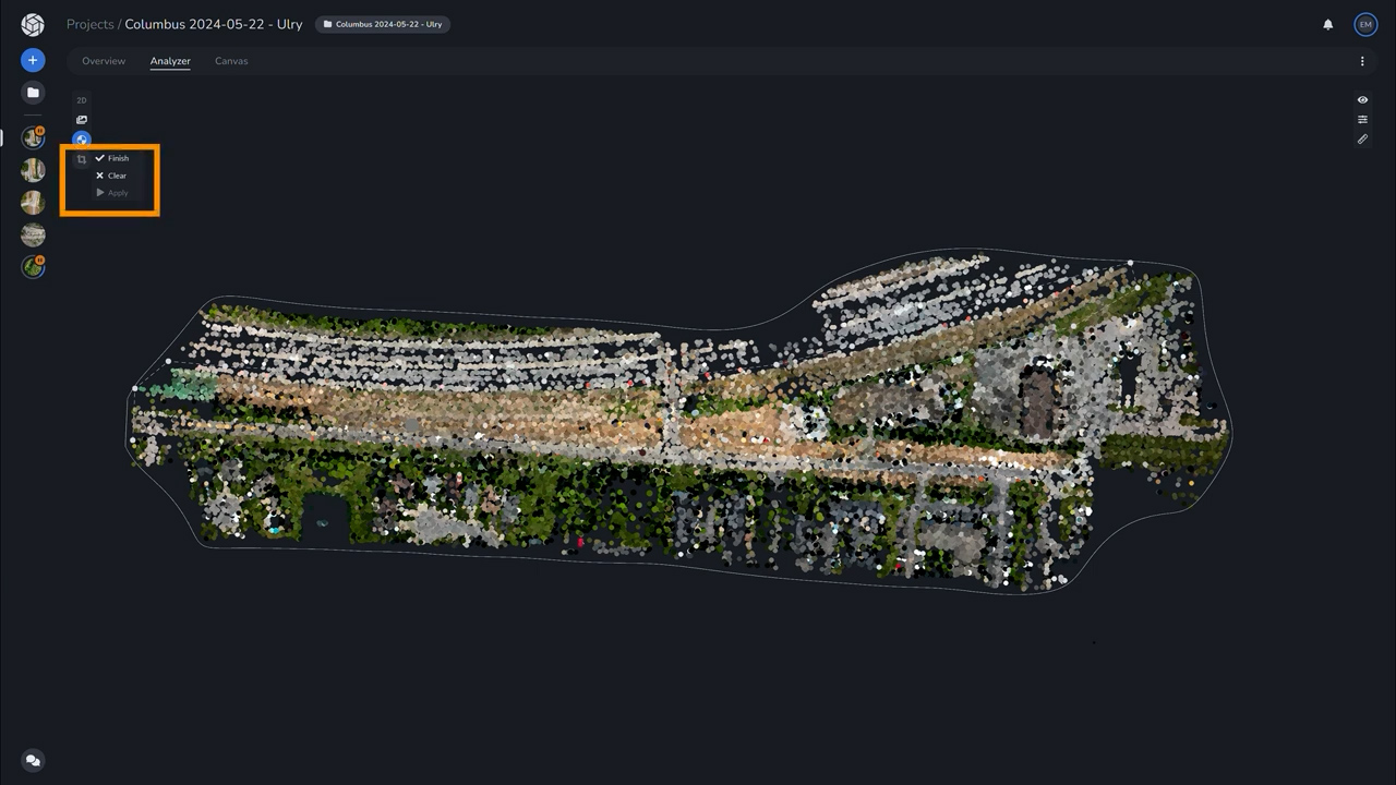
Step 2. Use the crop tool to draw a polygon around the section of the map you want to keep. Hit “Finish” to confirm it.
Step 3. Once your polygon is drawn, the part you wish to retain will be highlighted in green, while the areas to be cropped out will be marked in red.
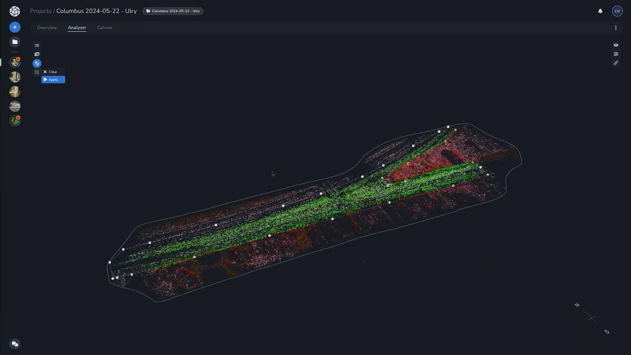
Step 4. Hit “Apply” to confirm your edit.
Step 5. The clipping will be applied when you add your GCPs and/or tiepoints and process your project, ensuring that the unwanted areas are removed before final output. You are not able to see the clipping bound border in the analyzer tab as a thin white line. You can toggle this off and on using the view tool on the right hand side.
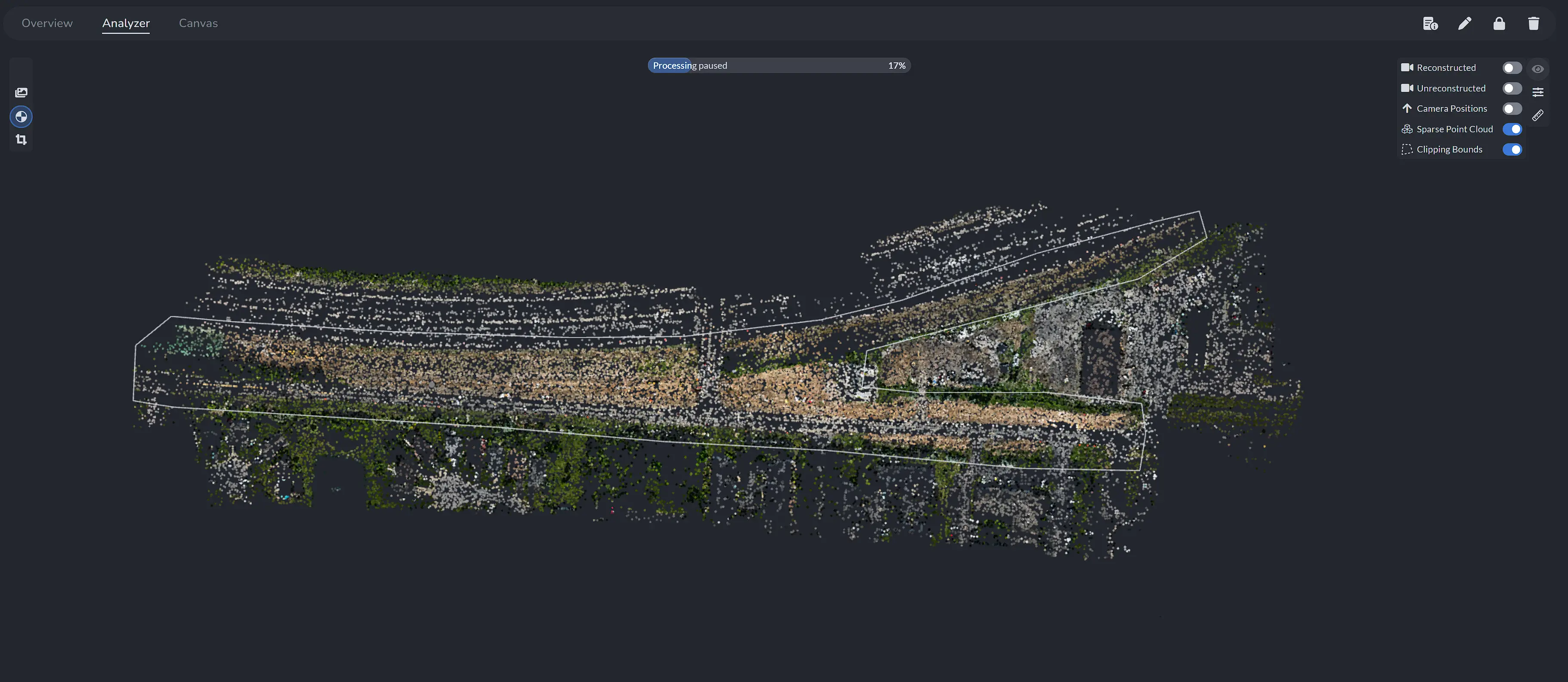
Pre-Processed clipping bounds selection with view menu and Clipping Bounds toggled "on"
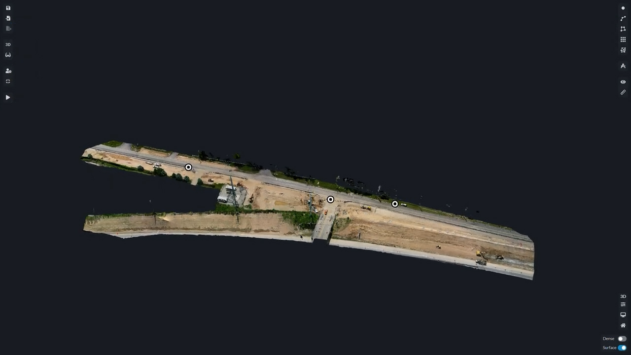
Post-processed final crop of selection as viewed in Canvas tab
Why use clipping bounds?
This tool is perfect for when you need to clean up your models by removing unnecessary or jagged edges, irrelevant sections of your dataset, or any areas that don’t contribute to the analysis. By cropping out these unwanted regions, you’ll improve the clarity of your final models, reduce file size, and speed up processing time. Whether you’re preparing data for client deliverables or just looking to focus on a specific part of a site, the Edit Clipping Bounds feature gives you the flexibility to make your models as precise as possible.
Who benefits from this feature?
- Construction professionals who want to focus on a specific building or site area.
- Surveyors who need to remove irrelevant land sections from large datasets.
- Environmental scientists narrowing in on specific regions for analysis.
- Marketing teams creating visually appealing models for presentations.
Why it matters:
With the Edit Clipping Bounds tool, we’re making it easier for you to focus on what matters in your photogrammetry models. Whether you’re optimizing workflow efficiency, creating sharper outputs, or just cleaning up messy data, this tool will save you time and improve the accuracy of your deliverables.
Start using the Edit Clipping Bounds feature today in PixElement, and see how it can take your aerial photogrammetry projects to the next level!