How Drone Photogrammetry is Revolutionizing the Vertical Construction Industry
Drone technology and aerial photogrammetry is transforming the commercial and residential construction industry, providing faster, more accurate data collection and project management tools. PixElement’s aerial photogrammetry software helps construction professionals utilize this cutting-edge technology to improve everything from surveying and safety inspections to project marketing. Here’s how drones are being used in construction today and what the future holds.
Key Uses of Drone Photogrammetry in Construction
-
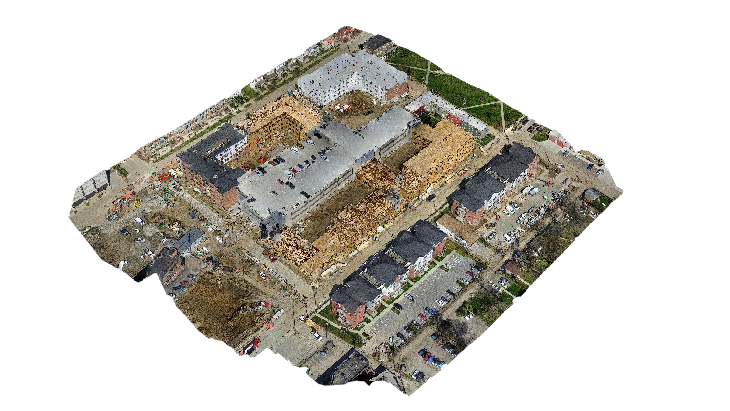
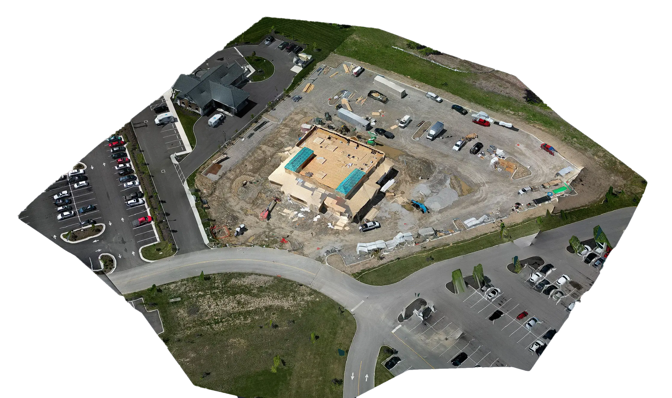
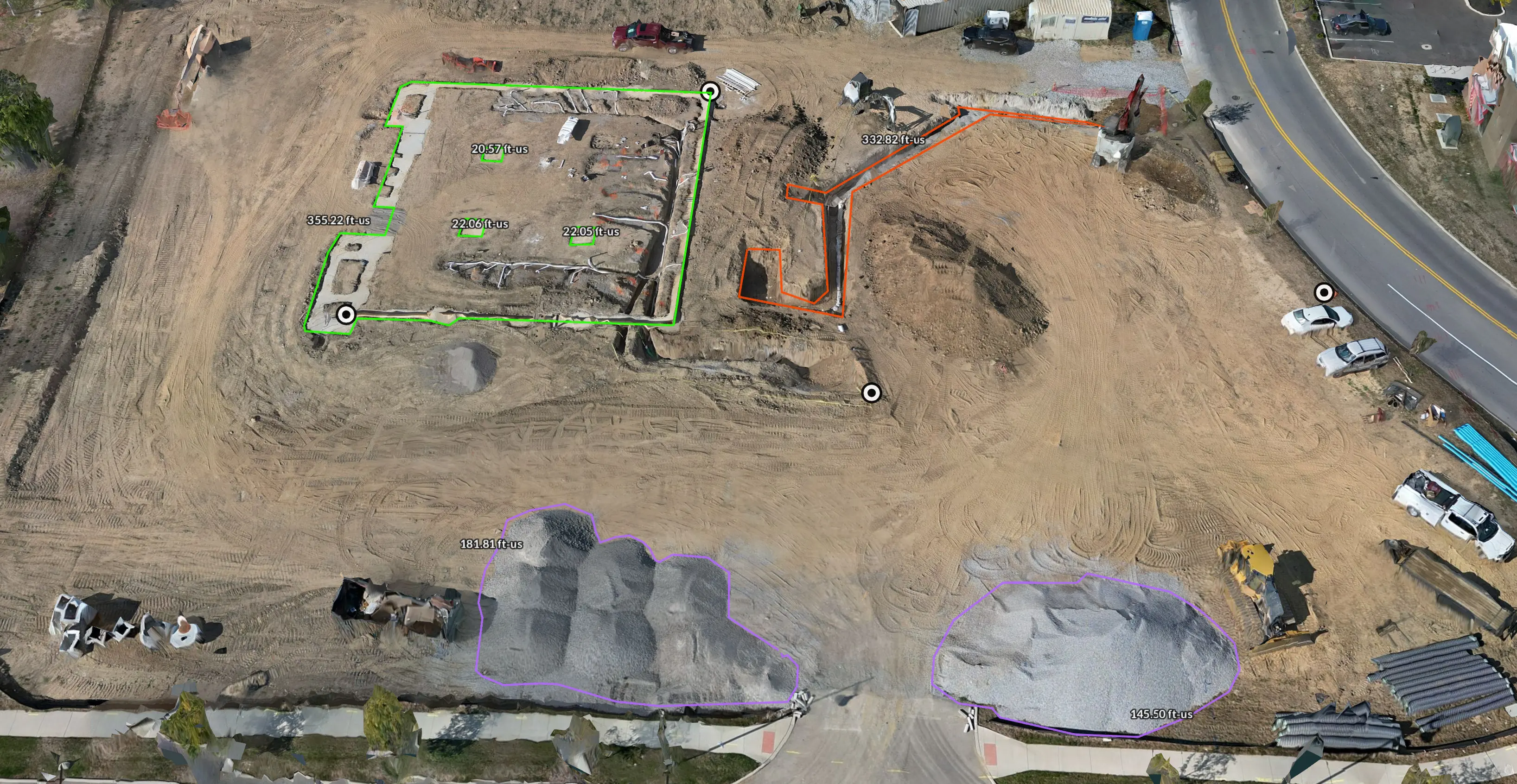
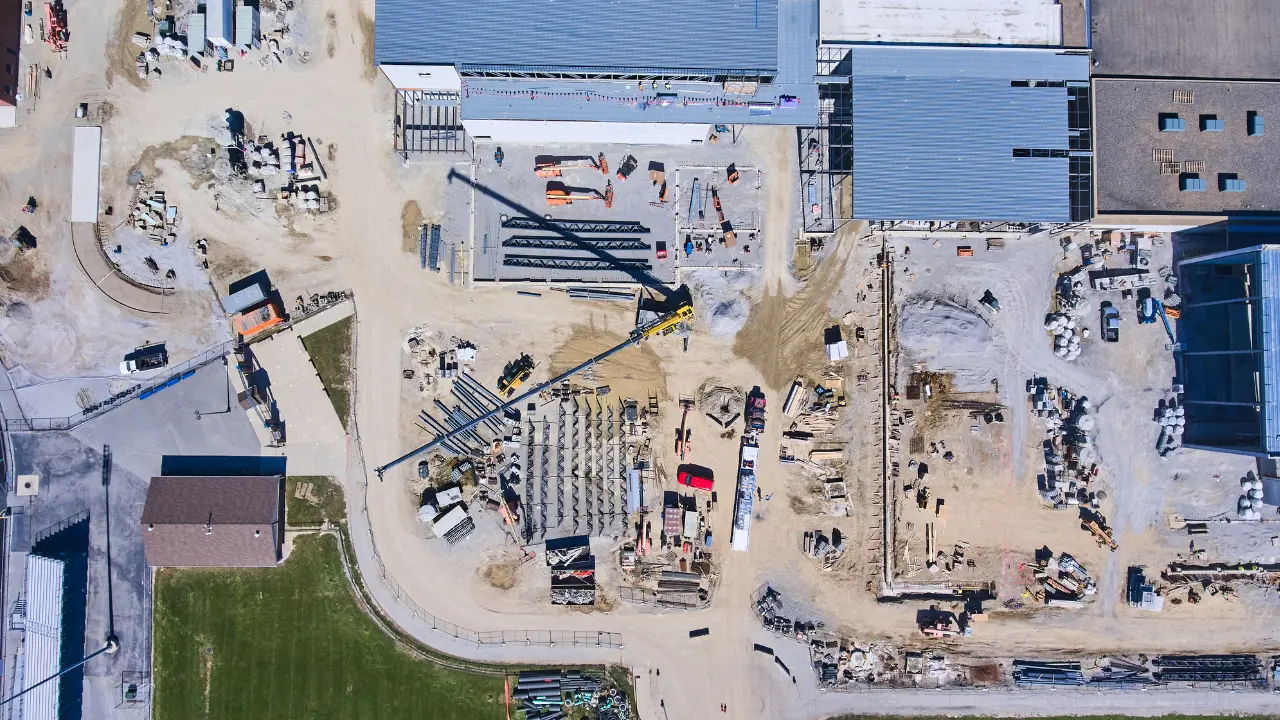
Surveying & Mapping: Clients equipped with PixElement software can create high-resolution maps and 3D models quickly and with precision in the field or at the office. This improves initial surveys and allows for regular site updates throughout the project, helping teams stay informed and adjust plans when necessary.
-
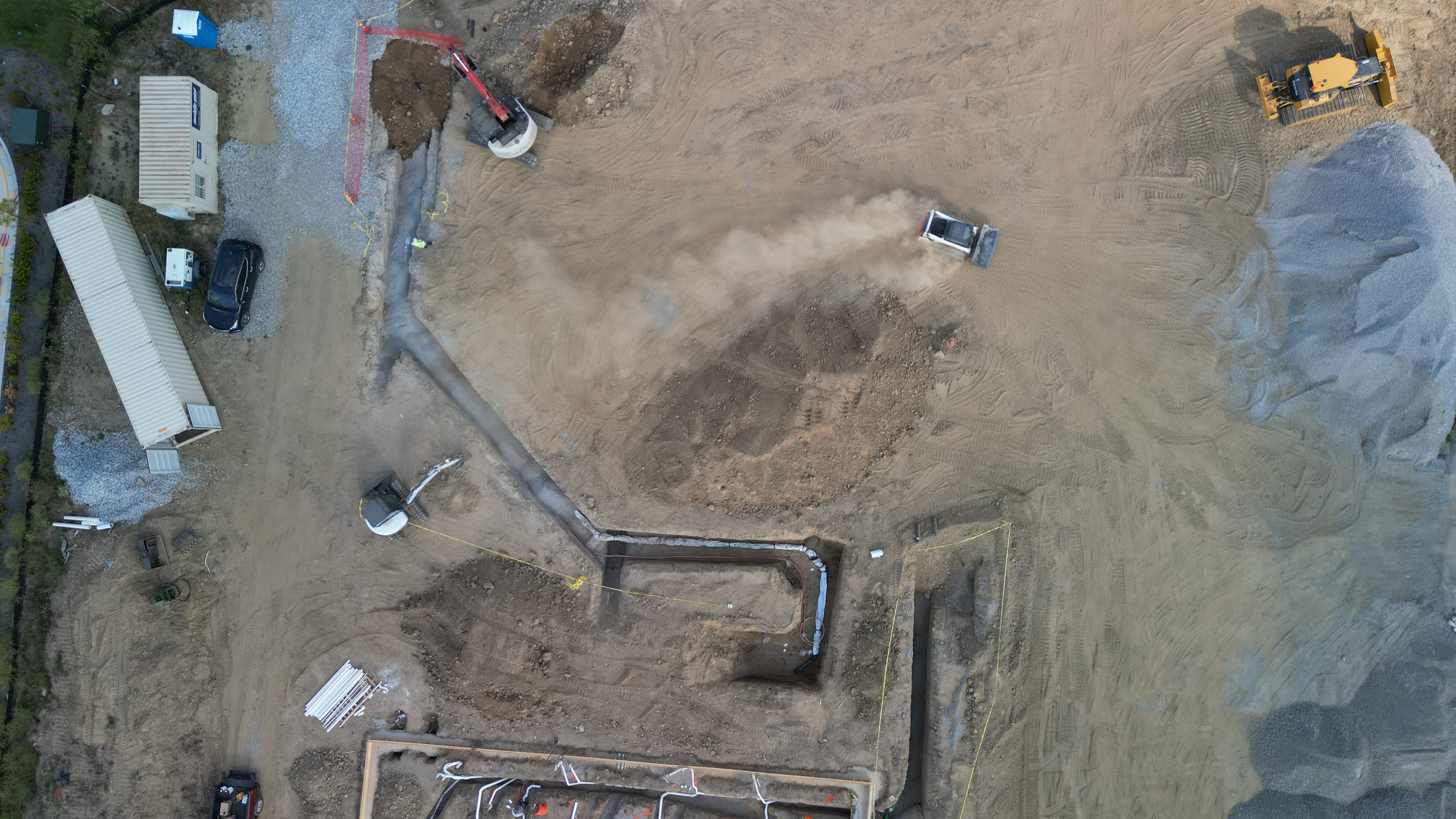
Progress Monitoring: Aerial imagery captured at regular intervals (daily, weekly etc.) provides a detailed overview of construction progress. This helps identify any delays or discrepancies, ensuring that milestones are met and projects stay on track.
-
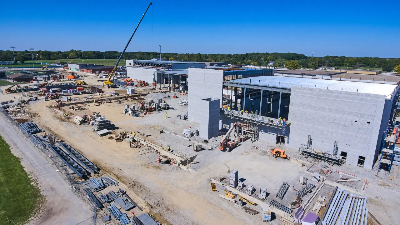
Safety Inspections: Instead of putting workers at risk, drones can safely inspect hazardous areas, identifying issues like structural instability or unsafe conditions. This proactive approach enhances site safety and reduces the likelihood of accidents.
-
Marketing & Presentation: Aerial photography/videography and photogrammetry models also offer visually compelling imagery for client presentations and marketing materials. Aerial views of ongoing or completed projects can attract new business and showcase work quality.
-
Quality Control & Material Management: Drones help maintain quality by detecting construction inconsistencies and monitoring material stockpiles. This real-time data enables better resource management and reduces costly errors or delays.
Drone Usage in Construction: A Growing Trend
The adoption of drones and aerial photogrammetry in construction has steadily increased. A 2018 study by DroneDeploy reported that 57% of respondents were using drones in construction projects. By 2019, this number continued to grow, with 36% of construction professionals already incorporating drones into their work, while another 10% were planning to adopt them.
The growing adoption is largely driven by the need for faster, more accurate data collection, improved job site safety, and the ability to monitor projects from new perspectives. Vertical construction, in particular, has benefited from these advances, allowing teams to map tall buildings, manage materials efficiently, and keep track of complex, multi-story projects.
Key Benefits of Drones in Construction
-
Improved Surverying & Mapping: Faster, more accurate site assessments.
-
Enhanced Safety: Drones reduce the need for manual inspections in dangerous areas.
-
Increased Efficiency: Automating tasks like site monitoring speeds up workflows.
-
Cost Savings: Reduced labor time and early issue detection lower overall project costs.
-
Better Planning: Real-time aerial data feeds into planning tools like BIM, improving design accuracy and taking on project complexity.
-
Marketing Potential: High-quality visuals enhance client presentations and company branding.
The Future of Drones in Construction
The future is bright for drones and aerial photogrammetry in construction, with advancements on the horizon:
-
Autonomous Operations: Drones will execute more tasks without human input. Autonomous drone docks allow for mission flights 24/7.
-
BIM Integration: Drones will work seamlessly with Building Information Modeling (BIM) systems to provide real-time project updates.
-
Advanced Sensors: Improved sensors like thermal imaging and LiDAR will further enhance drone capabilities.
-
AI & Machine Learning: These technologies will allow deeper analysis of drone data, optimizing project management and risk mitigation.
-
Environmental Monitoring: Aerial photogrammetry will help construction companies monitor environmental impacts and support sustainable practices.
Conclusion
Mapping your project sites is no longer just a futuristic concept; it’s an essential tool that construction professionals are embracing to save time, improve safety, and enhance project outcomes. PixElement’s aerial photogrammetry solutions empower companies to tap into these benefits, offering a streamlined way to optimize every phase of construction projects.
Whether you’re looking to elevate your project management or enhance your marketing efforts, PixElement is here to help. Reach out to us today to see how drone technology can transform your next construction project. A 14-day free trial is available to you at www.PixElement.com.
Check out our youtube channel and tutorial playlists to learn more about how PixElement is being used, and how to use it for your projects. https://www.youtube.com/@PixElement365