Tracking Road Construction Projects with Aerial Photogrammetry - Ulry Road Project Featurette
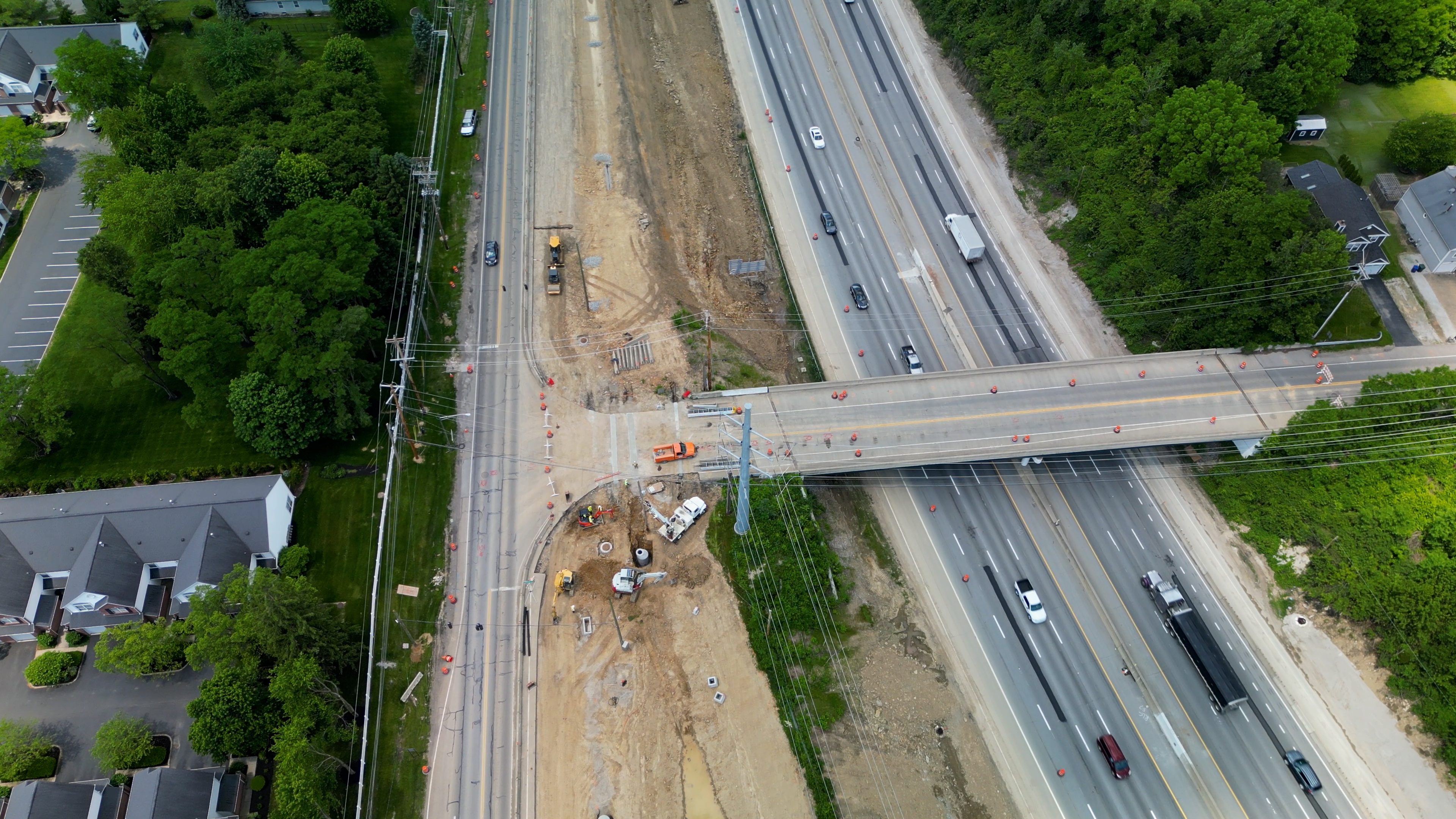
In this article we are exploring an aerial photogrammetry mission to check out the progression of a road expansion project on Ulry Road in Westerville, Ohio. This project started back in April of 2024 and we initially flew our first mission on May 8th.
Why the Expansion is Critical
As Westerville continues to grow, spurred in part by the construction of the nearby Intel chip factory, the area has experienced a surge in new residential developments. This population boom has resulted in significantly more traffic, leading to bottlenecks along Ulry Road, which was originally designed as a two-lane roadway. With so many more individuals needing access to the expanding neighborhoods, city planners determined that the road would require a turn lane and additional lanes to accommodate the increasing traffic flow.
In addition to the road widening, this expansion also includes the installation of a sidewalk along the north side of the road and a shared-use path on the south side. These enhancements are crucial for improving pedestrian safety and promoting accessibility for cyclists to the shopping center nearby as well as the Metro Park. The project also incorporates critical updates to traffic signals, lighting, traffic control, and drainage infrastructure, ensuring that this busy route can effectively serve both current and future residents.
Using PixElement’s photogrammetry tools, we processed the data captured during each mission to generate accurate 3D models and maps of the site. These tools allow project managers and construction teams to closely monitor how the expansion is progressing, from the early stages of land surveying and grading to the installation of sidewalks and traffic signals. With each successive flight, we’ve been able to document changes and verify that the project remains on track.
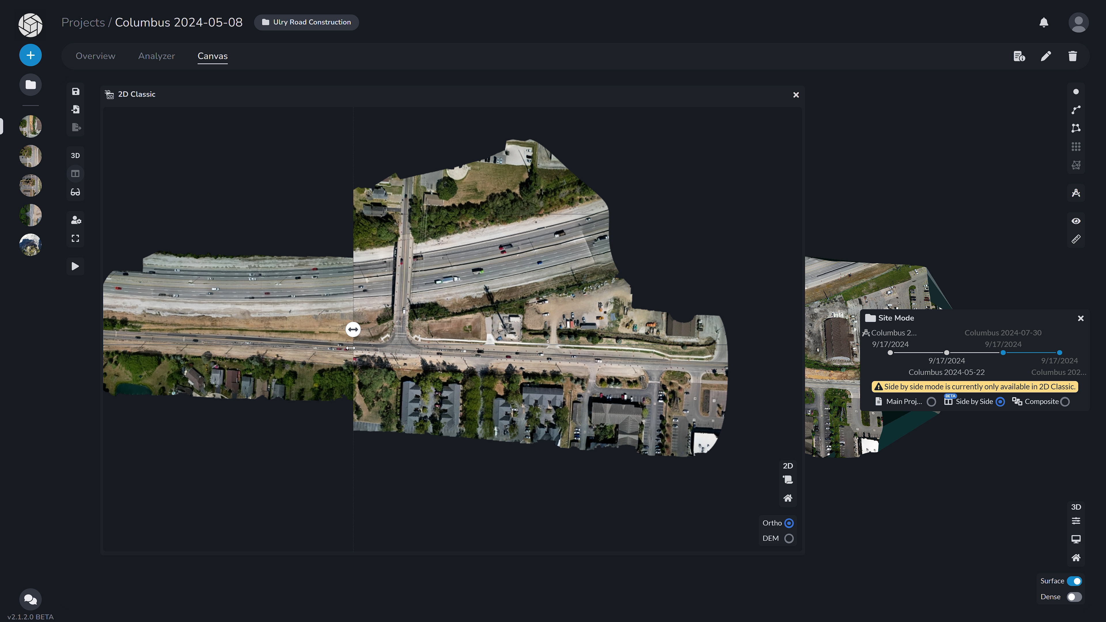
Using the Site Mode Tool, we can seamlessly compare datasets captured at different stages of the project. The side-by-side viewer allows us to view two sets of data simultaneously in a 2D classic canvas view, enabling us to track changes and progress over time. By dragging the viewer, we can explore specific areas of interest and directly observe how the site has evolved throughout the timeline, offering precise visual comparisons that help streamline project management and decision-making.
Future Developments on the Horizon
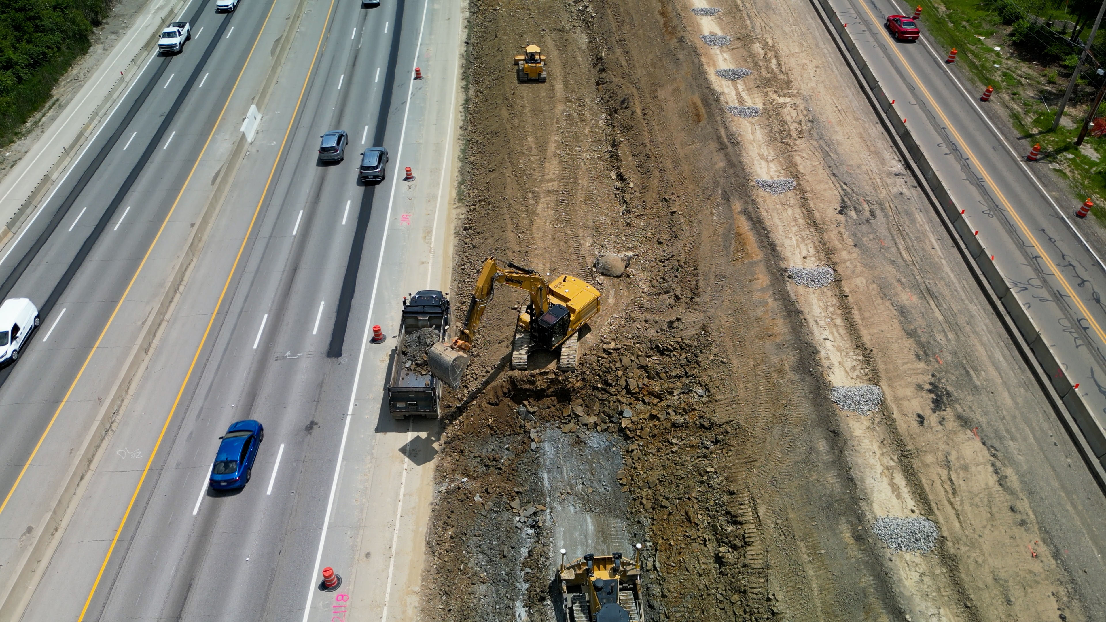
Not only is the Ulry Road expansion nearing completion, but our latest flight also reveals another significant project underway nearby. Plans are in place to widen the highway adjacent to Ulry Road, a move that will further alleviate congestion in the area and accommodate the growing population. Aerial photogrammetry has allowed us to keep stakeholders informed about both projects, ensuring everyone—from city planners to construction managers—remains in sync.
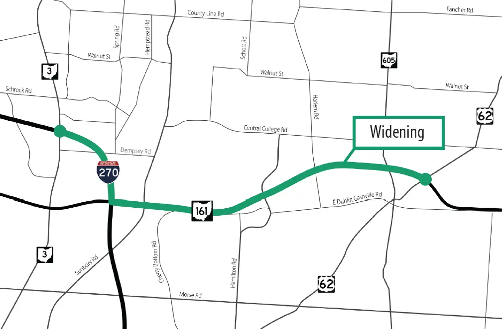
ODNR Map of SR-161 Highway Widening Project
Why Aerial Photogrammetry Matters
Tools like aerial photogrammetry are game-changers for infrastructure projects. They offer visibility into how a project evolves over time, allowing construction teams and city planners to make informed decisions based on accurate, real-time data. Traditional land surveys can take days or even weeks to complete, while drones equipped with photogrammetry technology can capture large areas in a matter of hours. This technology not only saves time but also ensures that all parties have a clear understanding of the project’s status at any given moment.
Aerial photogrammetry also helps identify potential issues early on, allowing for adjustments that can keep a project on schedule and within budget. Whether it’s monitoring traffic flow during construction or verifying the placement of new infrastructure, these tools provide vital insights that keep projects running smoothly.
Conclusion
The Ulry Road expansion is just one example of how aerial photogrammetry can transform the way we approach road construction and urban planning. By offering a clear, accurate view of each stage of the project, PixElement’s technology has enabled us to monitor progress, ensure quality, and keep everyone involved informed.
Thanks for joining us on this mission to explore the road expansion progress. Stay tuned for future updates as we continue to track infrastructure developments and other projects with PixElement.