Aerial Mapping in Road and Highway Construction
The demand for efficient and cost-effective infrastructure development is at an all-time high. Road and highway construction projects are among the most complex and resource-intensive undertakings, requiring precision, planning and focus on safety. This is where PixElement, combined with drone technology, is making a significant impact, transforming the way these projects are planned, executed, and monitored.
Accurately Estimate Project Costs and Win More Contracts
With PixElement, construction companies gain access to high-precision aerial data that enables them to generate detailed, accurate cost estimates. This precision gives contractors an edge in the competitive bidding process, as they can present more realistic and data-driven proposals that reflect true project scope and costs. Accurate bids not only increase the chances of winning contracts but also help avoid potential cost overruns during construction.
Conduct Detailed Pre-Construction Site Surveys
PixElement simplifies the process of pre-construction site surveys by turning drone-captured images into detailed, up-to-date maps. Whether you need orthomosaic maps, baseline topographic maps, corridor maps, or earthwork surveys, PixElement processes these datasets into actionable information, helping companies evaluate project costs and plan effectively before breaking ground. This ensures all stakeholders have the critical data they need before any dirt is moved.
Monitor Progress in Real Time
As the site is flown every few days or weeks as the project progresses, models are used to compare all materials moved and to evaluate equipment and conformance to the construction schedule. Construction projects often face delays due to unforeseen issues on the project site. Photogrammetry enables real-time monitoring, allowing project managers to track progress, identify problems early, and make data-driven decisions. This not only keeps the project on schedule but also reduces costs by minimizing rework.
Enhance Safety
Construction sites can be hazardous, particularly in large scale projects like highway construction, which are inherently dangerous, with risks ranging from working at height to operating machinery in hazardous conditions. Drones can significantly mitigate these risks by performing tasks that would otherwise require human involvement in potentially unsafe environments and for the inspection of difficult-to-reach areas without putting workers at risk.
Improve Communication
Clear and effective communication is crucial in road and highway construction.The aerial imagery and 3D models generated from drone data can easily be shared among stakeholders, from engineers and architects to government agencies and the public. This enhances collaboration, ensuring that everyone involved in the project is on the same page.
Drones and Photogrammetry in Action
To illustrate the impact of drones and aerial photogrammetry in road construction, let’s take a look at a few real-world examples:
-
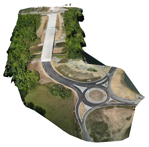
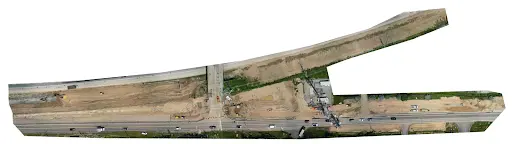
Road Projects:
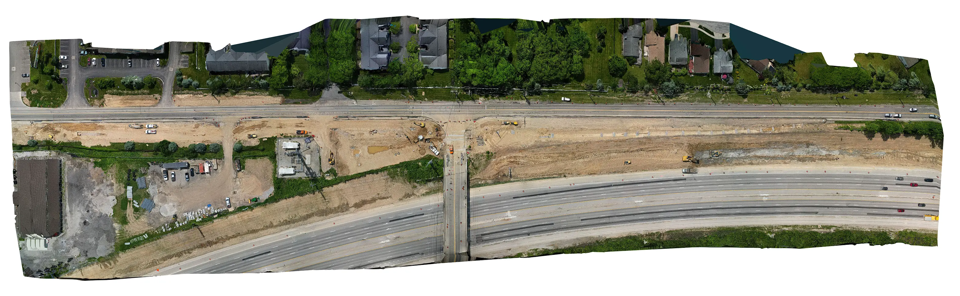
Many road and highway expansion projects have benefited from the ability to quickly survey large areas. This has allowed for faster project initiation and more accurate cost estimates. Additionally, the high-end resolution imagery captured by drones helps engineers identify potential obstacles or environmental concerns early in the planning process.
-
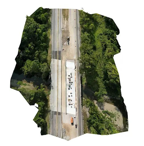
Bridge Construction:
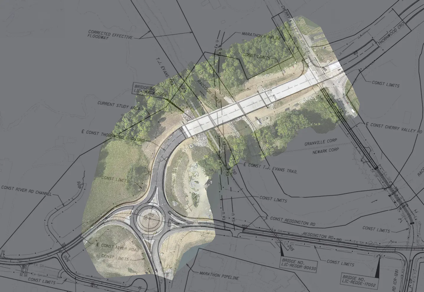
In bridge construction, continuous monitoring of alignment and elevation is critical. Any deviation from design specifications can have serious implications, not only in terms of structural integrity, but also in terms of project timelines and costs. By providing continuous monitoring throughout the construction phase, drones and visualization software like PixElement help in detecting and addressing issues in real-time.
-
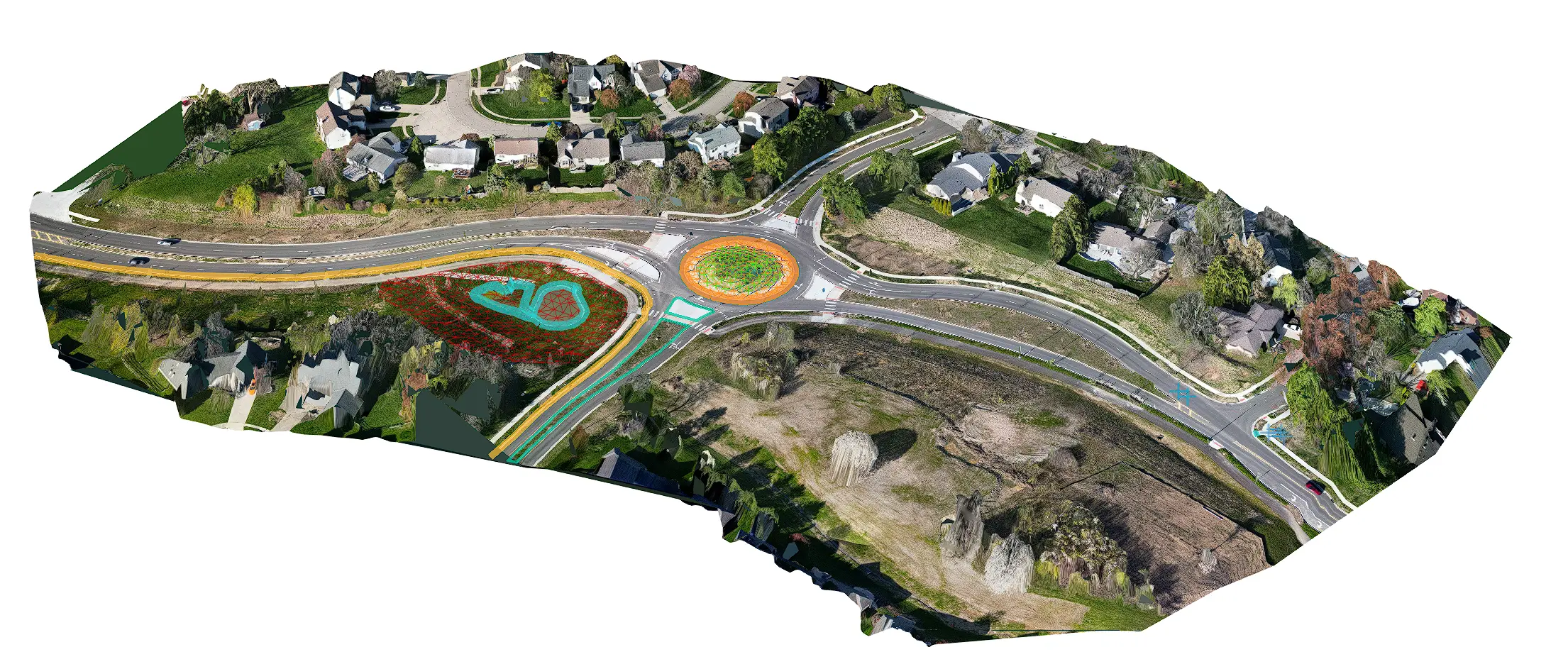
Urban Road Planning:
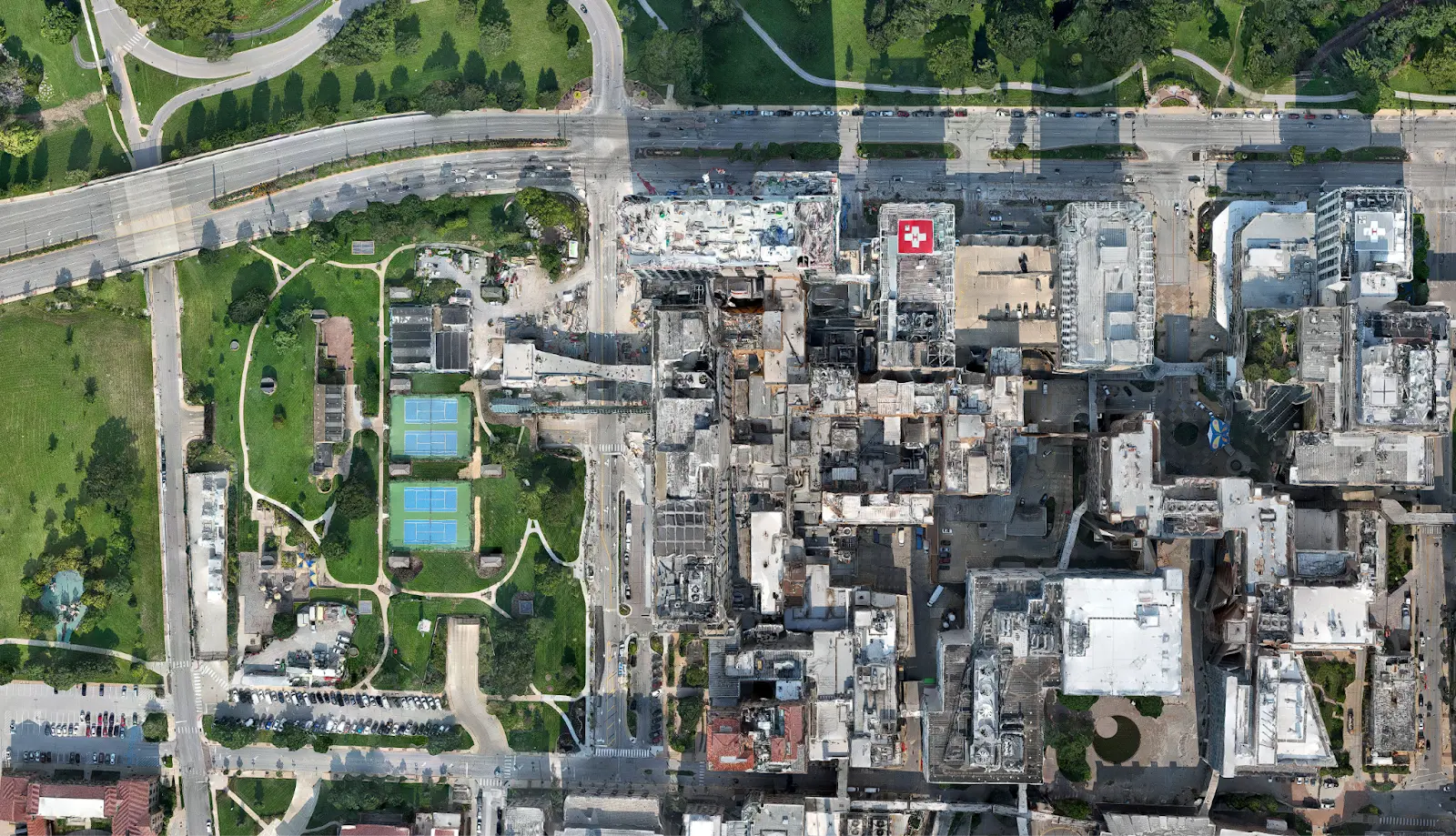
In urban areas, where space is at a premium, aerial photogrammetry has been used to create detailed 3D models of existing infrastructure, as well as tracking project progression. The technology has helped planners design roads that minimize disruption to the surrounding area while maximizing traffic flow.
The integration of drones and aerial photogrammetry into road and highway construction is no longer just a trend - it is becoming an industry standard. Tools like PixElement bring unprecedented accuracy, efficiency and safety to complex infrastructure projects, allowing companies to better estimate costs, plan with precision, monitor progress in real-time, and enhance communication among stakeholders and team members. As the demand for rapid and reliable infrastructure development continues to grow, those who embrace these tools will find themselves better equipped to meet the challenges and seize the opportunities that lie ahead. With the power of aerial photogrammetry, the future of road construction looks not only more efficient, but also more innovative and sustainable for our planet.