The History of Aerial Photogrammetry & Mapping
Maps and geospatial systems are an integral part of our everyday lives, guiding us through towns and cities, aiding in disaster response, and even assisting in archaeological discoveries. But have you ever wondered how aerial photogrammetry and mapping came to be?
Early Beginnings: The Birth of Aerial Photography
The roots of aerial photogrammetry and mapping can be traced back to the mid-19th century when French photographer and balloonist, Gaspard-Felix Tournachon, also known as “Nadar”, took the first aerial photograph in 1858 from a hot air balloon over Paris.
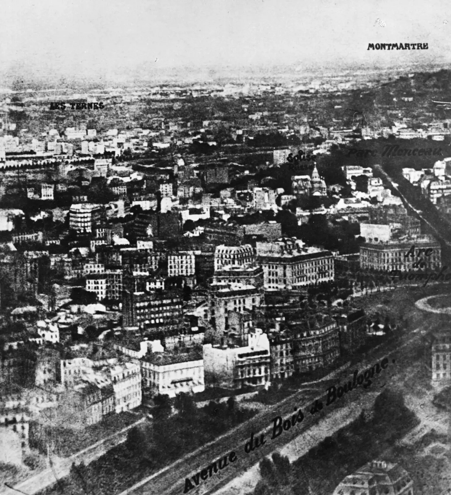
The first ever aerial photograph taken over Paris, France. (Getty)
Other than manned hot air balloons, unmanned kite aerial photography was pioneered by E.D. Archibald, an English meteorologist, in the late 19th century. By attaching a camera to a kite string, Archibald achieved stunning aerial images, demonstrating the feasibility of the innovative technique.
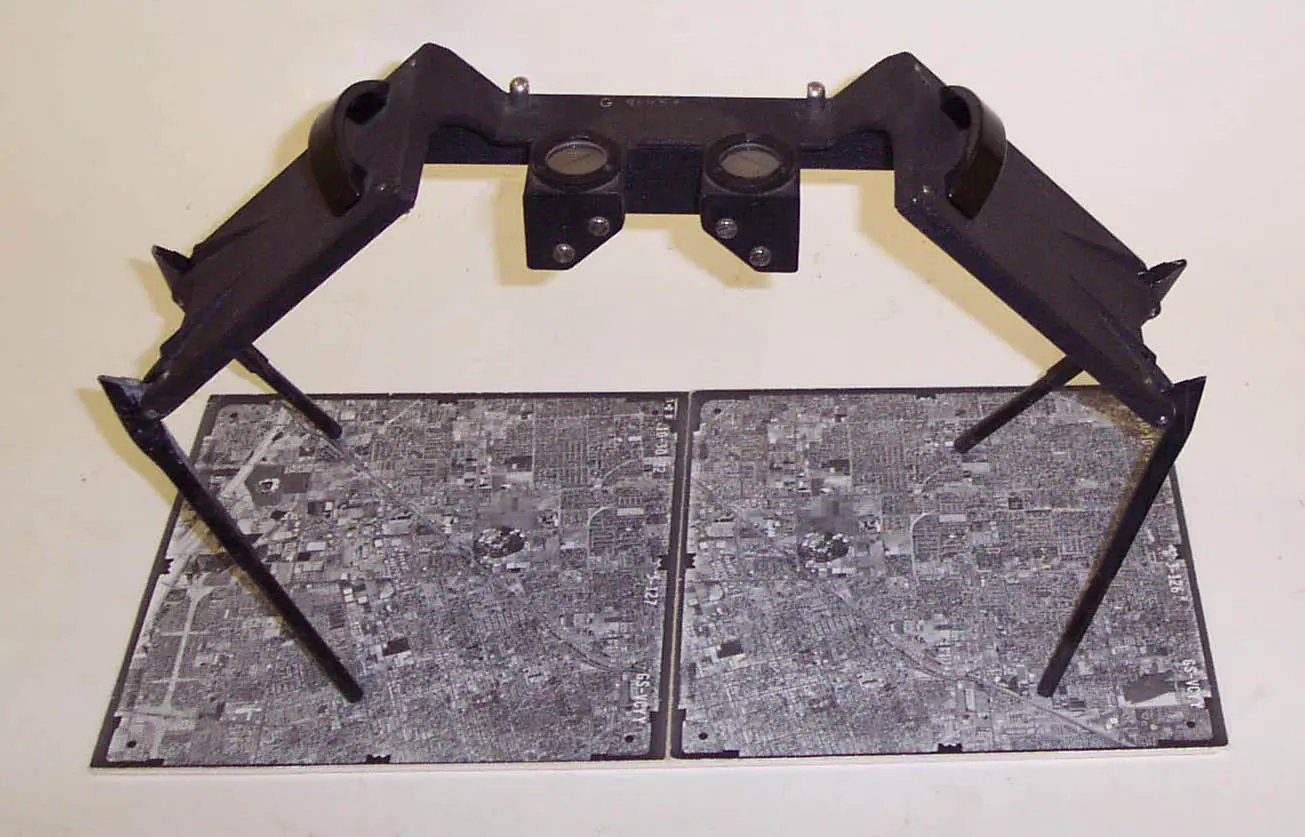
Stereoscope used for early aerial photogrammetry, allowing for 3D terrain analysis from overlapping vertical photographs. (USGS)
In 1912, Frederick Charles Victor Laws initiated aerial photography experiments while serving in the British Royal Flying Corps. His efforts involved capturing photographs from the British dirigible (airship) Beta. Through his experiments, Laws made the groundbreaking discovery that vertical photos taken with a 60% overlap could produce a stereoscopic effect when viewed through a stereoscope. This breakthrough unlocked a new way of creating depth in the images, proving useful for terrain analysis. By examining the three-dimensional images, cartographers and surveyors could identify and measure geographical features such as mountains, valleys, rivers, and man-made structures with greater accuracy. The British, however, did not start using reconnaissance flights with aerial imagery until 1914.
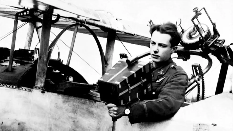
A British Aerial Photographer. (BBC)
World War I: A Catalyst for Advancement
World War I helped accelerate advancements in aerial reconnaissance and mapping techniques. Prior to the war, aerial reconnaissance primarily relied on artists sketching landscapes from the air, a method riddled with limitations in accuracy and efficiency. However, the demands of modern warfare spurred rapid innovation in aerial photography. Germany was among the first to recognize the potential of aerial photography for military intelligence, utilizing it to gain strategic advantages. Soon, both Allied and Central Powers embraced aerial photography for mapping trenches, identifying enemy positions, and monitoring battlefield conditions.
However, traditional aircraft were not the only means of aerial reconnaissance during this time. Remarkably, pigeons were also enlisted for this purpose. Pigeons were equipped with lightweight cameras and trained to fly over enemy territory, capturing aerial images that were then developed and analyzed by military intelligence. This unconventional approach provided valuable insights into enemy movements and terrain features. The use of pigeons in aerial reconnaissance during World War I exemplifies the ingenuity and resourcefulness of military strategists during a time of unprecedented technological change.
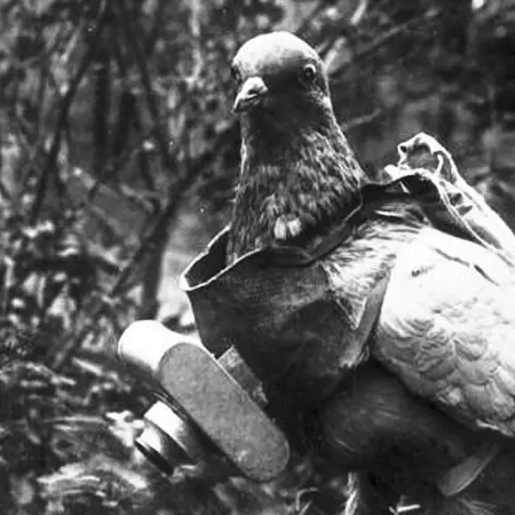
Homing Pigeon equipped with a small camera for aerial photography. (AP Photo)
Aerial imagery was first used comprehensively to plan an engagement in the early months of 1915. At the Battle of Neuve Chapelle, British intelligence distributed 1,500 photographic maps of the German trench fortifications to British infantry commanders. For the first time, aerial observers coordinated artillery barrages with an infantry advance. Despite being a strategic failure for the Allies, the engagement demonstrated the increasing sophistication of imagery interpretation and exploitation techniques for intelligence and cartographic purposes.
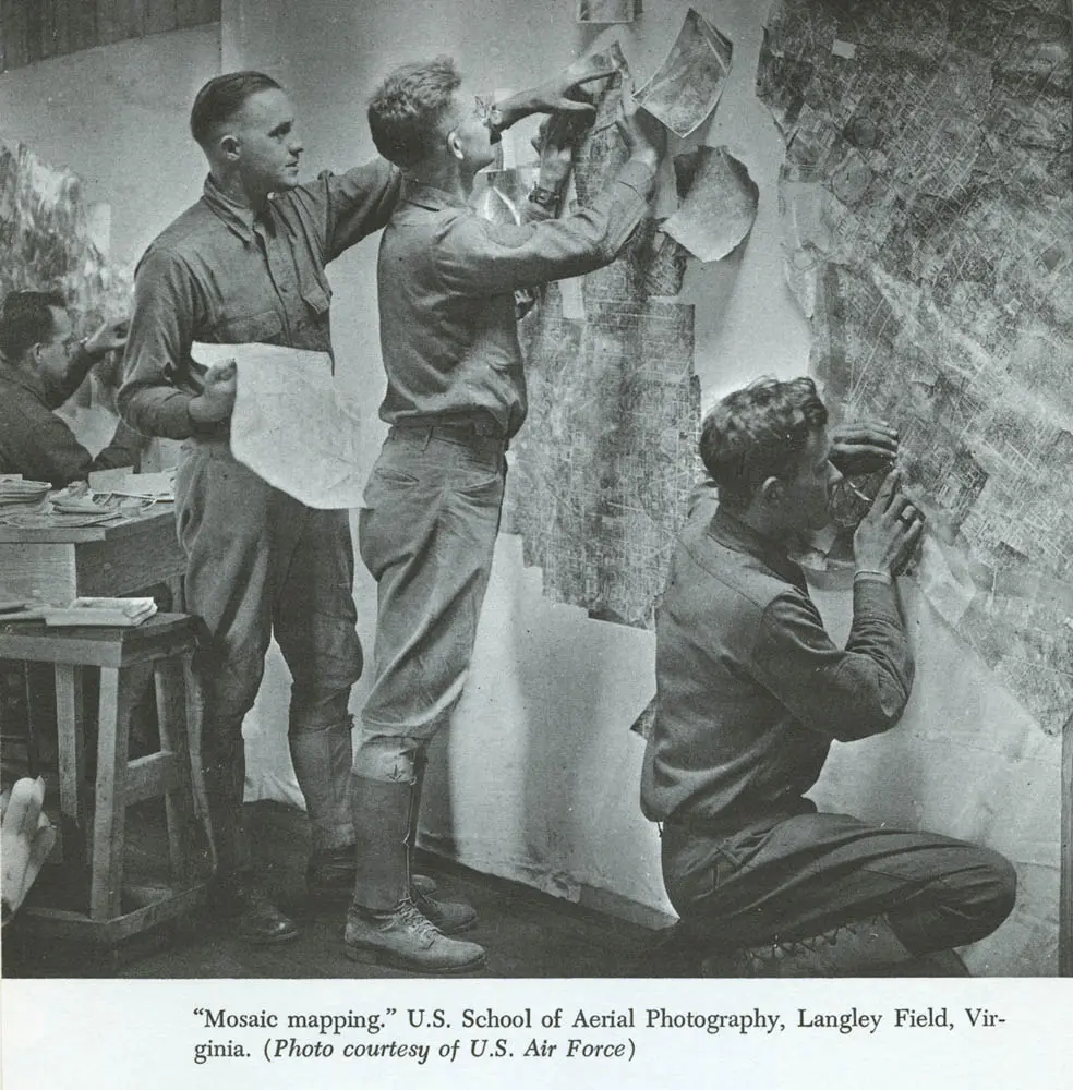
Mosaic maps, which became an important tool throughout the war, were made by taking a series of overlapping vertical photos and aligning them together to create a comprehensive view of the enemy’s trench network. In the same way that an analyst today might use drone imagery to develop a “pattern of life” analysis based on behavioral signatures, photo interpreters in the First World War used stereoscopes—a device used to view two separate images—to make comparative studies of the imagery. “The interpreter is trained to know how things ought to look under all sorts of different conditions in a vertical photo,” wrote Harold Porter in Aerial Observation, in 1921. Interpreters looked for visual clues that might denote changes in the enemy’s position. For example, soil displacement or shadows could help identify trenches, embankments, artillery batteries, and troop movements.
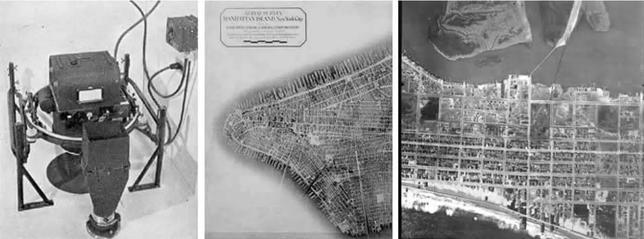
Left: Fairchild Aerial Camera. Center: Lower Manhattan Island via 100 photographs at 10,000 ft. Right: Ocean City, New Jersey, 1920.
The commercialization of aerial photography surged during and after World War I, driven by technological advancements and surplus equipment. Beyond military use, entrepreneurs recognized its potential for urban planning, land surveying, and agriculture. Post-war, surplus aircraft and cameras flooded the market, spurring adventurous photographers and businesses into the field. Governments and private sectors also invested in aerial surveys for mapping and resource documentation. Sherman Fairchild created an aerial map of Manhattan Island using a series of overlapping photographs. This map became commercially successful, and was utilized by various agencies and businesses. Other cities soon followed suit, finding Fairchild’s aerial surveys to be quicker and more cost-effective compared to traditional ground surveys. This period marked the dawn of widespread commercial adoption, setting the stage for modern aerial imaging practices that could thrive with significant civilian applications.
Continued developments during this period was the use of color photography, which provided a more detailed and realistic representation of the terrain. Additionally, the integration of infrared film allowed for better vegetation analysis and water body mapping, enhancing the ability to monitor natural resources.
World War II
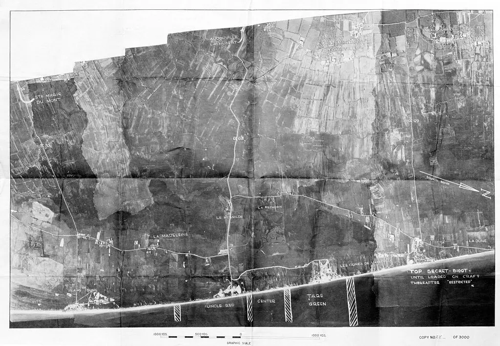
Left: Aerial Reconnaissance photographs of Utah Beach prior to D-Day Landings. Right: Fairchild K-17 Reconnaissance and Mapping Camera.
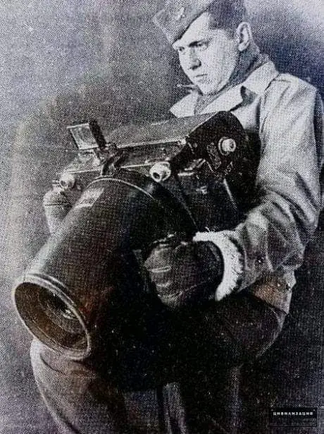
During World War II, aerial photography evolved into a critical tool for military reconnaissance and intelligence gathering. With the outbreak of war, both Axis and Allied forces recognized the strategic importance of obtaining accurate and detailed aerial imagery for planning operations, assessing enemy positions, and mapping terrain. Aerial reconnaissance missions became a routine part of military operations, employing specially equipped aircraft fitted with cameras to capture high-resolution images of enemy territory.
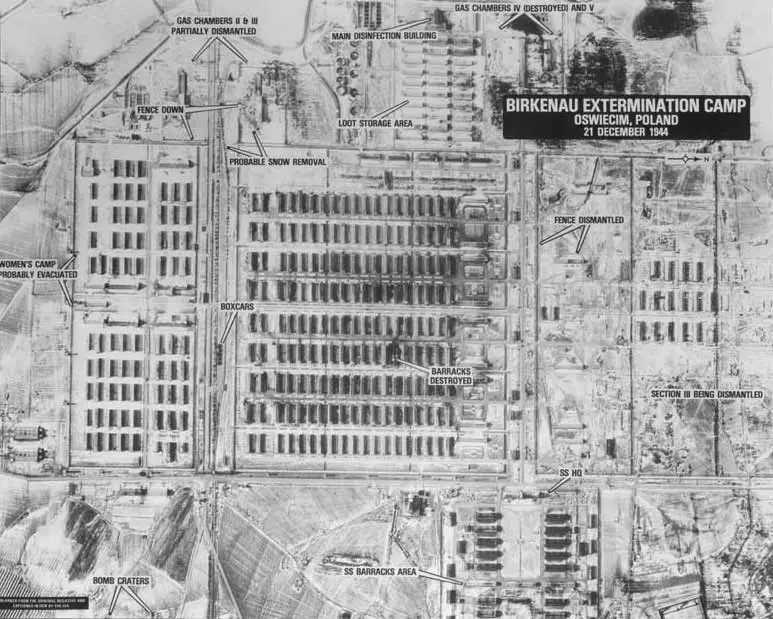
Auschwitz-Birkenau Concentration & Extermination Camp Aerial Survey with Annotations. (USHMM)
Aerial photography and mapping also played a pivotal role in uncovering the existence and operations of concentration camps. Allied reconnaissance missions, primarily aimed at gathering military intelligence, inadvertently captured detailed images of camps such as Auschwitz. These images provided crucial evidence of the atrocities being committed and were later used in post-war trials to prosecute war criminals.
Post-War Innovation: Refinement and Expansion
Following the war, aerial photogrammetry and mapping continued to evolve rapidly, driven by advancements in technology and the increased demand for precise geospatial information. The era saw significant improvements in camera technology, aircraft design, and surveying techniques led to more precise and accurate maps.
Advent of LiDAR
LiDAR sensors, originally deemed “Colidar” (coherent light detection and ranging) were first used in the early 1960s, primarily for military targeting by the Hughes Aircraft Company. The first real-world application of LiDAR was in Meteorology at the National Center for Atmospheric Research to measure cloud formations and monitor pollution levels. Public introduction of LiDAR soared during the Apollo 15 mission in 1971, when astronauts employed a laser altimeter to map the Moon’s surface from orbit.
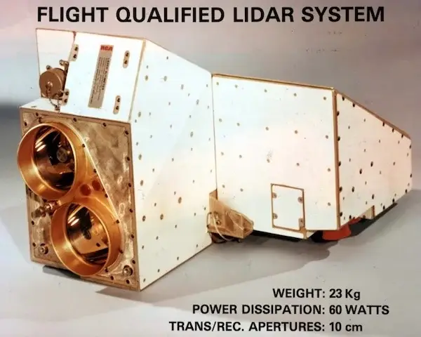
LiDAR system flown on Apollo Mission (NASA)
Additionally, the Apollo 15 mission deployed Lunar Laser Ranging Retroreflector Arrays, which are still used today to measure the Earth-Moon distance with high precision. These advancements in laser technology have enhanced our ability to collect detailed spatial data. Today, LiDAR sensors are mounted in satellites, aircraft and drones offering precision in terrain mapping.
The Cold War and the Space Race
During the Cold War, the rivalry between the United States and the Soviet Union extended beyond military and political spheres and into the realm of space exploration. Known as the Space Race, this competition for supremacy in space exploration became a defining feature of the Cold War era. Both superpowers sought to demonstrate their technological prowess and ideological superiority by achieving significant milestones in space exploration, such as launching satellites, sending humans into space, and ultimately landing astronauts on the moon. Aerial photography played a crucial role in the Space Race, as reconnaissance satellites and aircraft provided vital intelligence on the capabilities and activities of each side’s space program. These satellites captured images of launch sites, spacecraft, and other infrastructure, helping to monitor progress and assess threats. Additionally, the development of satellite-based navigation systems, such as GPS, emerged as a byproduct of the Space Race, revolutionizing aerial mapping and navigation capabilities worldwide.
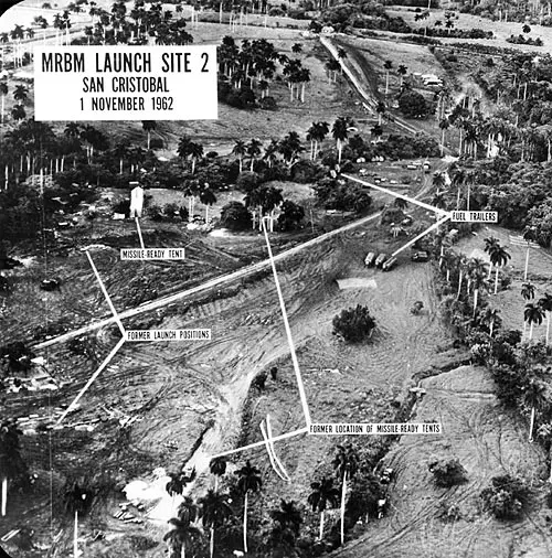
Aerial photograph of Soviet Union ballistic missiles in Cuba (1962). (US National Archives)
The U-2 spy plane, a high-altitude reconnaissance aircraft used by the United States during the Cold War, played a particularly significant role in aerial reconnaissance efforts. Operated by the Central Intelligence Agency (CIA), the U-2 conducted covert surveillance missions over Soviet territory, gathering valuable intelligence on military installations, missile sites, and other strategic targets. In October 1962, during the Cuban Missile Crisis, U-2 reconnaissance flights revealed the presence of Soviet ballistic missiles in Cuba, escalating tensions between the two superpowers and bringing the world to the brink of nuclear war. The U-2’s ability to capture detailed aerial imagery from high altitudes provided crucial intelligence to U.S. policymakers, enabling them to assess the situation and formulate an appropriate response. Ultimately, the Cuban Missile Crisis was peacefully resolved through diplomatic negotiations, but it underscored the importance of aerial reconnaissance in shaping Cold War geopolitics and averting potential catastrophe.
The Digital Revolution: Transition from Film to Pixels
The advent of digital technology in the latter half of the 20th century revolutionized the field of aerial mapping. Traditional film cameras were gradually replaced by digital sensors, marking a significant technological milestone in aerial photogrammetry. This shift not only offered greater flexibility, efficiency, and image quality but also enhanced the speed and cost-effectiveness of capturing and processing aerial images. Digital technology enabled instant image review and eliminated the need for chemical processing, which streamlined operations across various applications.
Rise of GIS Programming and 3D Visualization
The development of Geographic Information Systems (GIS) starting in the early 1960s allowed for the integration of aerial imagery into sophisticated mapping platforms, enabling new applications and analyses. At the onset of the rise of GIS programming and 3D visualization, satellite and aircraft imagery served as the primary data sources for spatial analysis and mapping applications. GIS software empowered users to harness the wealth of information captured by these aerial platforms, enabling the creation of detailed maps, environmental assessments, and infrastructure planning. By integrating satellite and aircraft imagery with other geospatial data layers, such as topography, land use, and demographic information, GIS facilitated comprehensive spatial analyses and informed decision-making processes across various sectors. As GIS technology advanced, so did its capabilities, paving the way for innovative visualization techniques and interactive mapping tools that continue to shape the landscape of aerial photogrammetry and mapping today.
Rise of Drones and Furthering Technology
In recent years, the rise of drones has revolutionized the field of aerial photogrammetry and mapping, democratizing access to aerial imagery and data collection. Drones, equipped with high-resolution cameras and GPS technology, capture detailed aerial imagery with remarkable precision and flexibility. They are capable of reaching remote or hazardous areas that traditional aircraft cannot access, making them invaluable tools for applications such as land surveying, infrastructure inspection, and agricultural monitoring. Additionally, advancements in autonomous flight and machine learning algorithms have streamlined data acquisition and analysis, further enhancing the capabilities of drone-based mapping systems. As drones continue to evolve and become more accessible, they are poised to play an increasingly important role in shaping the future of our world.
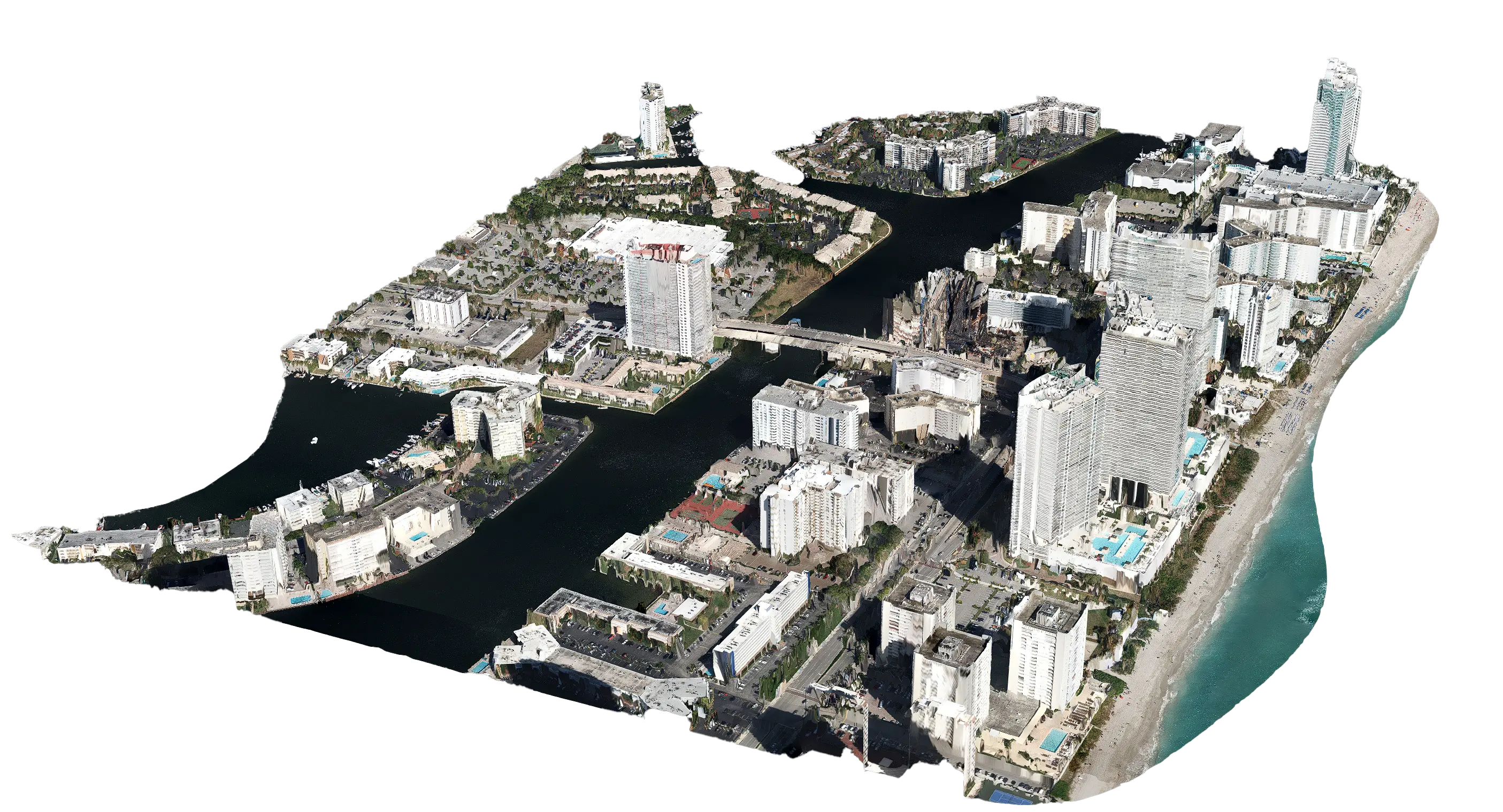
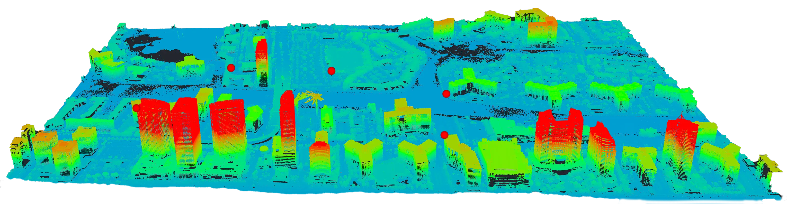
PixElement rendered 3D model and elevation model of combined LiDAR + Imagery dataset of downtown Miami, Florida.
The development and advancement of artificial intelligence and machine learning will also play key roles in shaping the future of how aerial systems and mapping software is used. Many of these baselines are already being used today. Self-launching drones that complete fully autonomous missions via cloud-based communication to their hub are becoming more common, as well as mapping software’s ability to learn and identify certain issues, such as cracks in key infrastructure like bridges and roadways. Additionally, these advancements include integrations into machine control interfaces, enabling real-time adjustments and maintenance scheduling to enhance efficiency and safety in various industries. This evolution not only streamlines data collection and analysis but also supports proactive measures in infrastructure management and maintenance. These capabilities not only enhance the precision and reliability of aerial mapping but also pave the way for more proactive maintenance and mitigation strategies and response to critical needs, underscoring the important role that these technologies play in protecting and efficiently managing our human-made and natural environments.
Conclusion
From its humble beginnings with Nadar’s balloon over Paris to the sophisticated drone and satellite systems of today, aerial photography and mapping has transformed how we view and understand our world. These innovations will further refine our capabilities to capture, analyze, and utilize spatial data, opening new horizons for scientific exploration and practical applications. Aerial photography, once a novelty, has become an emerging cornerstone of modern technology, continuously reshaping our interaction with the physical and digital worlds. As we continue to fly, the future of aerial photography holds limitless potential for discovery and innovation.
Works Cited
Abercromby, K.J., et al. “A History of Satellite Reconnaissance Volume I: Declassifying the Satellite Imagery Archive.” NASA Technical Reports Server, NASA, 2010, https://ntrs.nasa.gov/citations/20100031189.
Finnegan, Terrence J. Shooting the Front: Allied Aerial Reconnaissance and Photographic Interpretation on the Western Front - World War I. The History Press, 2011.
“History of GIS.” Esri, https://www.esri.com/en-us/what-is-gis/history-of-gis?srsltid=AfmBOooKw8R1QtDc8IUT-cVY1UvRllVfczKiIRmnbT5iNN23ZVfmNulu.
“History of Photogrammetry: The Entry of Drones – A Quick Lookback.” Skylark Drones, https://www.skylarkdrones.com/blog/history-of-photogrammetry-the-entry-of-drones-a-quick-lookback#:~:text=slightly%20offset%20photographs.-,%E2%80%8D,%E2%80%8D.
National Air and Space Museum. “The Beginnings and Basics of Aerial Photography.” National Air and Space Museum, Smithsonian Institution, https://airandspace.si.edu/stories/editorial/beginnings-and-basics-aerial-photography#:~:text=In%201860%2C%20James%20Wallace%20Black,a%20balloon%20but%20was%20unsuccessful.
“Pioneers of Aerial Photography.” Professional Aerial Photographers Association, https://papa.clubexpress.com/content.aspx?page_id=22&club_id=808138&module_id=158950#:~:text=The%20first%20known%20aerial%20photograph,the%20basket%20of%20the%20balloon!.
“The History of Aerial Photography.” Hartzel Propeller, https://hartzellprop.com/the-history-of-aerial-photography/.
“USGS EROS Archive - Aerial Photography: Aerial Photo Mosaics.” U.S. Geological Survey, https://www.usgs.gov/centers/eros/science/usgs-eros-archive-aerial-photography-aerial-photo-mosaics.