Importance of Imagery Overlap in Aerial Photogrammetry
In aerial photogrammetry, imagery overlap is an essential principle to master to obtain the best results from your dataset. Imagery overlap refers to the degree of redundancy in aerial photographs captured in a particular dataset. If you would like to view the video version of this blog post, please see the video above.
Imagery overlap facilitates the creation of a dense point cloud out of the images, which is the building block for creating a 3D model. By capturing multiple images of the same area from different angles, overlap ensures that every point on the terrain is captured from multiple perspectives, allowing the photogrammetry software to triangulate the position of each point with greater accuracy, resulting in a more detailed representation of the landscape.
Imagery overlap acts as a safeguard against occlusions and shadows, common challenges in aerial photogrammetry. When an area is captured from multiple viewpoints, the chances of important features being obscured by objects or cast in shadows are significantly reduced. The resulting 3D models are more complete and devoid of artifacts, providing invaluable insights for applications ranging from urban planning and land surveying to disaster response and environmental monitoring.
Imagery overlap enables robust feature matching, a crucial step in the photogrammetric process. By identifying corresponding points in overlapping images via the Reference Point Manager in PixElement, the algorithms can precisely align the images and reconstruct the scene in three dimensions. This alignment not only enhances the accuracy of the final model but also enables the integration of data from different sources, such as LiDAR or control points.
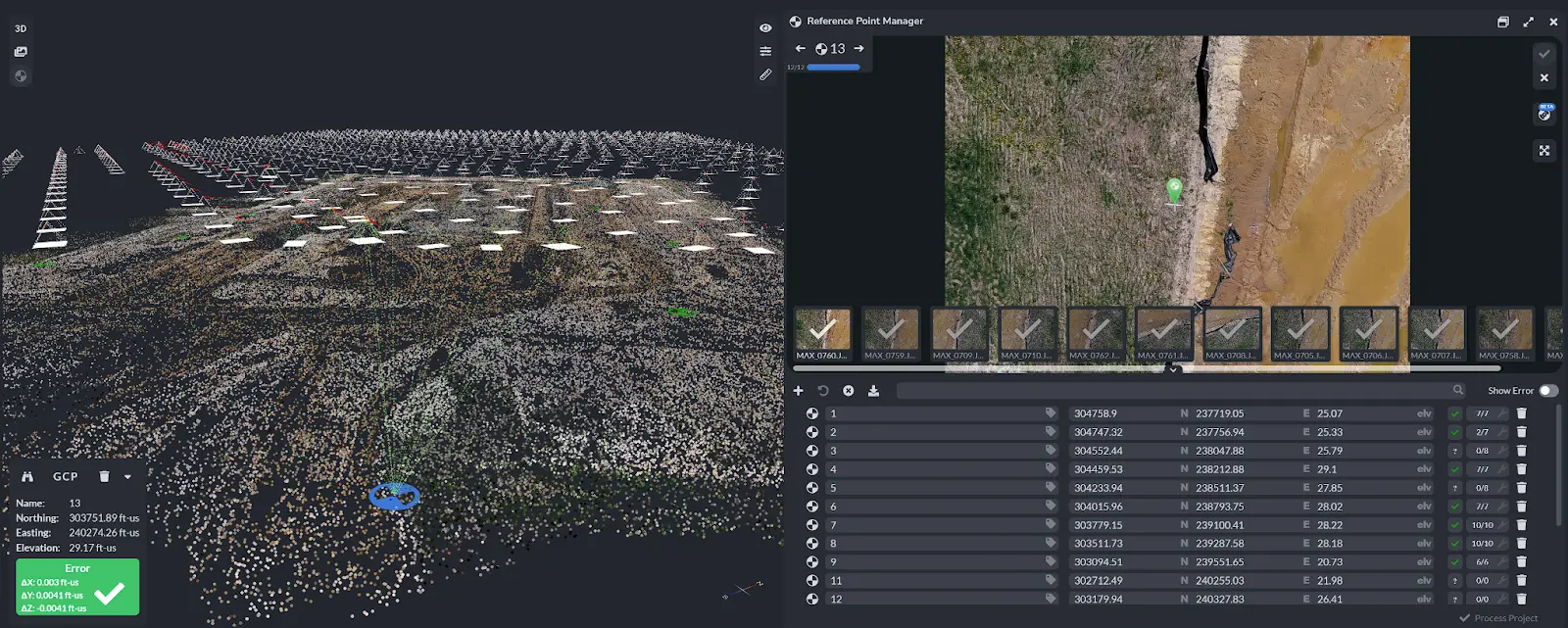
View of PixElement’s Reference Point Manager for connecting reference points to photos taken.
Imagery overlap is not merely a technical consideration but a strategic imperative in aerial photogrammetry. It underpins the reliability and fidelity of the data collected, empowering professionals across various industries to make informed decisions and derive actionable insights from the imagery. As technology continues to advance and the demand for high-resolution geospatial data grows, the importance of imagery overlap and best practices in aerial photogrammetry will only become more pronounced, shaping the future of mapping, surveying, and spatial analysis.
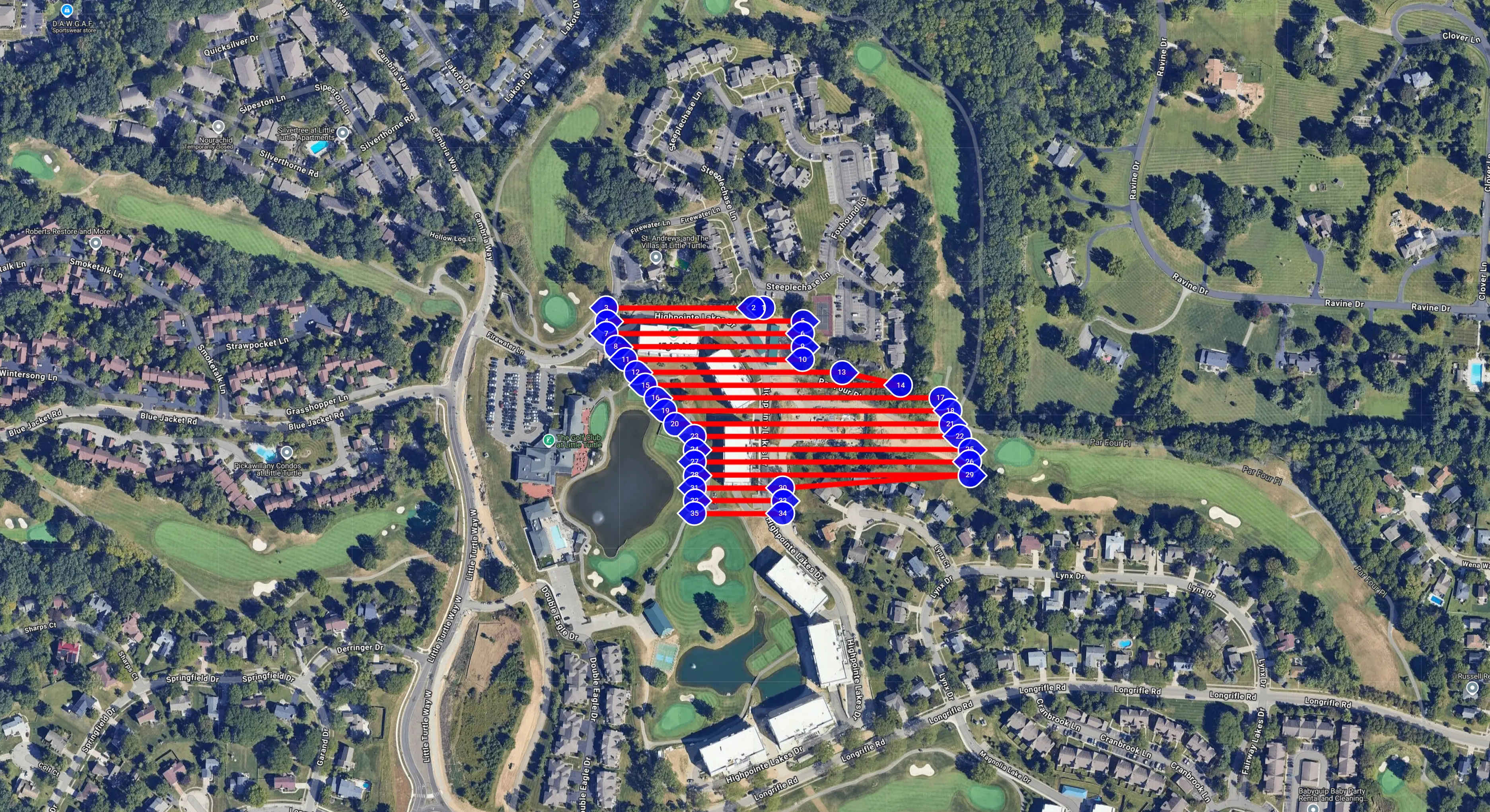
Best Practices of Imagery Overlap
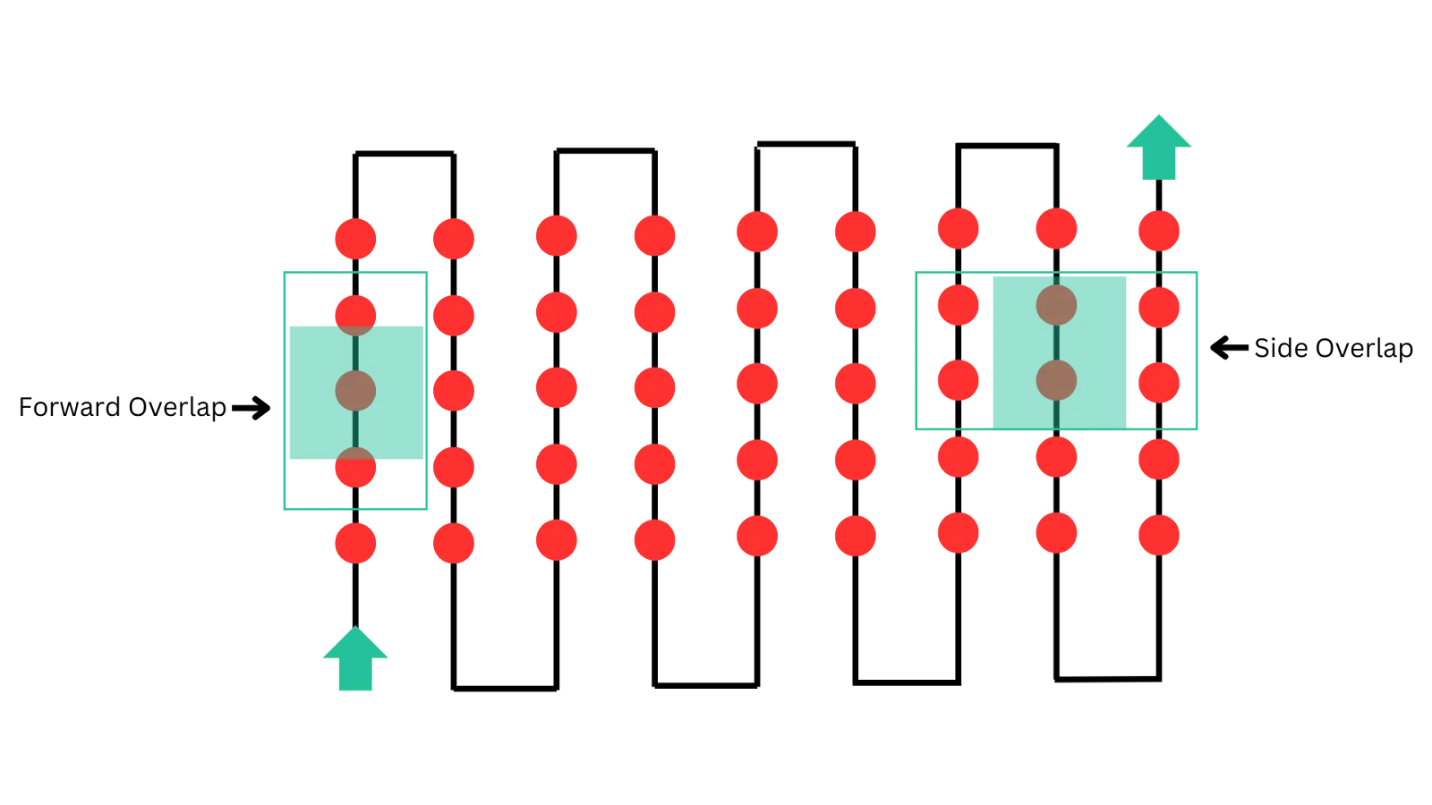
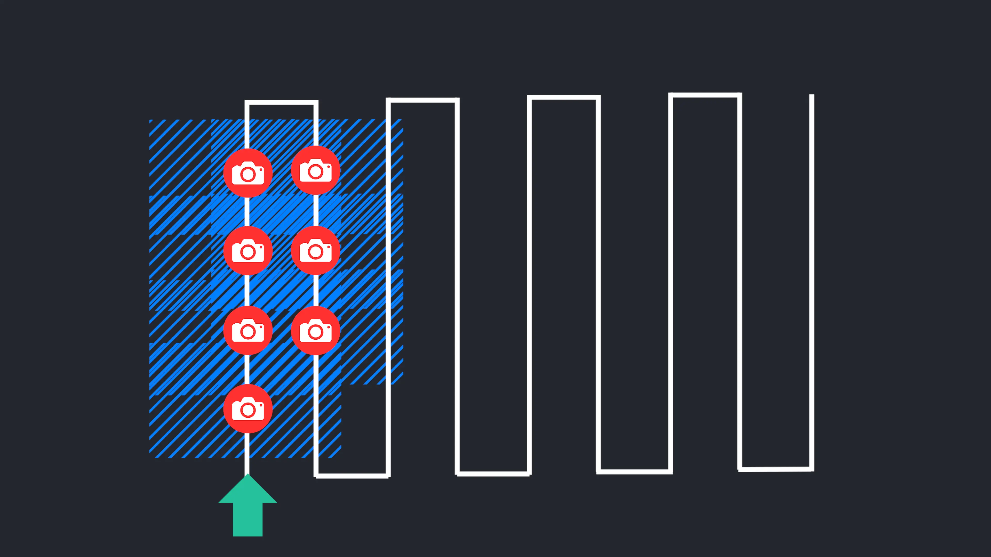
Each red circle represents a photo taken in the grid of a drone photogrammetry flight path. Forward and side overlap parameters should be considered when planning a mission.
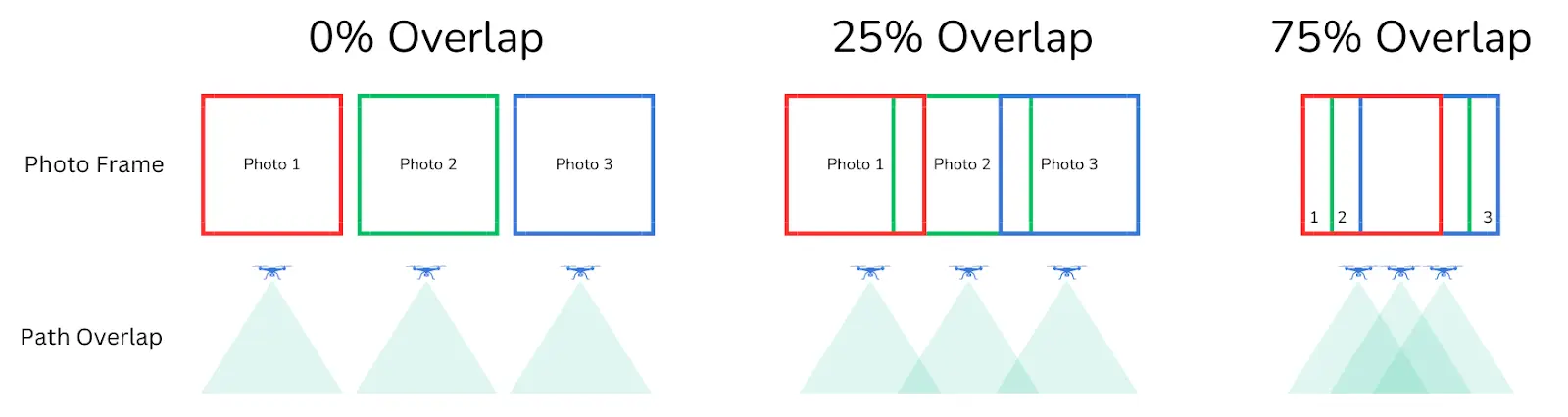
Frontal Overlap
Frontal overlap refers to the amount of overlap between consecutive images along the flight direction (forwards and backwards). For typical aerial mapping projects, a frontal overlap of 60% to 80% is commonly recommended. This means that 60% to 80% of each image should overlap with the preceding and succeeding images along the flight path. Higher frontal overlap provides more redundancy and aids in accurate feature matching and 3D reconstruction.
Side Overlap
Side overlap, also known as lateral overlap, pertains to the overlap between adjacent images across the flight direction. Similar to frontal overlap, a side overlap of 60% to 80% is often recommended. This ensures sufficient redundancy in image coverage and helps mitigate issues such as occlusions and shadows.
Total Overlap
Total overlap refers to the combined effect of frontal and side overlaps. In practice, the total overlap is typically higher than either frontal or side overlap alone. A total overlap of 80% to 90% is commonly used in aerial photogrammetry projects to ensure comprehensive coverage and robust data collection.
Adjustment for Terrain and Sensor Characteristics
The recommended overlap percentages may vary depending on factors such as terrain complexity, sensor characteristics (e.g., focal length, field of view), and desired level of detail in the final output. In rugged terrain or areas with significant elevation variations, higher overlap may be necessary to capture intricate features accurately.
It is important to note that when you utilize a mission planner for a photogrammetric flight, the overlap calculations are based on the height above ground. The mission planning application has no knowledge about whether or not there are tall buildings, structures, or vegetation at the site. As a result, it may be necessary to change your overlap percentages in the field, in order to maintain the nessary front and sidelap coverage in order to reconstruct the tops of buildings, for instance.
Consideration of Flight Altitude and Ground Sampling Distance (GSD)
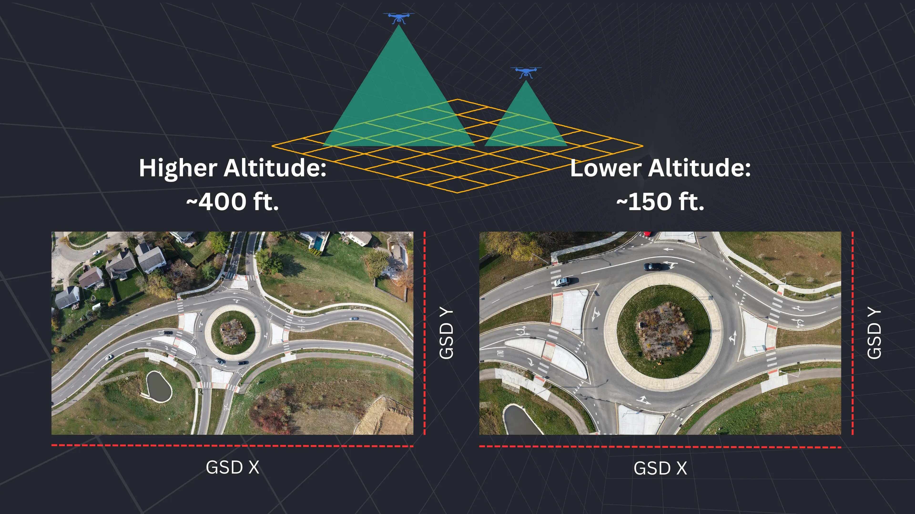
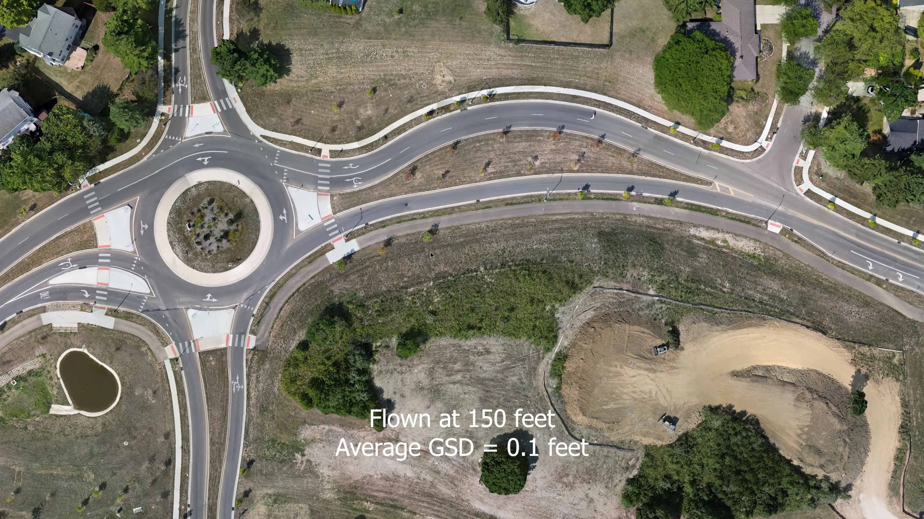
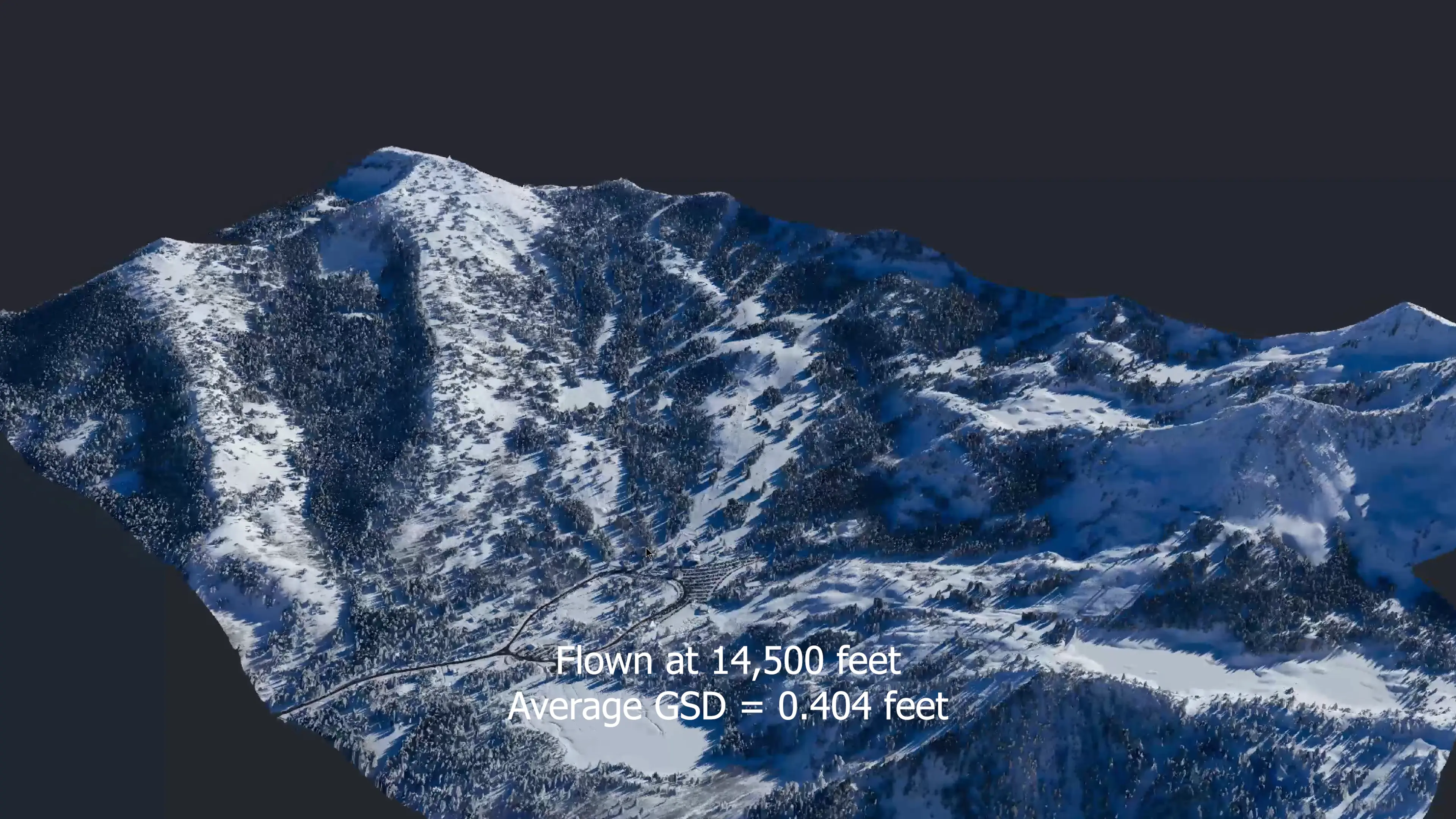
The flight altitude and ground sampling distance (GSD) of the camera system also influences the required overlap. Lower flight altitudes and finer GSDs generally necessitate higher overlap percentages to maintain adequate image coverage and detail. The higher your altitude, the greater the sampling distance, and therefore, less photos will need to be taken of the area. Although this is “efficient” and may require less flight time, it ultimately will hurt the project due to having less data and lower quality results. Low altitude flight allows for more data to be captured as well as for that data to be higher resolution. Urban planning projects might require lower flight altitudes to capture fine details, while forestry management projects may benefit from higher altitudes to cover larger areas more efficiently. Therefore, determining the appropriate flight altitude is subjective and should be tailored to the objectives and constraints of each application.
Use of Flight Planning Software
Utilize specialized flight planning software or tools provided by drone or aerial surveying platforms to calculate and optimize overlap settings based on project requirements and constraints. These tools often offer automated flight planning features that adjust overlap parameters according to specified criteria, streamlining the planning process.
By adhering to these principles and adjusting overlap settings based on project-specific considerations, pilots can effectively practice imagery overlap in aerial photogrammetry and ensure the acquisition of high-quality imagery for accurate 3D reconstruction and spatial analysis.