Introducing PixStories: From Capture to Context

At PixElement, we’re continuously inspired by the diverse ways our users apply aerial photogrammetry to solve real-world challenges—whether it’s mapping a remote construction site, documenting historical landmarks, or modeling terrain for environmental research. These are more than just datasets—they’re stories. And we think they deserve to be told.
That’s why we’re launching PixStories: a blog series highlighting projects built with PixElement software. In each post, we’ll showcase how users have captured, processed, and delivered actionable insights from the air—with a deeper look into the context, methodology, and purpose behind the work. From quarries to coastlines, ancient ruins to modern infrastructure, PixStories will bring you a curated collection of applied photogrammetry in action.
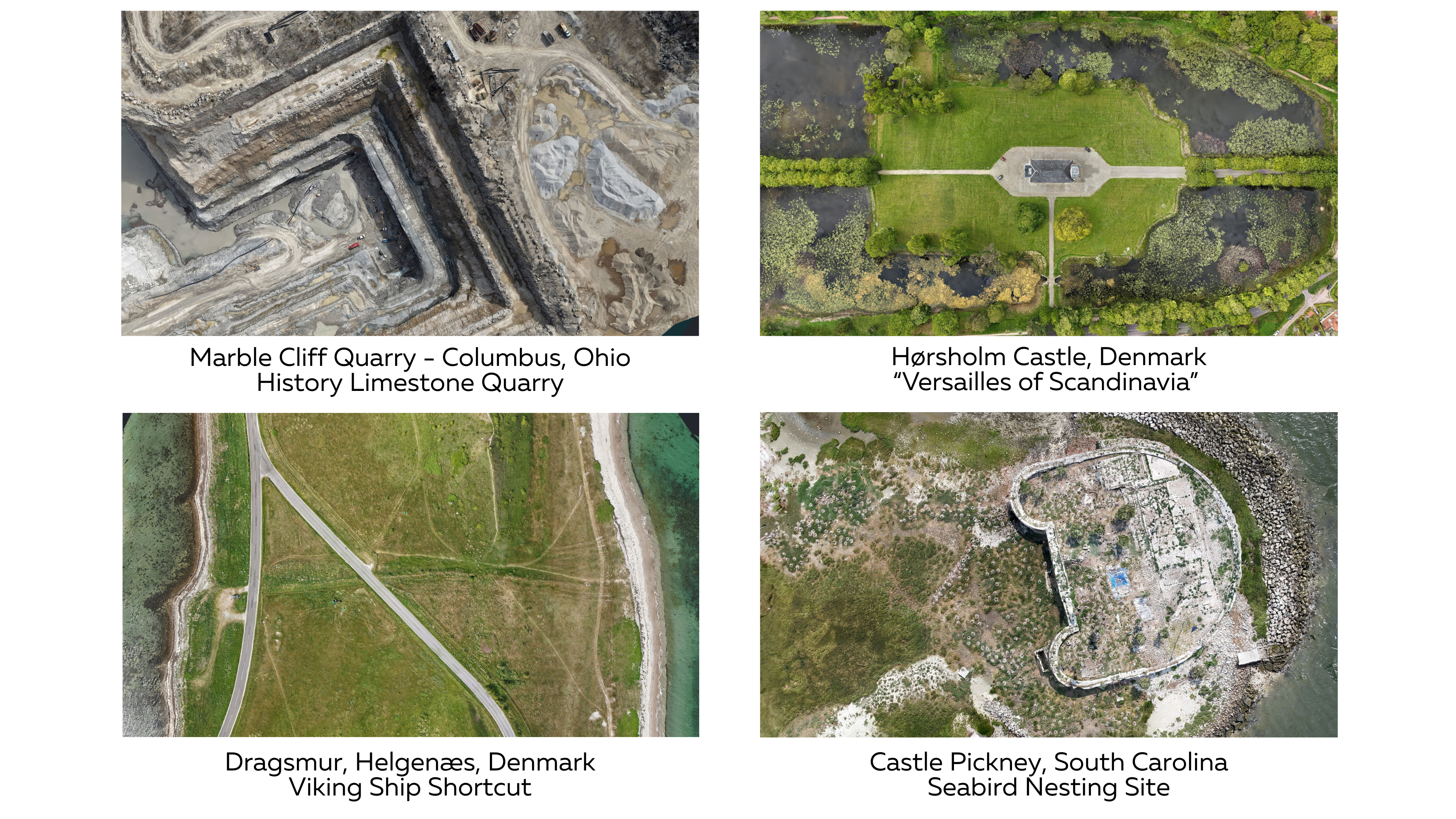

We’ve been capturing, traveling the world, and building datasets for years across coastlines, quarries, mountains, and ancient ruins. With every flight, we’re reminded that the land holds more than just topography; it holds memory. From forgotten foundations beneath overgrowth to the engineered precision of modern infrastructure, photogrammetry gives us a way to read the landscape like a living document. It connects us to the stories that have shaped our terrain—stories of industry, adaptation, conflict, and care.
In many ways, mapping is one of the oldest human instincts. We’ve always sought to understand our surroundings, to trace the contours of the world we inhabit. Through PixElement, we carry that tradition into the digital age by transforming raw imagery into maps, models, and meaning. With PixStories, we aim to bring that meaning forward, spotlighting the context behind the data, the terrain behind the mesh, and the story beneath the surface.

Why PixStories?
Photogrammetry isn’t just about generating pretty 3D models. It’s a technical craft that blends art, science, and storytelling. Our goal is to pull back the curtain and show how aerial data collection translates into measurable value across industries like construction, surveying, conservation, and research. We’ll share visuals, workflows, and lessons learned—plus tips for getting the most out of PixElement in the field.
Share Your Work with the Community
Have a story to tell? We’d love to hear it!
Whether you’ve mapped a challenging site, documented change over time, or used PixElement in an unexpected way, we invite you to contribute to the PixStories series. Sharing your dataset and process can help others learn, discover new use cases, and celebrate the craft of geospatial storytelling. To submit your project for consideration, fill out the form above.
Stay Tuned
We’re just getting started. Over the coming weeks and months, PixStories will unfold with new projects from across the globe. Some large-scale and high-impact, others quiet and intricate. Each will offer a glimpse into how photogrammetry brings terrain, structure, and context into focus.
So sit tight, bookmark the page, and keep an eye out. The next story might just shift the way you see your own work, and the world around you.
