PixElement Takes Flight in Photogrammetry Education at Ferris State University
In the realm of surveying and engineering education, the Surveying and Engineering Program at Ferris State University’s College of Engineering Technology stands as a beacon of excellence, nurturing the talents of future professionals. At the heart of this lies the Surveying and Engineering (SURE) 340 Photogrammetry course, taught by Adjunct Professor Jared Miller, where students delve into the fascinating world of photogrammetry. This article will explore the integration of PixElement into Professor Miller’s curriculum, and its impact on student learning.
Navigating the Course: SURE 340 Photogrammetry
SURE 340 serves as an introductory exploration into photogrammetry, encompassing a wide array of topics including the history of the discipline, aerial cameras, stereoscopy and techniques in orientation. Through hands-on activities, students engage in basic mapping tasks gaining practical insights into the principles and applications of photogrammetry. Offered typically in the spring semester at Ferris State, this course serves as a gateway to the dynamic field of spatial data analysis and mapping.
PixElement: A Catalyst for Learning
PixElement offers students a user-friendly platform to delve into the intricacies of photogrammetry. Professor Miller underscores its significance, stating, “PixElement is great for introducing new users, (in our case at Ferris State, students) to the procedure of producing accurate and usable photogrammetry deliverables such as orthoimagery and digital elevation models.” PixElement further “streamlines the learning process since PixElement’s cloud software package does all the heavy computation lifting for us.”
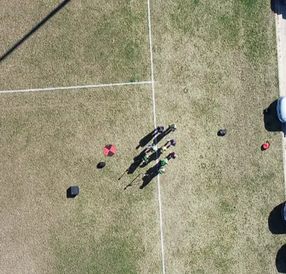
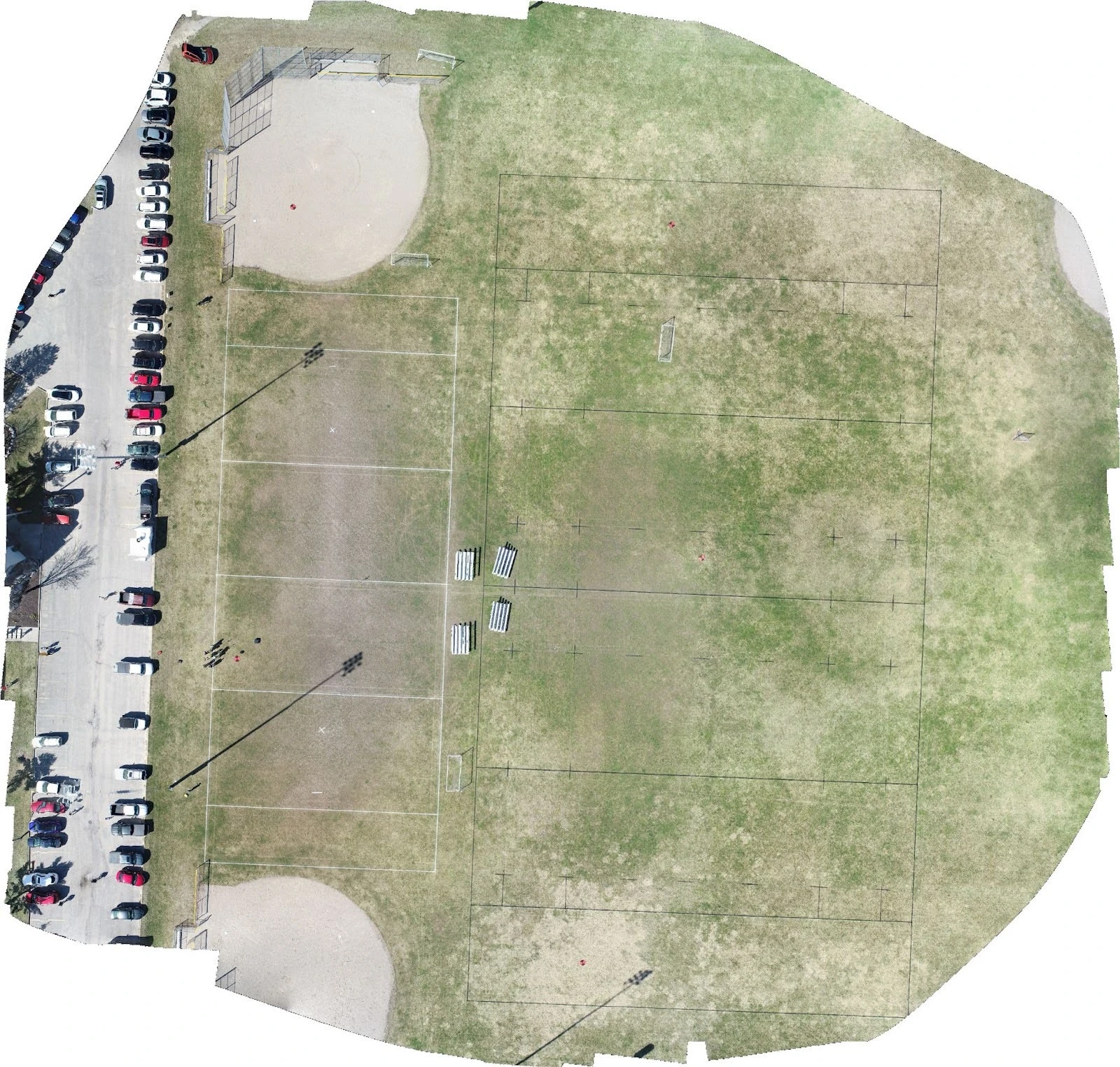
Nadir photo of SURE 340 class on project site and final orthophoto
Empowering Remote Learning
In an era marked by remote learning, PixElement emerges as it enables students to explore diverse workflows from the comfort of their homes, or anywhere in the world. Professor Miller notes, “This approach also opens up different workflows allowing students to work from home and explore all the different features available on PixElement at their leisure.” The intuitive design and workflow of PixElement have garnered praise from students, with one remarking that, “PixElement was very streamlined and easy to use,” further expressing plans to implement the software in professional settings.
From Theory to Practice: Creating Projects with PixElement
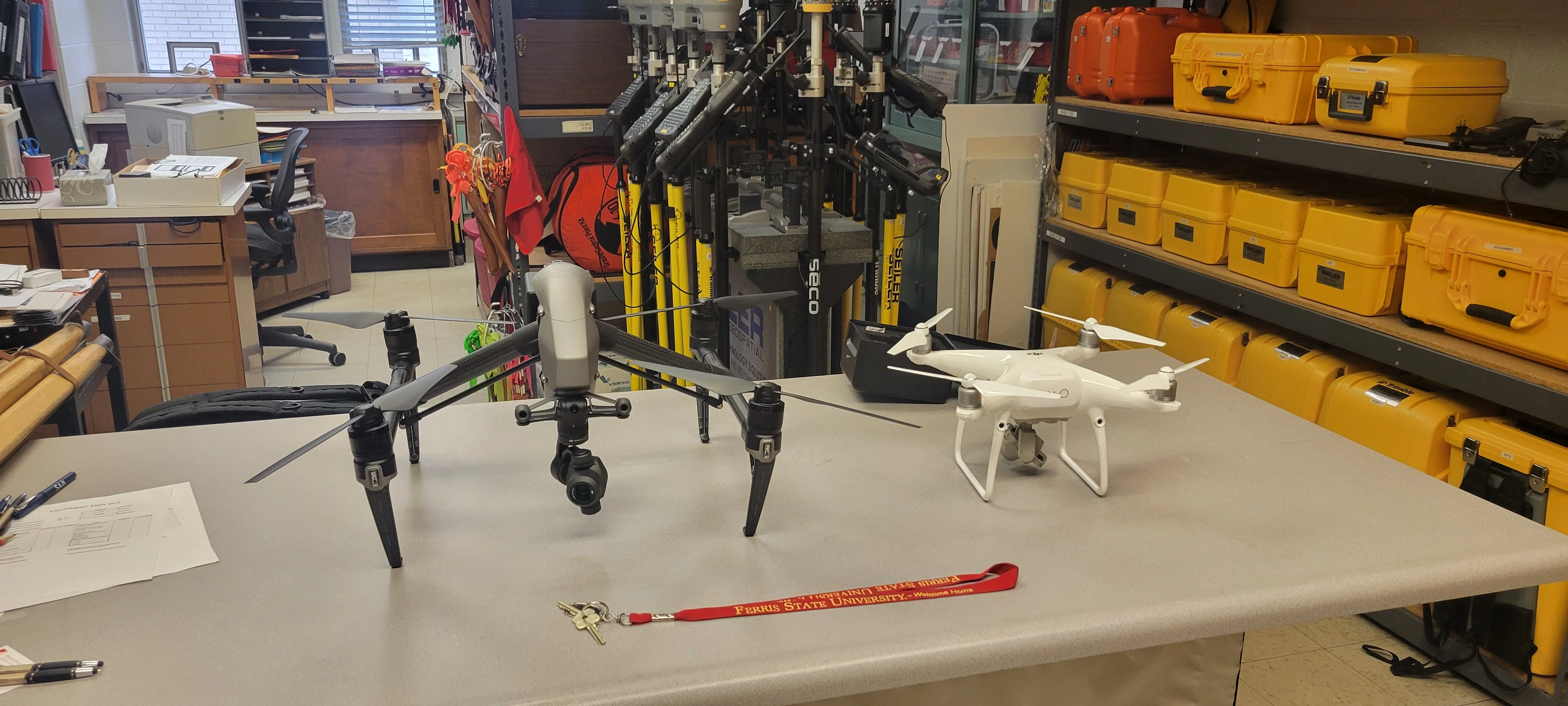
Drones used for SURE 340 photogrammetry instruction (DJI Inspire 2 and Phantom 4 Pro)
The practical application of PixElement in student projects amplifies its impact on the educational landscape. Professor Miller’s class project focusing on drone safety and control points exemplifies this synergy between theory and practice. He elaborates, “Our project focused on safety of drone use and utilizing control points to construct a 3-dimensional model and finally an ortho-image. Having PixElement available to each student, one of them being a remote learner, had a tremendous impact on the course’s approach to processing the data.”
As the semester draws to a close, Professor Miller affirms, “PixElement will be one of our core software suites for the photogrammetry courses here at Ferris State’s Surveying & Engineering program because of the powerful cloud processing ability and ease of use that PixElement provides.” With its robust features and cloud-based capabilities, PixElement is poised to shape the future of photogrammetry education, empowering students to navigate the complexities of spatial data analysis with confidence and proficiency.
Special shoutout to Katy Moore, who is retiring from the Ferris State University School of Engineering & Computing Tech Programs after twenty-two years. Katy’s dedication and contributions have left an indelible mark on the department. We wish her all the best in this new chapter of her life.