Choosing the right aerial mapping tool: LiDAR and/or Photogrammetry?
When it comes to capturing spatial data, two prominent technologies stand out: LiDAR and Photogrammetry. Each has its strengths and weaknesses, sometimes making the decision between them crucial for the success of your project.
Key Factors to Consider
Precision vs. Cost: LiDAR excels in capturing dense 3D data, especially in complex and cluttered environments, such as densely forested areas and urban canyons. However, it often comes with a higher price tag. Photogrammetry, on the other hand, can be more cost-effective but is limited to reconstructing what the camera can see. It cannot see through the canopy of a tree to the ground surface, or identify a 3D breakline in an area hidden by the shadow cast by a tall building.
Coverage and Accessibility: Photogrammetry can cover larger areas efficiently, especially from aerial platforms like drones, making it ideal for extensive mapping projects. LiDAR, while offering excellent accuracy, might be more limited. For drone LiDAR in particular, you may be limited to a certain altitude for accuracy requirements, which results in more flight lines and longer time on the jobsite. LiDAR also does not capture color, only intensity, whilst photogrammetry captures color information. Because LiDAR is an active form of sensing and provides its own illumination source, it can operate day or night. LiDAR also captures direct georeferencing whereas photogrammetry does not, which needs further post-processing georeferencing.
Data Processing: Both technologies require sophisticated data processing, but photogrammetry often demands more computational power and time due to the large volumes of imagery involved. LiDAR data processing can be more straightforward in comparison but is dense data and has hundreds of millions of points, even billions in “average” size projects.
Environmental Considerations: LiDAR performs consistently regardless of lighting conditions, making it suitable for day or night surveys. Photogrammetry heavily relies on good lighting conditions for optimal results, which might limit its applicability in certain situations.
Application-Specific Needs: Consider the specific requirements of your project. Are you focusing on urban planning, forestry management, archaeology or infrastructure inspection? Each application might favor one technology over the other based on factors like resolution, accuracy, and data density.
Integrating LiDAR and Imagery Data with PixElement
PixElement offers the ability to integrate your LiDAR datasets into photogrammetry projects, so the question becomes: If LiDAR and Photogrammetry are so different, why do we want to combine them?
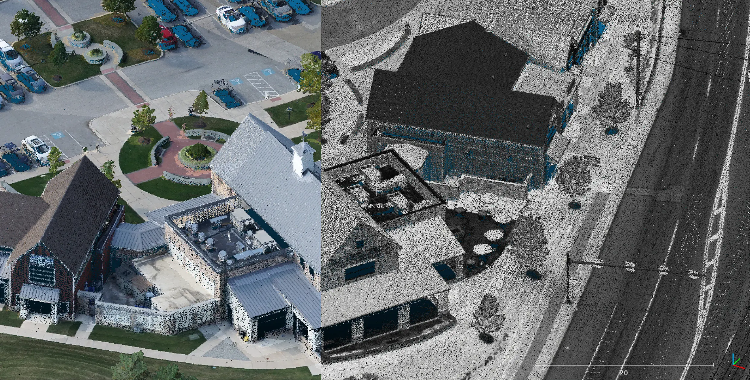
View of LiDAR + Imagery project RGB and intensity views showing how LiDAR and photogrammetry work together to get the most detailed results.
The Benefits of Processing a Combined LiDAR and Photogrammetry Project in PixElement
-
LiDAR + Imagery projects provide coverage in areas that otherwise might be error prone (e.g. woods/densely vegetated areas).
-
Integrate your LiDAR, images, and GCPs all in the same vertical and horizontal datum.
-
Provide perfect colorization that drone LiDAR vendors are incapable of providing.
![]()
-
Provide all the traditional photogrammetric deliverables (orthomosaic, 3D textured mesh, 2D planimetrics, etc.) in conjunction with the LiDAR deliverables (point cloud).
-
Multiple Modalities: Each dataset brings its own strengths to the table and thus the advantages of both are combined to create better reality in the scene.
-
LiDAR + imagery projects allow for the separate registration of LiDAR and photos to ground control points (GCPs).
-
Can be used with ground LiDAR scans + drone images, drone LiDAR scans + drone images, and aerial LiDAR scans + aerial imagery via aircraft.
Choosing which technology is right for your project depends on various factors including budget, project scope, environmental conditions and application requirements. Understanding these factors will empower you to select the right tool for unlocking the full potential of your spatial data projects.
Visit www.PixElement.com to learn more and start mapping today with a free trial!