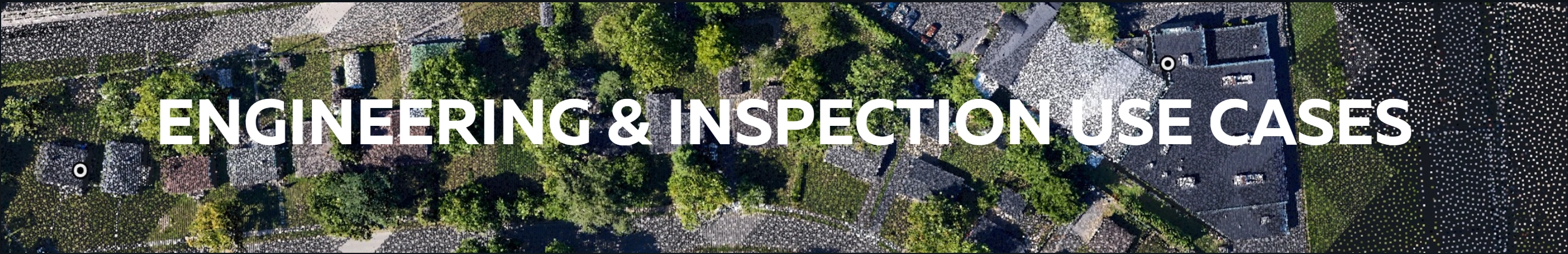
Electrical Transmission Corridor Mapping with PixElement
Electrical transmission corridors are among the most challenging environments for aerial mapping. Conductors typically range from 10–30 mm in diameter, placing them well below the effective pixel footprint of nadir RGB imagery flown at standard corridor altitudes. Conductors are thinner than most camera sensors can resolve, poles rise vertically with complex cross-arms and hardware, and vegetation competes for every line of sight.
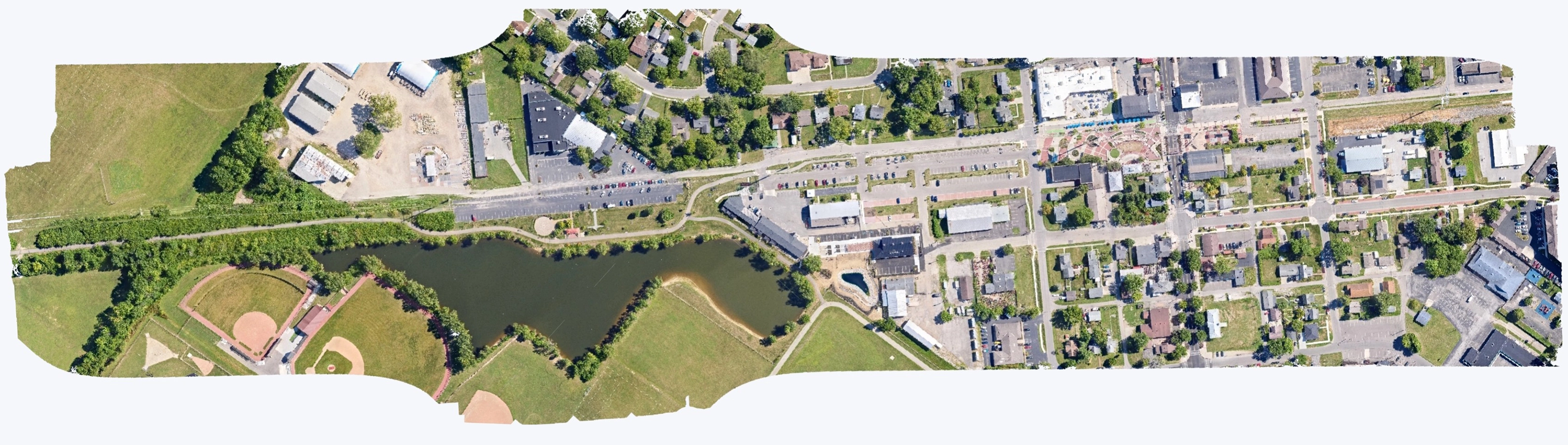
This PixStory focuses on how these technical challenges translate into real-world utility applications, including clearance validation, vegetation management, and long-term corridor risk assessment. The dataset presented is a large-format mixed RGB photogrammetry + LiDAR dataset, covering an overhead transmission corridor running through commercial, residential, and vegetated terrain. The dataset demonstrates how PixElement handles long, linear geometry, wire structures, vegetation penetration, and combined LiDAR–imagery workflows for engineering-grade utility mapping.
This is a large-format, long, linear corridor dataset captured as a combined LiDAR + RGB survey. It is designed to test PixElement on corridor-length geometry relevant to utility operations (continuous conductors, repeated structures, vegetation encroachment, and clearance-critical spans) rather than a small, isolated site map.
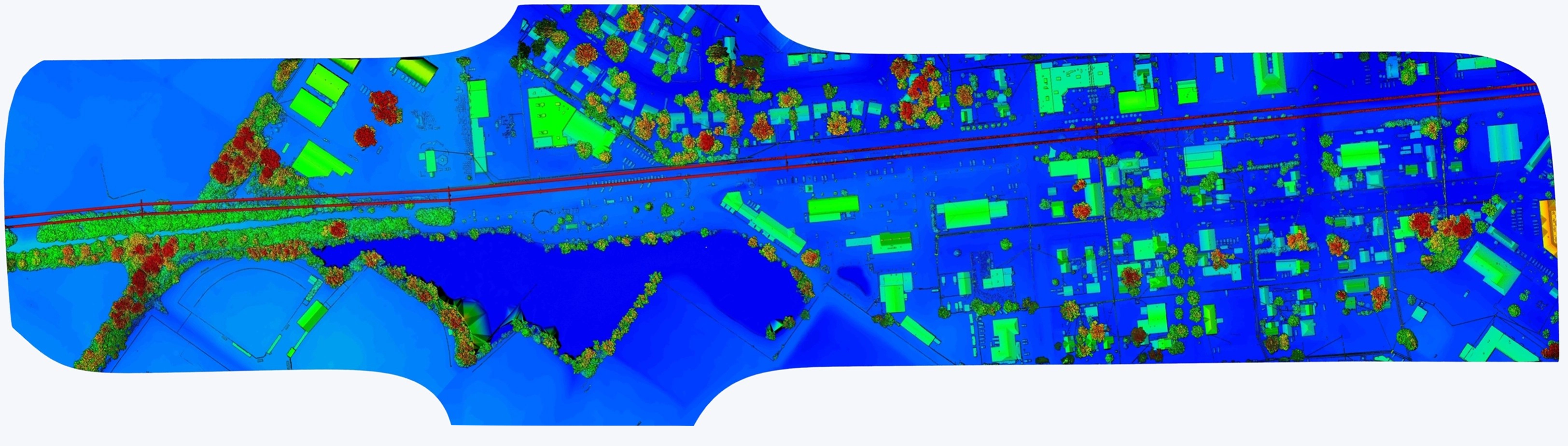
The dataset was captured using an airborne RGB camera and LiDAR sensor flown along the transmission corridor. Using PixElement’s processing workflows, both photogrammetric and LiDAR-derived products were generated, including a colored dense point cloud, a LiDAR ground-and-wire structural model, and a refined elevation visualization of the corridor.
While the RGB dataset provided strong natural color and environmental detail, it struggled (as expected) with the thin conductor geometry. The LiDAR dataset captured the missing structural elements: continuous wires, pole hardware, sag curves, vegetation height, and a clean bare-earth surface. Together, these datasets enabled a detailed, spatially accurate representation of the corridor’s infrastructure.
Orthoimage vs DEM - Drag the Slider to Compare
Accurate transmission corridor analysis requires understanding how conductor geometry changes under real operating conditions.
Conductor sag is not static. It varies with temperature, load, and span length, increasing during high-temperature conditions as conductors thermally expand. Seasonal and diurnal temperature changes can measurably alter conductor profiles (sometimes by ~25 feet), directly affecting minimum clearance to terrain and vegetation. Accurate sag modeling is therefore essential for compliance analysis and operational risk assessment, particularly during peak summer loading or wildfire risk periods, when reduced clearance can drive maintenance prioritization or trigger corrective action.
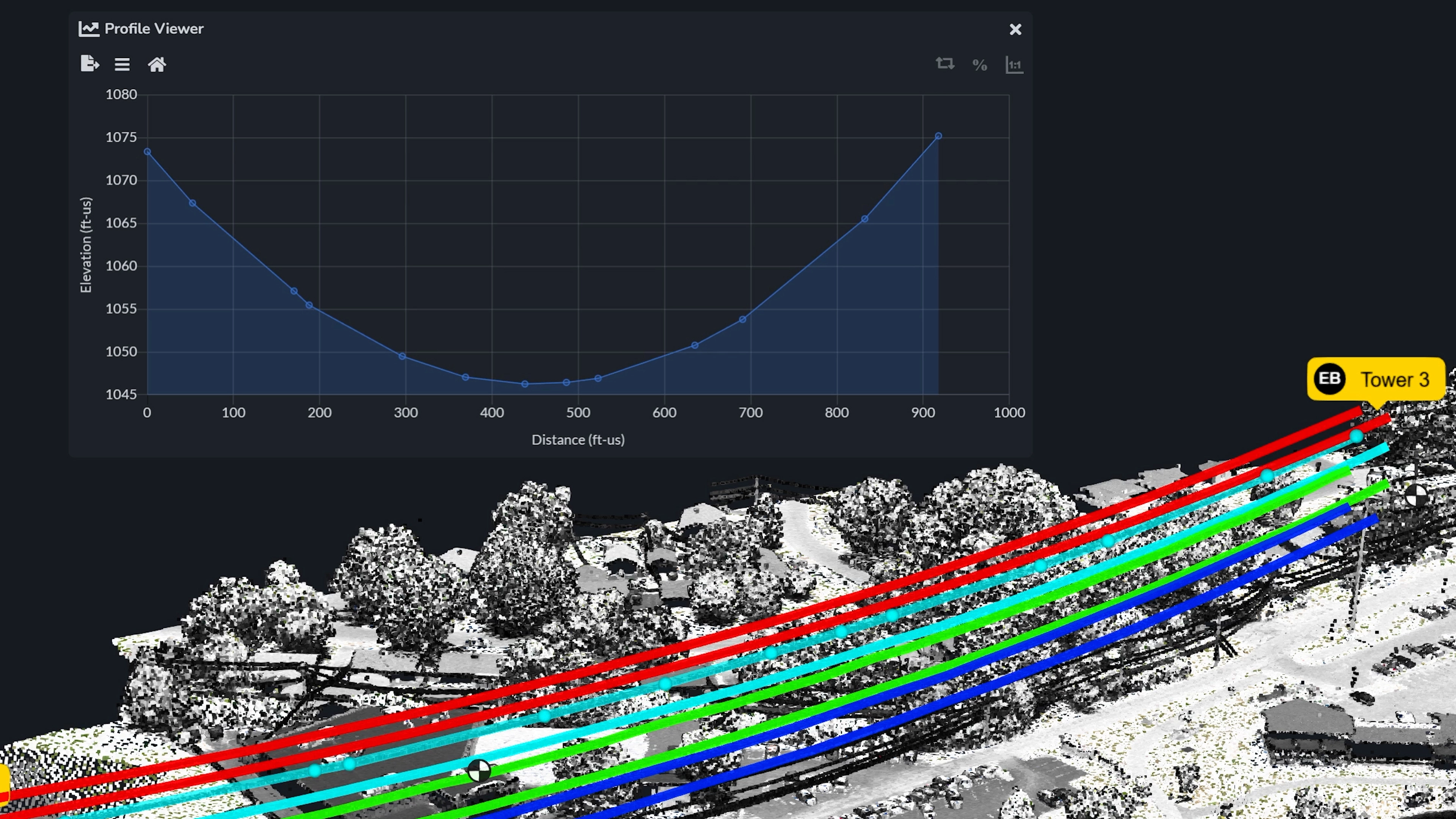
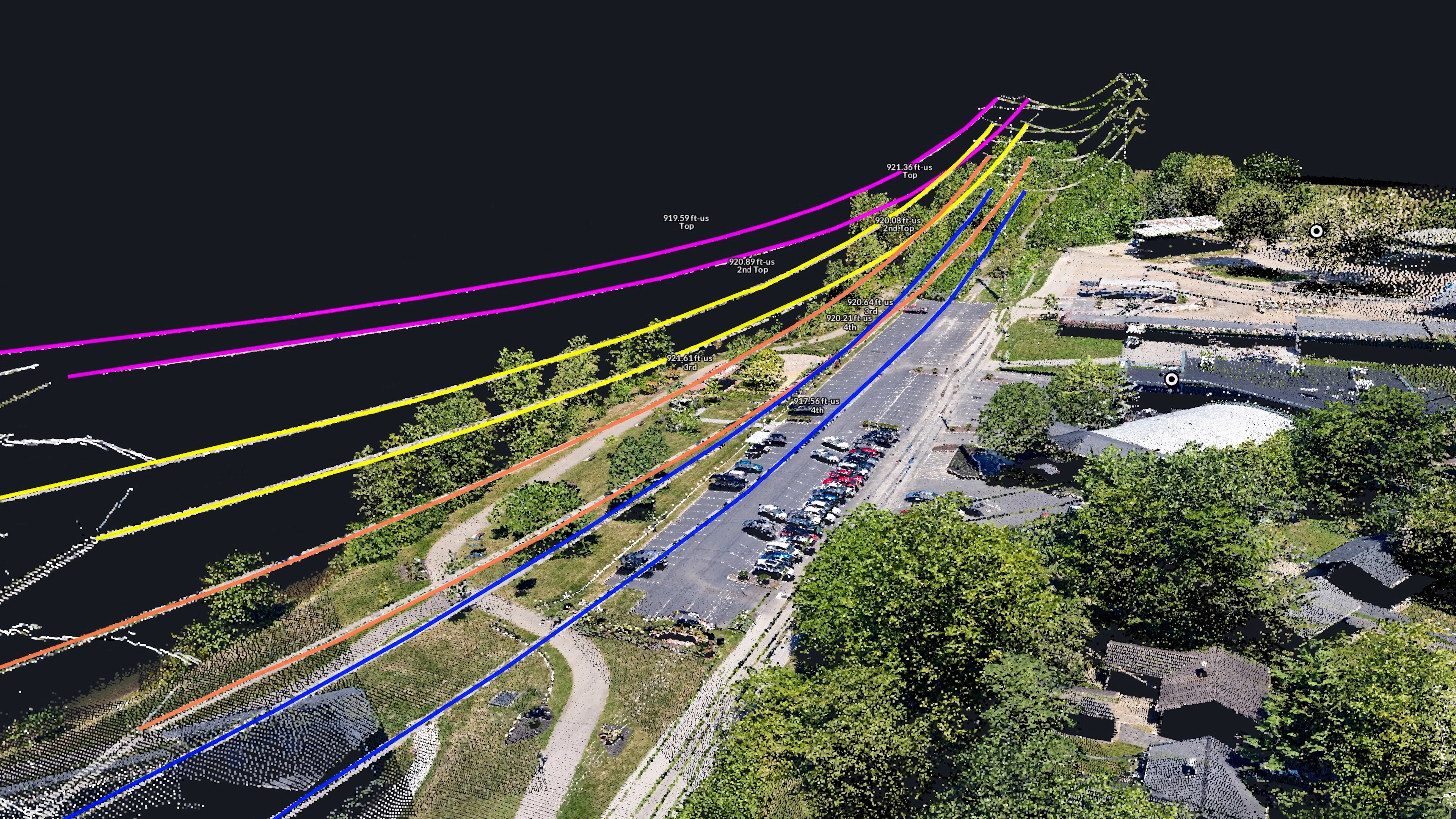
While LiDAR captures the physical position of conductors at the time of survey, engineering analysis typically requires fitting those observations to an idealized hanging geometry. Overhead conductors follow a catenary curve, which describes how a flexible cable suspends under its own weight between two support points.
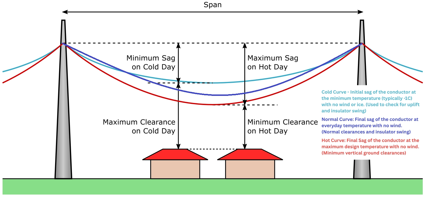
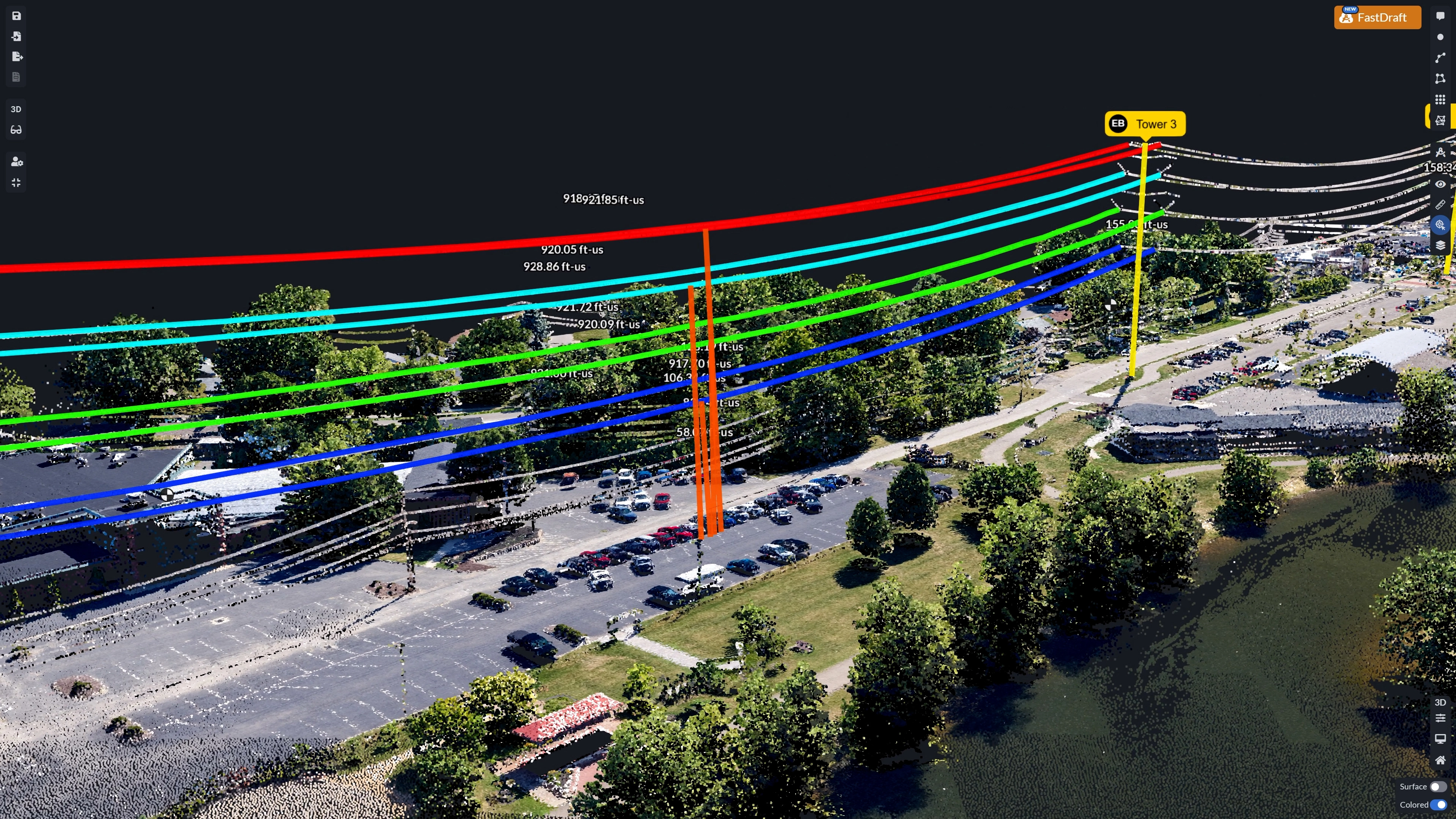
Using PixElement’s LiDAR point cloud and profile tools, conductor geometry can be extracted along a span and fit to a three-point catenary curve, providing a stable representation of the line’s expected behavior rather than a single snapshot influenced by momentary conditions. This fitted curve serves as a reference for evaluating clearance, span behavior, and potential risk under varying operating scenarios.
In practice, PixElement-derived conductor geometry can be exported into transmission analysis tools such as PLS-CADD, where environmental and operational parameters, such as ambient temperature, solar heating, humidity, and conductor properties are applied. These tools allow utilities to model how conductors will expand, contract, and sag across seasonal extremes rather than relying solely on the conditions present during data capture.
Wind loading can also be incorporated into these analyses. Lateral displacement caused by wind may push conductors toward nearby vegetation, structures, or adjacent phases, creating clearance risks that are not visible under calm survey conditions. By combining LiDAR-derived geometry with physics-based modeling workflows, users can assess whether conductors may sag too low or shift laterally enough to violate clearance requirements throughout the year. Together, conductor behavior and structure alignment define the clearance envelope that utilities must maintain to ensure safe, compliant operation of transmission corridors.
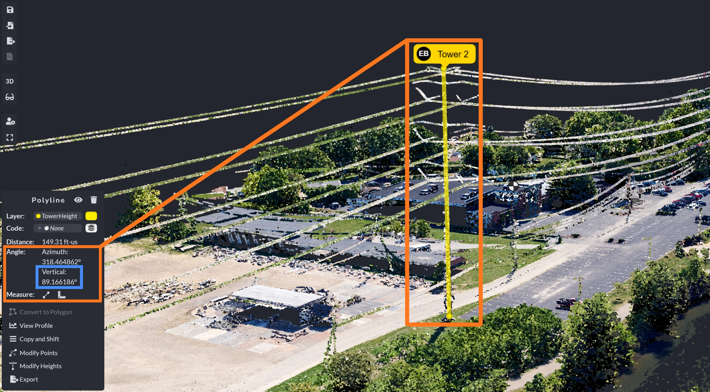
Vertical alignment of transmission structures is a critical indicator of structural condition. Using LiDAR-derived point clouds, PixElement enables assessment of the vertical angle (plumbness) of poles and towers by comparing the structure’s primary axis in relation to gravity. The base and top of each pole or tower can be precisely identified within the point cloud, establishing a stable reference for evaluating lean or displacement.
This approach supports condition assessment workflows where even small deviations from vertical alignment may indicate foundation movement, soil instability, or long-term structural degradation. When combined with repeat surveys, changes in tower or pole alignment can be tracked quantitatively over time rather than inferred through visual inspection alone.
Utility corridors introduce a set of structural visibility constraints that directly limit how reliably this behavior can be reconstructed from imagery alone. These thin, low-texture linear elements fall below the reliable reconstruction threshold of image-based workflows at practical corridor flight altitudes. Even with high overlap, the wires fall between pixels or appear as single-pixel streaks with insufficient texture for matching. Image-based reconstruction relies on surface texture and multi-view correspondence, which breaks down on thin, low-texture, and shadowed linear features such as conductors and cross-arms. Cross-arms and insulators sit beneath horizontal shadows, rendering them partially or completely invisible to the camera.
LiDAR, however, is unaffected by these conditions. The laser pulses capture:
- continuous wire geometry and sag profiles
- pole shafts, cross-arms, and hardware
- canopy height variation
- accurate ground beneath dense vegetation
These characteristics make combined RGB and LiDAR workflows essential for high-quality utility mapping. This is especially critical for transmission corridors, where the most safety-critical features are also the least visible to image-based reconstruction.
PixElement’s LiDAR processing enables clear delineation of linear features while still applying RGB color for visual interpretation. This hybrid approach preserves geometric accuracy while improving visual interpretability. The result is a corridor model suitable for engineering review, vegetation encroachment analysis, and decision-making across utility operations. Because LiDAR directly measures geometry rather than inferring it from imagery, repeated corridor surveys can be compared over time to monitor vegetation growth and structural change with consistent spatial reference.
The combined LiDAR and imagery workflow shown supports multiple utility applications that depend on consistent, measurable corridor geometry.
Transmission engineers and utility inspection teams need to know where risk exists along long, complex corridors.

This LiDAR+imagery workflow enables end users to measure clearances, identify encroachments, and assess infrastructure condition directly from a unified 3D corridor model, without relying on fragmented datasets or manual field interpretation.
Applicable Users
- Transmission & Distribution Engineers — clearance validation, design surfaces, compliance analysis
- Utility Inspection Teams — measurable visual inspection of poles, vegetation, and corridor condition
- Planners & Asset Managers — maintenance prioritization and long-range corridor planning
These outputs align with common utility workflows defined by EPRI and IEEE for transmission clearance analysis, vegetation management, and infrastructure assessment.
High-resolution geospatial models generated in PixElement enable utilities and engineering teams to:
- Assess conductor clearance relative to terrain and vegetation
- Measure tower and pole plumbness
- Identify tree encroachment and growth trends
- Create accurate planimetric and design surfaces across long corridor segments
- Generate colorized, engineering-ready deliverables for inspection and planning
By combining LiDAR-derived structure with photogrammetric texture, PixElement delivers corridor models that are both measurable for engineering analysis and interpretable for inspection and planning.
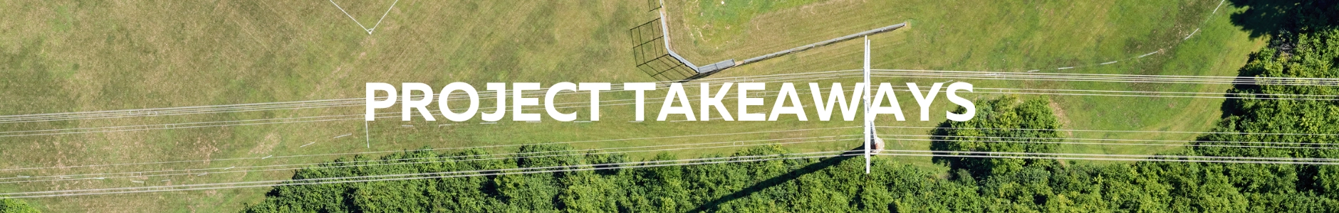
This project highlights how PixElement supports utility corridor workflows by combining measurable geometry, visual context, and engineering-ready outputs within a single platform.
Key capabilities demonstrated include:
- Integration of LiDAR and RGB imagery to generate orthomosaics, 3D meshes, and colorized point clouds from a unified dataset
- Extraction and measurement of conductor geometry, including catenary profile fitting and export for downstream transmission analysis
- Measurement of pole and tower locations, including assessment of vertical alignment (plumbness) relative to the gravity vector
- Identification of vegetation encroachment and evaluation of conductor sag and clearance risk along corridor spans
- Use of annotations and measurement tools to clearly visualize features, constraints, and inspection findings within the 3D model
- Ability to share datasets and collaborate with engineering teams, inspection partners, and stakeholders through a common spatial reference
Together, these capabilities demonstrate how PixElement bridges aerial data capture and utility engineering workflows, enabling accurate analysis, clear communication, and collaborative decision-making across transmission corridor projects.
Explore the Dataset:
References:
Electric Power Research Institute (EPRI). Applications of Airborne LiDAR for Transmission Line Design, Inspection, and Vegetation Management. EPRI Report No. 3002015507, 2023.
U.S. Department of Energy (DOE). Transmission Vegetation Management and Wildfire Risk Mitigation. Office of Electricity, 2023.
IEEE Power & Energy Society. Use of LiDAR Data for Overhead Transmission Line Modeling and Clearance Analysis. Technical Report, 2022.
Zhang, Z., Chen, Y., & Huang, X. Limitations of Image-Based Reconstruction for Thin Linear Features in Urban and Corridor Environments. ISPRS Journal of Photogrammetry and Remote Sensing, 2021.
Ahokas, E., Kaartinen, H., & Hyyppä, J. Accuracy of Airborne Laser Scanning for Corridor Mapping. Photogrammetric Engineering & Remote Sensing (ASPRS), 2019.
Images and datasets sourced from PixElement processing outputs and citation imagery.