Castle Pinckney - From Stronghold to Sanctuary
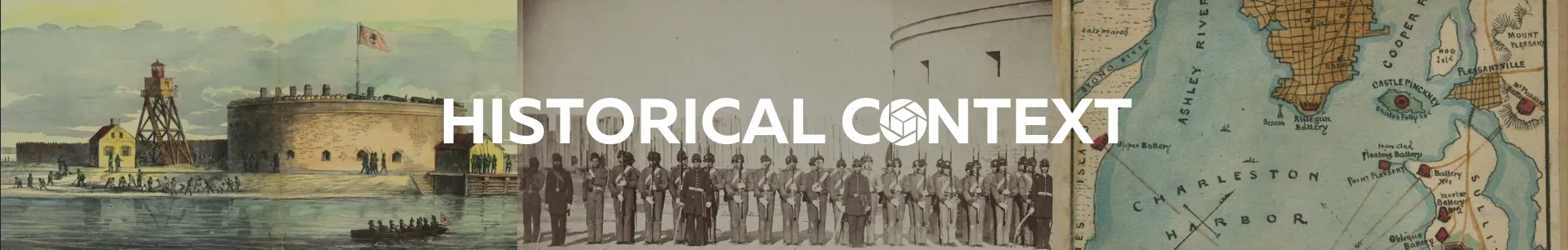
At the mouth of Charleston Harbor lies Castle Pinckney, a circular masonry fort quietly eroding on the Shutes Folly Island, a relic of America’s early coastal defenses.
The application of aerial photogrammetry to historic and coastal defense sites offers new perspectives on how the past endures and erodes along America’s shorelines. In this PixStory, we present a 3D dataset captured over Castle Pinckney, a circular masonry fort constructed on Shutes Folly Island at the mouth of Charleston Harbor, South Carolina. Built after the Revolutionary War and fortified following the War of 1812, Castle Pinckney never saw full-scale combat but stood watch through generations of American conflict. During the Civil War, it briefly served as a Confederate Prisoner of War (POW) prison for Union soldiers captured at Fort Sumter, a grim chapter in the early days of a fractured nation.
Today, Castle Pinckney stands as both ruin and refuge. The same fortifications once meant to repel invasion have become nesting grounds for brown pelicans and other seabirds that have claimed the crumbling ramparts as home. The site’s transformation from stronghold to sanctuary captures a larger story of how nature reclaims what humans leave behind, and how modern mapping technologies can preserve that process for future generations.
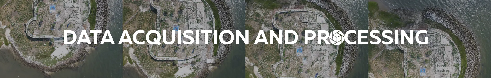
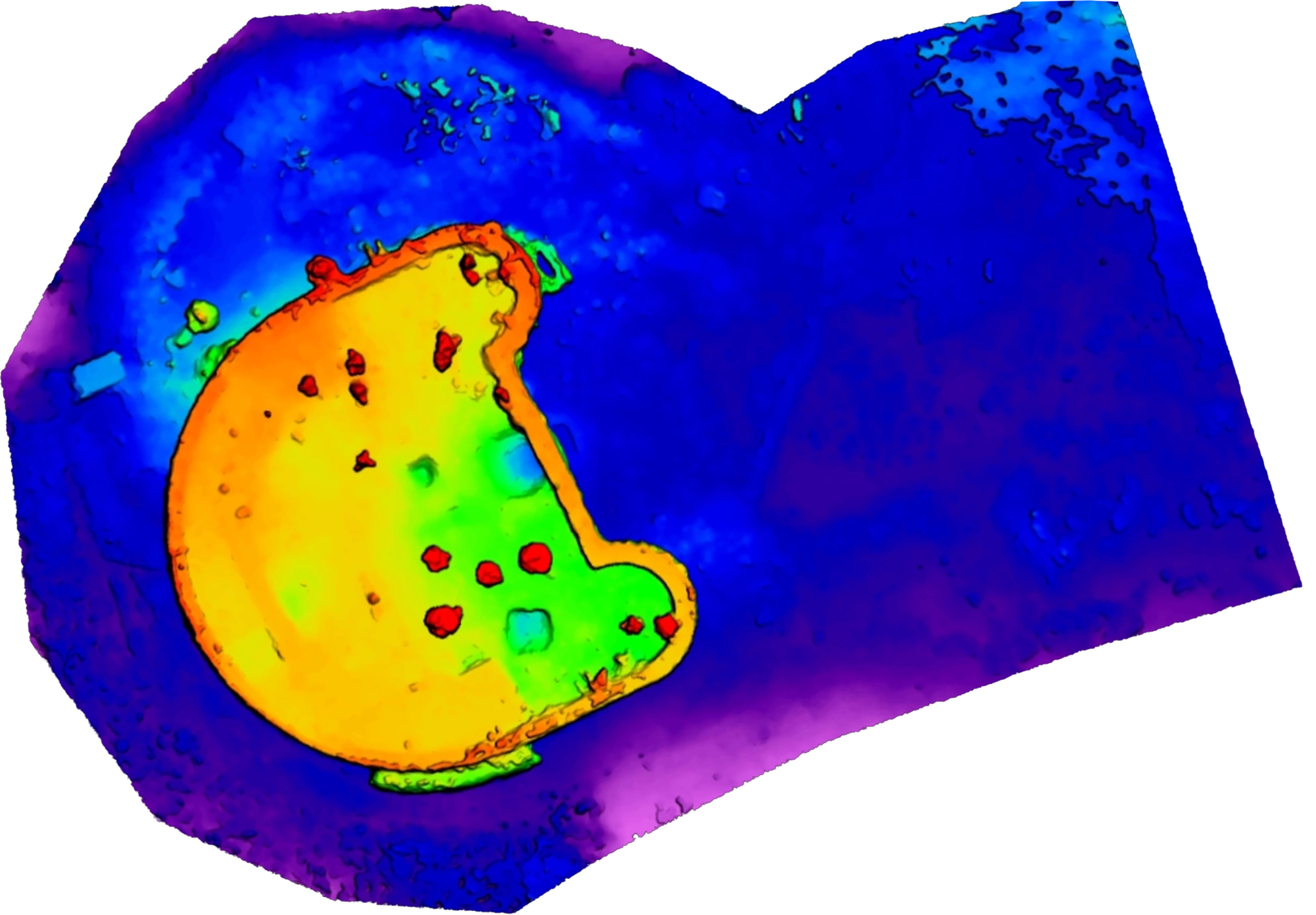
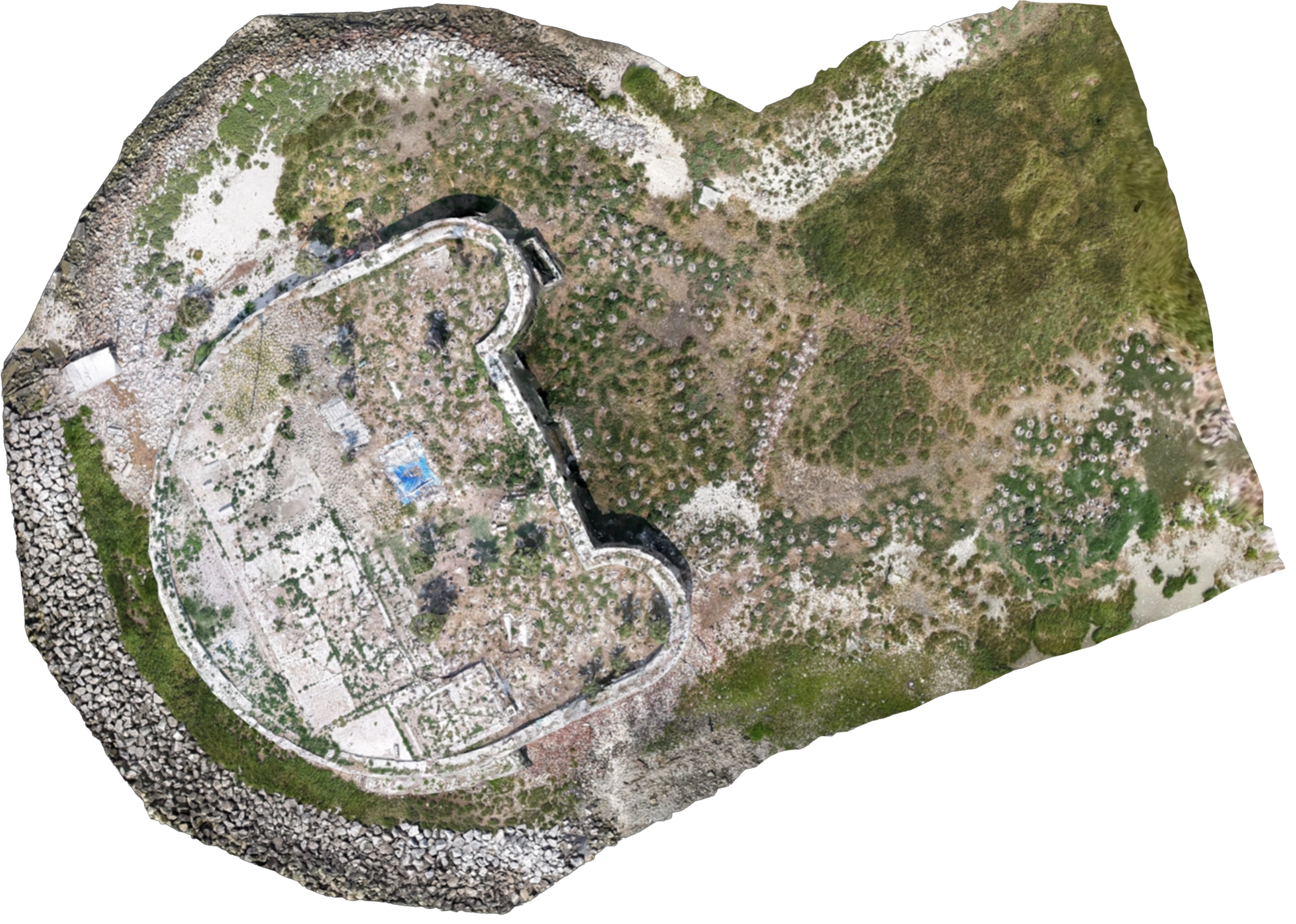
The dataset was acquired via a low-altitude UAS flight conducted over the fort. Using PixElement’s photogrammetric processing, an orthomosaic, 3D mesh, and digital elevation model were generated, providing detailed insight into the fort’s remaining structure, erosion patterns, seabird nesting sites, and surrounding marshlands. Together, these products form a spatially accurate digital record of the site. Beyond visualization, the results demonstrate how aerial photogrammetry can support coastal heritage monitoring, offering a measurable eans of assessing structural decay, shoreline retreat, and ecological change through time.
Orthoimage vs DEM - Drag the Slider to Compare
Shute’s Folly Island, on which Castle Pinckney stands, has served many roles across centuries. Once rumored to be a site of pirate executions and later an orange grove, it first held fortifications during the American Revolution. In 1780, General Benjamin Lincoln is believed to have ordered eight ships sunk near the island to obstruct British vessels advancing through Charleston Harbor.
Following the Revolutionary War, Castle Pinckney was conceived as part of the United States’ early coastal fortification system to protect Charleston Harbor. Completed in 1810 and later reinforced after the War of 1812, it stood as a circular brick bastion equipped with heavy artillery meant to guard the inner channel. During the Civil War, Confederate forces occupied the fort and briefly used it as a prison for captured Union soldiers from Fort Sumter. Though it never experienced direct bombardment, the fort served as a strategic symbol of control within the harbor’s defenses.
After the war, Castle Pinckney fell into disuse, weathering hurricanes, neglect, and steady erosion. Over the next century, the island and fort became the domain of seabirds, saltgrass, and shifting tides. The once-military landscape transformed into an ecological refuge, where fortifications built for defense now shelter seabirds and coastal life. Designated a National Monument by President Calvin Coolidge in 1922, Castle Pinckney’s protected status was later withdrawn in 1954, leaving the fort vulnerable to decades of neglect and coastal decay.
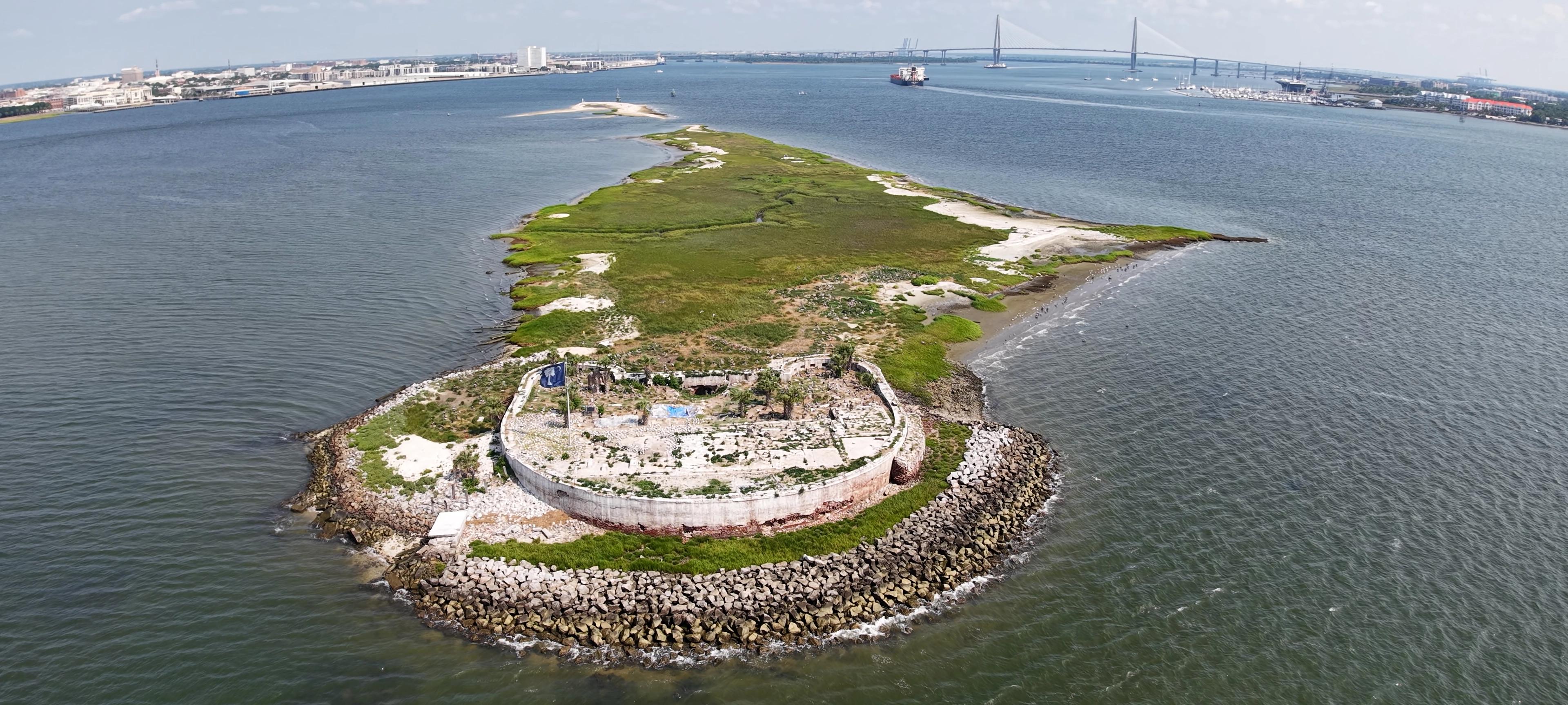
In August 2019, Castle Pinckney became the focus of its first archaeological excavations, marking a milestone in the study of South Carolina’s coastal fortifications. Castle Pinckney is one of the last few seacoast forticiation sites still standing, and the last one that had yet to be excavated. The fieldwork was carried out through an international collaboration between University College London, the South Carolina Institute of Archaeology and Anthropology, and the Castle Pinckney Historical Society. Funded by the Society for Post-Medieval Archaeology and the South Carolina Archaeological Research Trust, the project investigated the fort’s surviving masonry, interior spaces, and surrounding deposits to better understand its construction and later use. An 1821 pattern artillery button along with several artifacts and architectural remnants were recovered during the archaeological dig.
Castle Pinckney remains closed to the public, accessible only by boat and rarely visited. Yet from the air, its story continues, captured through drone-based photogrammetry that allows for both historical documentation and environmental observation without disturbing the fragile site. As a National Register-listed property facing ongoing coastal risk, systematic documentation is critical.
High-resolution geospatial models generated in PixElement enable researchers and conservationists to:
- Assess structural degradation caused by erosion and tidal exposure.
- Document the site’s transformation as part of Charleston’s coastal ecosystem.
- Create interactive, educational visualizations for heritage awareness.
By archiving Castle Pinckney in 3D, this project preserves more than architecture, it preserves a dialogue between history and nature, between defense and renewal.

Documentation & Preservation
High-accuracy spatial data provide a durable digital record for long-term monitoring and conservation planning.

Coastal Change Analysis
Quantify shoreline retreat, sediment deposition, and vegetation encroachment across tidal cycles.

Education & Public Engagement
Digital models and visualizations bring inaccessible sites into classrooms and museums, expanding awareness of coastal heritage.

Comparative Studies
Use datasets like Castle Pinckney in broader frameworks examining fortification design, material decay, and maritime defense networks.
Explore the Dataset:
Preserving the Past Through Precision
This project illustrates how photogrammetry functions not merely as visualization but as a scientific method of documentation, capturing spatially accurate, georeferenced data for sites that are otherwise at risk. At Castle Pinckney, this digital record preserves both cultural heritage and natural transformation — a fort once built for defense now serving as a sanctuary for wildlife. Through projects like this, PixElement supports the ongoing stewardship of fragile landscapes where history, ecology, and technology converge.
References:
South Carolina Institute of Archaeology and Anthropology. “Castle Pinckney and Shute’s Folly Island.” Legacy, vol. 23, no. 2, 2025, pp. 20–22. University of South Carolina, castle-pinckney.org .
Langhorne, Elizabeth H., and Joseph S. Lewis. Historic Places of Charleston County, South Carolina. National Park Service, U.S. Department of the Interior, 1978.
Castle Pinckney Historical Society. Castle Pinckney History. Castle Pinckney Historical Society, 2025, castle-pinckney.org .
South Carolina Institute of Archaeology and Anthropology, and University College London. “Archaeological Excavations at Castle Pinckney.” Fieldwork Report, 2019.
Images sourced from PixElement, Adobe Stock and citation imagery.